Situation Summary
Indonesia's composite threat profile remains moderate at rank #31 globally (score 66), but is experiencing acute volatility in its eastern territories. On 2 July, armed separatists from the West Papua National Liberation Army (TPNPB) killed American pilot Nicholas F. Gosselin and destroyed a civilian PT AMA aircraft at Yahukimo airstrip in Papua Highlands, claiming the action as a direct warning to Indonesian and U.S. governments. The incident has triggered elevated military operations in Papua and aviation-sector security reviews, signaling renewed separatist capability and willingness to target civilian infrastructure in remote zones.
Key Developments
- Yahukimo regency, Papua Highlands – 2 July 2026 (1400–1600 hrs local): TPNPB armed separatists shot and killed American pilot Nicholas F. Gosselin and set fire to a civilian PT AMA aircraft (7 Papuan passengers aboard) immediately after landing at Ipdeheik airstrip, Balinggama village. No security alerts were detected pre-landing; communications were lost post-touchdown.
- Yahukimo regency – 3 July 2026: Indonesian military conducted body-recovery operation; pilot's remains confirmed retrieved and slated for transfer to Jakarta and U.S. Embassy custody. Operation confirms military engagement and elevated alert posture in region.
- Papua Highlands – 2–3 July 2026: TPNPB spokesperson Sebby Sambom publicly claimed responsibility via social media (Facebook, X/Twitter), framing the attack as a "message" and warning of future targeting of all civilian aircraft believed to support Indonesian military logistics.
- Papua province – 3 July 2026: Indonesian military announced enhanced security operations, additional force deployment to Highlands, and tightened perimeter security around remote airstrips and flight corridors identified as vulnerable.
- Indonesia (national) – 3 July 2026: Directorate General of Civil Aviation and Transportation Ministry initiated review of flight safety and coordination procedures for remote Papua routes in response to the attack.
- Papua conflict discourse – 2–3 July 2026: International and Indonesian media outlets amplified separatist framing of the incident as part of ongoing armed conflict; helicopter operations footage circulated widely across platforms, intensifying visibility of the Papua security crisis.
Highest-Risk Areas
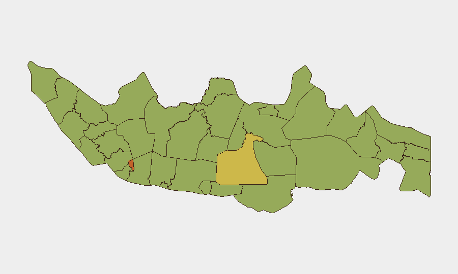
Jakarta (75.9) remains the foremost urban concentration, driven by administrative, judicial, and political activity; South Sulawesi (61.7), East Java (57.4), and West Java (54.7) follow, reflecting mixed drivers including crime, organized labor disputes, and localized separatist sentiment. However, Papua (not separately ranked in the top-12 list) has demonstrated acute tactical threat to civilian and international operations, as evidenced by the 2 July shootdown and now-active TPNPB targeting of aviation. The sub-national ranking does not capture the severity or immediacy of Papua's armed separatist threat to specific asset classes (aviation, remote infrastructure, expatriate presence).
How GeoBit Would Assist
Security and risk teams should leverage AOI Monitoring & Early Warning on Yahukimo, Wamena, and other Papua Highlands airstrips to detect pre-attack indicators (force staging, communications anomalies); OSINT fusion on X/Twitter, Facebook, and Telegram to track TPNPB messaging, targeting rhetoric, and operational claims in real time; and Aviation tracking integrated with conflict mapping to flag route-risk elevation and recommend alternative corridors. Entity extraction and sentiment analysis on separatist channels will support early identification of future attack declarations.
7-Day Outlook
The TPNPB's public claim of responsibility and explicit warning of continued aviation targeting will likely sustain elevated military operations in Papua and regional aviation restrictions through mid-July. Civilian flight operators should expect delays, route diversions, and enhanced security protocols. Separatist messaging intensity and any additional force mobilization signals will be critical indicators of imminent escalation or de-escalation.
Highest-Risk Areas — Ranked
| # | State / Region | Risk |
|---|---|---|
| 1 | Special capital Region of Jakarta | 75.9 |
| 2 | South Sulawesi | 61.7 |
| 3 | East Java | 57.4 |
| 4 | West Java | 54.7 |
| 5 | Maluku | 51.8 |
| 6 | Jambi | 48.8 |
| 7 | Riau | 48.1 |
| 8 | Special Region of Yogyakarta | 47.6 |
| 9 | North Sumatra | 47.1 |
| 10 | West Nusa Tenggara | 46.9 |
| 11 | Banten | 46.7 |
| 12 | Central Java | 46.4 |
Sources
Previous Daily Briefs
A new Indonesia brief is written every day — each with its own risk map and downloadable CSV. Here's the last week; use the calendar to go further back.
📅 Browse every day by calendar →
Highlighted days have a brief. Tap a day for that day's map & analysis, or “csv” for that day's dataset ($5).