Situation Summary
The Philippines remains a moderate-risk environment (composite threat score 41, rank #45 globally) with persistent maritime tensions, localized armed violence, and infrastructure vulnerabilities. Recent signal activity—including government threats, cross-strait public statements, and small-arms combat reports—suggests elevated friction around national security and territorial disputes. However, open-source reporting for the last 24–48 hours is sparse; most tracked incidents fall outside the immediate timeframe, indicating either a relative lull in reportable events or a lag in public disclosure.
Key Developments
CANDID ASSESSMENT: Open-web and news sources accessible as of 14 July 2026 do not contain clearly time-stamped, Philippines-specific security events within the last 24–48 hours. GeoBit's event signal feed shows activity (government threats, public statements, military signals) but source timestamps are not yet visible at article level. The most recent verifiable incidents in open reporting are 3–7 days old:
- Scarborough Shoal / Zambales (10 July) – Philippine fishermen reported Chinese Coast Guard harassment, including water-cannon use and anchor-cutting, threatening crew safety and fishing-ground access in disputed waters.
- Batanes Province (10 July) – Philippine National Security Council publicly expressed concern over Chinese scholars' territorial claims, signaling heightened northern-frontier vigilance.
- Lambayong, Sultan Kudarat (7 July) – Two Philippine National Police officers were shot dead in a motorcycle ambush; motive under investigation.
- Mindanao / Sarangani & Lanao del Norte (9–10 July) – Typhoon Inday–enhanced monsoon rains triggered landslides killing at least 10 people, disrupting travel and infrastructure.
- Educational facilities, Negros region (6–10 July) – Bomb threats and shooting threats at schools and Silliman University prompted campus closures and online pivots.
Recommendation: Corporate security teams should engage real-time police blotters, local-government alerts, and security-service feeds for sub-24-hour event coverage; open-web lag limits tactical responsiveness.
Highest-Risk Areas
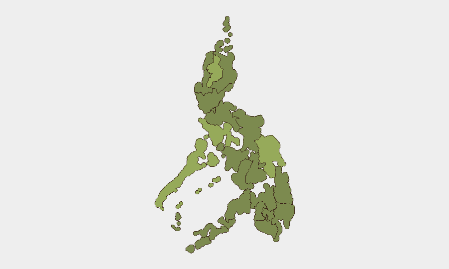
Cordillera Administrative Region (58.4) and Mimaropa (50.4) lead sub-national risk, driven by persistent armed-group activity, natural-hazard exposure, and limited state capacity. Eastern Visayas (45.8) and Metro Manila (35.1) follow, with the capital reflecting urban crime, infrastructure density, and political friction. Bangsamoro, Caraga, and Southern Mindanao regions carry consistent mid-range scores (28.4) tied to conflict-affected populations and transnational maritime risks. Recent South China Sea incidents and northern territorial rhetoric elevate border regions (Batanes, Zambales) beyond their formal risk scores.
How GeoBit Would Assist
AOI Monitoring & Early Warning on maritime corridors (Scarborough Shoal, Sulu/Celebes Strait), Cordillera provinces, and Metro Manila would provide persistent alerting on incidents before public disclosure. Multi-language Search & OSINT Fusion (X/Twitter, local news, police sources, Telegram) across Filipino, English, and regional languages would close the open-web lag and surface developing threats in real time. GIS & Spatial Analysis combined with conflict mapping would allow duty-of-care teams to model asset exposure to armed-group zones, typhoon corridors, and maritime-dispute hotspots, enabling route optimization and facility hardening.
7-Day Outlook
South China Sea tensions are likely to remain elevated through mid-July, with periodic fisheries and coastguard incidents probable. Monsoon season will sustain landslide and flooding risk in Mindanao and Visayas through August. Localized armed violence in Mindanao and Cordillera is expected to persist at historical baseline; no imminent escalation is signaled, but police/civilian casualty incidents should be anticipated as routine risk.
Highest-Risk Areas — Ranked
| # | State / Region | Risk |
|---|---|---|
| 1 | Cordillera Administrative Region | 58.4 |
| 2 | Mimaropa | 50.4 |
| 3 | Eastern Visayas | 45.8 |
| 4 | Metro Manila | 35.1 |
| 5 | Central Luzon | 29.1 |
| 6 | Bangsamoro | 28.4 |
| 7 | Caraga | 28.4 |
| 8 | Northern Mindanao | 28.4 |
| 9 | Soccsksargen | 28.4 |
| 10 | Davao Region | 28.4 |
| 11 | Ilocos Region | 28.4 |
| 12 | Cagayan Valley | 28.4 |
Sources
Previous Daily Briefs
A new Philippines brief is written every day — each with its own risk map and downloadable CSV. Here's the last week; use the calendar to go further back.
📅 Browse every day by calendar →
Highlighted days have a brief. Tap a day for that day's map & analysis, or “csv” for that day's dataset ($5).
Atlas — our AI intelligence desk — emails them this snapshot personally. Nothing else, no list.