Situation Summary
Tonga remains a low-threat environment globally (rank #195, composite score 3), with no active tracked security events as of 16 July 2026. The kingdom's security profile is shaped by geopolitical positioning rather than internal instability; recent diplomatic tensions with China over missile-testing activities have drawn official statements from Tongan leadership but have not triggered domestic civil unrest or measurable internal security degradation. Risk is geographically concentrated in Tongatapu, the capital island, where administrative density and population clustering amplify minor incidents.
Key Developments
No verified security, crime, civil-unrest, or infrastructure incidents have been reported in Tonga during the last 24–48 hours. A 14 July 2026 diplomatic signal regarding China artillery/missiles activity appears in event feeds, but this reflects regional geopolitical reaction rather than a Tonga-based incident. Road-policing enforcement activity (DUI operations) and drought/water-management advisories appear in archived government and media channels but lack current-window timestamps and remain routine administrative matters rather than acute developments.
Highest-Risk Areas
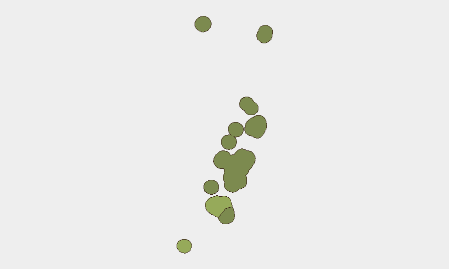
Tongatapu (risk score 45) concentrates two-thirds of Tonga's population and virtually all government, commercial, and diplomatic infrastructure, making it the primary locus of any security incident, regardless of cause. Vavaʻu (risk 28) and Haʻapai (risk 22) represent secondary concern zones, driven by geographic isolation, limited law-enforcement presence, and maritime-access complexity rather than active criminal or political instability. The outer island groups (ʻEua, Ongo Niua) carry minimal risk and remain peripheral to corporate security planning. Risk rankings likely reflect administrative capacity and incident reporting density rather than underlying violence or unrest.
How GeoBit Would Assist
Corporate security teams with personnel or assets in Tonga should employ AOI Monitoring & Early Warning on Tongatapu and maritime chokepoints to detect any escalation in civil unrest, labor action, or maritime incident before it affects operations. OSINT fusion (X/Twitter, Telegram, local news, police/government statements) would provide 6–12 hour lead time on community tensions, protest activity, or transport disruptions. Routing & Network Analysis should be pre-cached for alternative evacuation and supply routes in the event Tongatapu's limited road network is compromised by weather, protest, or infrastructure failure.
7-Day Outlook
No acute threat indicators suggest elevated risk over the next seven days. Seasonal weather patterns (winter in the South Pacific, July rainfall) remain the primary operational hazard; geopolitical posturing toward China is unlikely to translate to internal Tongan instability or visa/movement restrictions affecting corporate presence. Continued routine monitoring of government statements and maritime traffic is warranted as standard practice.
Highest-Risk Areas — Ranked
| # | State / Region | Risk |
|---|---|---|
| 1 | Tongatapu | 45 |
| 2 | Vavaʻu | 28 |
| 3 | Haʻapai | 22 |
| 4 | ʻEua | 18 |
| 5 | Ongo Niua | 12 |
Sources
Previous Daily Briefs
A new Tonga brief is written every day — each with its own risk map and downloadable CSV. Here's the last week; use the calendar to go further back.
📅 Browse every day by calendar →
Highlighted days have a brief. Tap a day for that day's map & analysis, or “csv” for that day's dataset ($5).
Atlas — our AI intelligence desk — emails them this snapshot personally. Nothing else, no list.