Situation Summary
Vanuatu remains in a low acute risk environment with no verified security incidents, civil unrest, or infrastructure disruption reported in the last 24–48 hours. Recent diplomatic friction between Vanuatu and France—centred on statements and rejections dated 28 July regarding New Caledonian and regional governance issues—has not translated to ground-level instability or travel-risk events. Sub-national risk concentration in Shefa Province (risk score 72) reflects persistent underlying vulnerability rather than active escalation.
Key Developments
- No new security incidents reported in Vanuatu in the 24–48 hours preceding this brief (as of 30 July 2026). Dedicated security monitoring and regional news feeds confirm an absence of verified protests, violence, or infrastructure disruption during this window.
- Ongoing natural hazards: Ambae volcano remains at Alert Level 3 with elevated activity; marine strong wind warnings are current across national coastal waters. These are persistent hazard advisories, not new discrete events, but warrant continued monitoring for logistics and travel planning.
- WWII ordnance clearance (Cook Barracks, Port Vila): An ordnance identification and disposal operation occurred on 17 July and was reported 23–24 July; this falls outside the 24–48-hour window but may inform site security protocols for Port Vila–based personnel.
- Diplomatic statements (28 July): Multiple public statements and rejections between Vanuatu, France, and the French government regarding New Caledonian governance and MSG leadership issues remain at the declarative level with no operational security impact reported on the ground.
- No escalation in civil or political unrest: Monitoring platforms report no significant trend, no actionable security thesis, and stable signal activity. Earlier political tensions related to traditional leaders' disputes (23–24 July) have not resurged.
Highest-Risk Areas
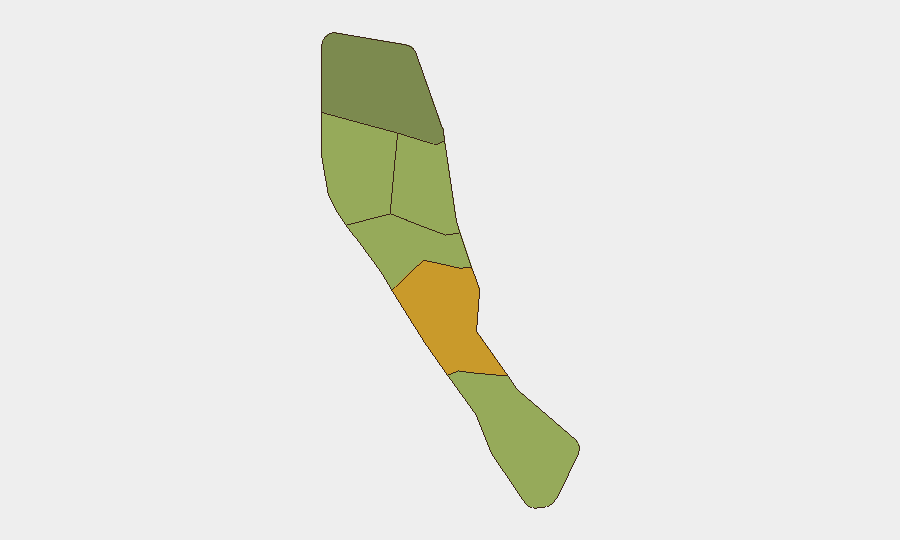
Shefa Province—which includes Port Vila, the capital—drives the national risk ranking at score 72, reflecting urbanization, population density, and infrastructure concentration that amplify exposure to crime, civil unrest, and service disruption. Penama (58) and Sanma (52) provinces follow, suggesting vulnerability linked to remoteness, limited state capacity, and maritime border proximity. These scores reflect chronic structural risk rather than acute escalation; no current events have spiked provincial risk in the last 48 hours.
How GeoBit Would Assist
AOI Monitoring & Early Warning on Port Vila, Shefa Province, and coastal maritime zones would detect any resumption of political activity or civil friction before ground-level escalation. Conflict & Military and Network & Actor Analysis capabilities enable tracking of diplomatic statements and factional positioning to assess whether Vanuatu–France tensions carry operational spillover risk. Environmental & Health monitoring (volcanic activity, cyclone risk, maritime hazard tracking) supports duty-of-care logistics planning for personnel in high-risk provinces.
7-Day Outlook
Vanuatu's security trajectory remains stable over the next seven days, with no indicators of imminent civil escalation or infrastructure disruption. Diplomatic rhetoric between Vanuatu and France is unlikely to convert to security incidents absent unexpected New Caledonian political upheaval or regional escalation. Natural hazards (Ambae Alert Level 3, marine conditions) should be monitored for logistics impact but do not indicate elevated human-security risk.
Highest-Risk Areas — Ranked
| # | State / Region | Risk |
|---|---|---|
| 1 | Shefa Province | 72 |
| 2 | Penama | 58 |
| 3 | Sanma | 52 |
| 4 | Malampa | 48 |
| 5 | Tafea | 45 |
| 6 | Torba | 35 |
Sources
Previous Daily Briefs
A new Vanuatu brief is written every day — each with its own risk map and downloadable CSV. Here's the last week; use the calendar to go further back.
📅 Browse every day by calendar →
Highlighted days have a brief. Tap a day for that day's map & analysis, or “csv” for that day's dataset ($5).
Atlas — our AI intelligence desk — emails them this snapshot personally. Nothing else, no list.