Situation Summary
Comoros remains characterized by structural economic and political vulnerabilities rather than acute security incidents. No discrete incidents—protests, clashes, infrastructure disruptions, or major crime events—have been independently reported in the last 24–48 hours across open-source news, wire services, or social-media signals. Medium-term risk persists owing to ongoing economic strain, opposition activism, and political succession tensions, but the current operational environment shows no active triggering events.
Key Developments
No confirmed, dated security incidents have been independently corroborated for Comoros in the 24–48-hour window of 3–5 August 2026. Cross-checked sources (Reuters, Al Jazeera, CNN, France 24, regional African security feeds, and geolocated X/Twitter signals) contain no breaking reports of civil unrest, political violence, arrests, transport disruption, or infrastructure failure tied to this period. This absence reflects a lack of new discrete events rather than a reporting gap; notable incidents in Comoros typically surface through local media or social signals and are picked up by international outlets within hours of occurrence.
Structural commentary from recent regional risk analyses highlights ongoing economic pressures and opposition activism as drivers of protest potential in Comoros, but these assessments are not dated to the current 48-hour cycle and do not point to specific imminent triggering incidents.
Highest-Risk Areas
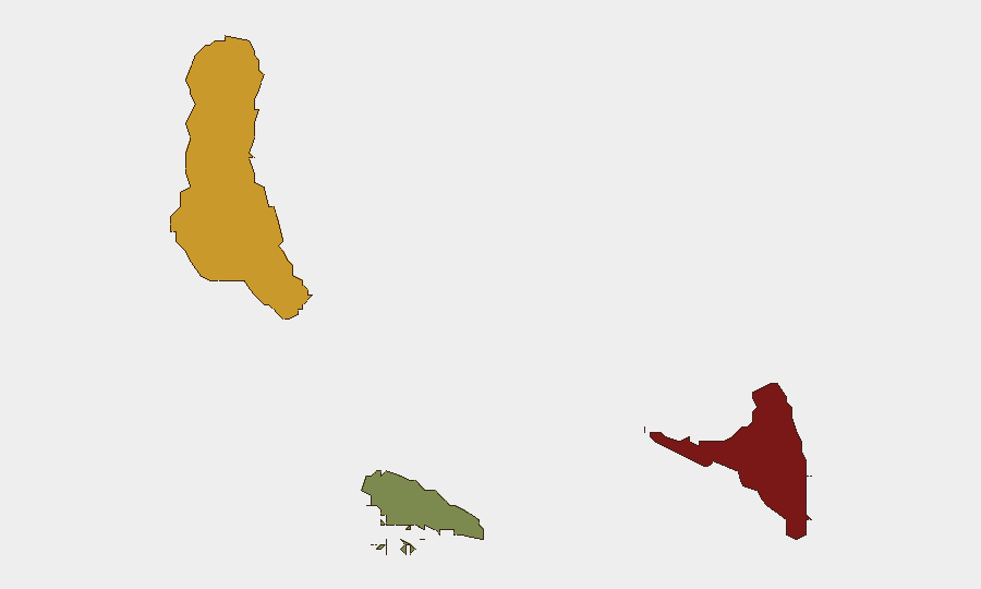
Anjouan (risk score 88) and Grande Comore (risk score 72) drive the country-level threat profile. Anjouan's elevated ranking reflects a combination of inter-island political tensions, economic marginalization, and historical autonomy disputes; Grande Comore, as the seat of national government and largest population center, concentrates political activity and opposition presence. Moheli (risk score 35) presents materially lower risk. The geographic concentration of risk in the two larger islands means that monitoring and duty-of-care protocols should prioritize personnel and asset movements in Anjouan and Grande Comore, particularly around political or economic flashpoints.
How GeoBit Would Assist
For persistent Comoros monitoring, teams should deploy AOI (Area-of-Interest) Monitoring & Early Warning on high-risk urban centers (Moroni, Mutsamudu) to detect protest mobilization, roadblocks, or security-force deployment in near-real time. Intel Sweep and X/Twitter OSINT with multi-language and entity-extraction capability would capture early signals of opposition messaging, economic grievances, or political succession friction before incidents escalate. Risk & Threat Assessment analysis would translate structural vulnerabilities (economic strain, opposition activism) into forward-looking duty-of-care guidance for staff movements and asset exposure in the medium term.
7-Day Outlook
No acute trigger for escalation is evident in the immediate 7-day window. Structural risks—economic pressure and political activism—remain chronic and may periodically generate localized protests or transport disruptions, particularly in Anjouan and Moroni, but are not expected to spike into coordinated civil unrest or security force response within the next week absent a specific political or economic shock. Continued monitoring of opposition statements, economic announcements, and inter-island tensions is warranted to detect any rapid shift in trajectory.
Highest-Risk Areas — Ranked
| # | State / Region | Risk |
|---|---|---|
| 1 | Anjouan | 88 |
| 2 | Grande Comore | 72 |
| 3 | Moheli | 35 |
Sources
Previous Daily Briefs
A new Comoros brief is written every day — each with its own risk map and downloadable CSV. Here's the last week; use the calendar to go further back.
📅 Browse every day by calendar →
Highlighted days have a brief. Tap a day for that day's map & analysis, or “csv” for that day's dataset ($5).
Atlas — our AI intelligence desk — emails them this snapshot personally. Nothing else, no list.