Situation Summary
Indonesia's composite threat score (48/100) positions it at #38 globally, with 724 tracked events indicating sustained but dispersed security pressures. The security environment remains shaped by separatist activity in remote eastern provinces, civil unrest in major urban centers (particularly Jakarta), and sporadic institutional friction. The 24–48 hour window shows no broad deterioration, but the Papua incident signals renewed operational capability and intent among armed separatist groups, with potential downstream effects on aviation and foreign national safety.
Key Developments
- Papua Highlands, Yahukimo regency (Ipdeheik airstrip), 2 July 2026: West Papua National Liberation Army (TPNPB) fighters shot and killed American pilot Nicholas F. Gosselin following his landing in a PT AMA civilian aircraft; the aircraft was subsequently burned. Seven Indigenous Papuan passengers were unharmed. The attack was confirmed by multiple international outlets (ABC Australia, ABC News, Deutsche Welle) and verified social media imagery.
- Papua Highlands, Balinggama–Yahukimo sector, 3 July 2026: Indonesian National Armed Forces (TNI) conducted a "special rapid seizure operation" and recovered Gosselin's body from the conflict zone, reaffirming the flight's civilian status and passenger manifest.
- Papua/West Papua (general), 2–3 July 2026: TPNPB spokespeople issued new public threats stating that civilian aircraft operating in Papua may be targeted if perceived as supporting Indonesian security forces, framing the pilot killing as a "message" to Indonesian and US governments. These statements were disseminated across social media and news outlets, signaling hardened targeting doctrine and intent to escalate messaging.
- Jakarta and nationwide, 2 July 2026: Event signals indicate concurrent institutional strain, including arrests/detentions in Jakarta, disapproval statements directed at government and presidential figures, and public criticism from financial and educational sectors. These events, while individually lower-intensity, reflect baseline civil friction typical of Indonesia's political landscape.
Highest-Risk Areas
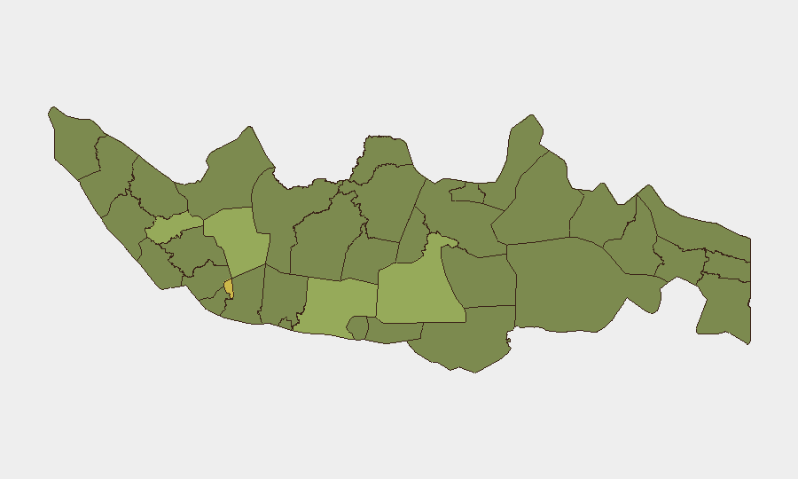
Jakarta (63.9) dominates Indonesia's threat ranking, reflecting its status as the national capital, primary economic hub, and focal point for institutional tension and public dissent. East Java (48.9) and South Sulawesi (44.2) follow, driven by localized crime, organized labor disputes, and historically volatile intercommunal dynamics. The Papua/West Papua region, though not separately ranked in the sub-national index, now warrants elevated attention following the TPNPB attack: separatist groups remain operationally active in remote areas where state control is limited, civilian infrastructure is exposed, and foreign nationals are sparse but present.
How GeoBit Would Assist
Security teams should deploy Intel Sweep and OSINT fusion to monitor TPNPB communications (X, Telegram, social channels) for targeting intent and operational planning. AOI Monitoring & Early Warning should be configured for Papua airstrips, Jakarta protest routes, and East Java port/manufacturing zones to provide real-time alert on emerging activity. Routing & Network Analysis can generate safe transit corridors and identify high-risk air/ground routes, while Conflict & Military mapping tracks TPNPB force disposition in Papua to support aviation risk assessment and duty-of-care decisions.
7-Day Outlook
TPNPB is likely to sustain rhetoric around civilian targeting and use the pilot killing for recruitment and morale messaging; further aviation incidents in Papua are possible but not certain in the immediate term. Jakarta and major urban centers should be monitored for escalation in labor or political dissent tied to the recent institutional friction signals. Overall risk trajectory remains moderate-to-stable absent a major triggering event.
Highest-Risk Areas — Ranked
| # | State / Region | Risk |
|---|---|---|
| 1 | Special capital Region of Jakarta | 63.9 |
| 2 | East Java | 48.9 |
| 3 | South Sulawesi | 44.2 |
| 4 | Bangka-Belitung Islands | 41.1 |
| 5 | Jambi | 41.1 |
| 6 | West Java | 37.2 |
| 7 | North Sumatra | 37 |
| 8 | Riau | 35.7 |
| 9 | Central Java | 35.1 |
| 10 | West Kalimantan | 34.8 |
| 11 | Banten | 34.8 |
| 12 | Special Region of Yogyakarta | 34.8 |
Sources
Previous Daily Briefs
A new Indonesia brief is written every day — each with its own risk map and downloadable CSV. Here's the last week; use the calendar to go further back.
📅 Browse every day by calendar →
Highlighted days have a brief. Tap a day for that day's map & analysis, or “csv” for that day's dataset ($5).
Atlas — our AI intelligence desk — emails them this snapshot personally. Nothing else, no list.