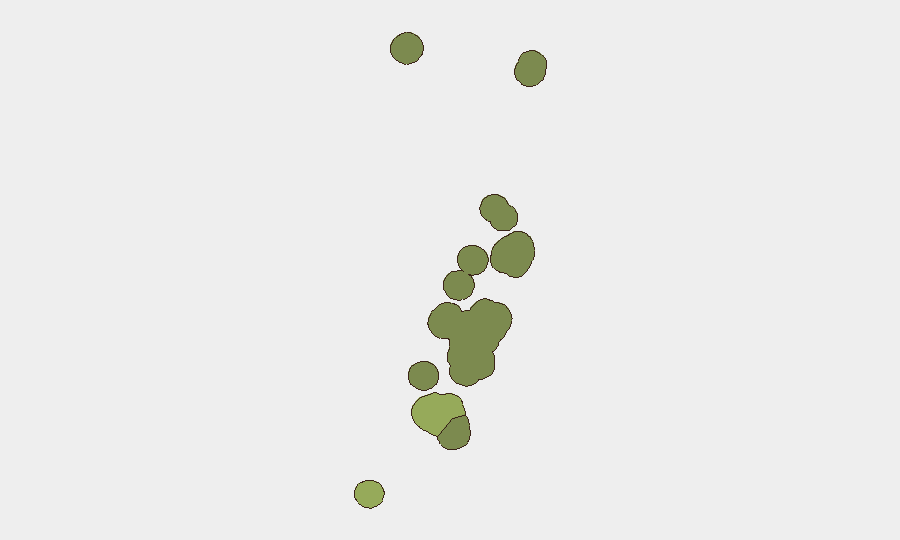
Situation Summary
Tonga remains a low-threat environment with a composite threat score of 2 and no tracked security events in the current assessment window. The archipelago maintains a stable security posture under Level 1 travel advisory guidance (Exercise Normal Precautions). Recent public health and political developments—dengue outbreak closure and by-election processes—do not present immediate security risks to corporate personnel or assets. The risk profile is consistent with a small Pacific island state with limited civil disorder, organized crime, or conflict activity.
Key Developments
No discrete security, civil-unrest, crime, political-instability, infrastructure, or travel incidents were verified in Tonga for 2026-08-09 to 2026-08-11. Web research and available event feeds returned no new incidents meeting the 24–48-hour window criterion.
Background context (outside current window):
- Ministry of Health confirmed end of dengue outbreak as of 19 July 2026; no new cases reported since.
- Police drug operation resulted in two arrests on 5 August 2026; routine law-enforcement activity.
- By-election writs for Tongatapu 2 and Niua 17 constituencies expected following bribery-related resignations; political process remains orderly.
Highest-Risk Areas
Tongatapu (risk score 45) remains the dominant risk driver, reflecting its status as the capital and population center; concentrated commercial, political, and administrative activity increases exposure to petty crime, civil gathering, and infrastructure dependency. Vavaʻu (risk 28) and Haʻapai (risk 22) follow as secondary centers with lower population density and corresponding lower absolute risk. ʻEua and Ongo Niua carry minimal risk profiles. The risk gradient reflects urbanization and asset concentration rather than active conflict or organized instability; routine due-care protocols appropriate for small island economies apply.
How GeoBit Would Assist
Intel Sweep & OSINT Fusion would provide continuous monitoring of Tonga media, social platforms (X, local news feeds), and regional incident reporting to detect early signs of political tension, labor action, or infrastructure disruption before they escalate. AOI Monitoring & Early Warning with persistent geospatial focus on Tongatapu's key commercial and transport nodes would alert security teams to spontaneous gathering, blocked routes, or port/airport disruption. Risk & Threat Assessment capability would flag upticks in drug trafficking, maritime incidents, or regional instability (e.g., cyclone season preparedness, neighboring-state political shifts) that could indirectly affect Tongan operations or expatriate movements.
7-Day Outlook
No material change in threat trajectory is anticipated over the next seven days. Tonga's political calendar (by-elections) and routine law-enforcement activity are unlikely to generate acute security events affecting corporate operations. Seasonal weather monitoring (cyclone preparedness in the South Pacific spring) remains a standard operational consideration, though no active tropical systems are currently forecast for the region.
Brief Confidence: Moderate. Web research confirms no breaking incidents in the 24–48-hour window; assessment reflects stable baseline. Additional real-time feeds (local police, port authority, diplomatic channels) would strengthen confidence in the all-clear assessment.
Highest-Risk Areas — Ranked
| # | State / Region | Risk |
|---|---|---|
| 1 | Tongatapu | 45 |
| 2 | Vavaʻu | 28 |
| 3 | Haʻapai | 22 |
| 4 | ʻEua | 18 |
| 5 | Ongo Niua | 12 |
Sources
Previous Daily Briefs
A new Tonga brief is written every day — each with its own risk map and downloadable CSV. Here's the last week; use the calendar to go further back.
📅 Browse every day by calendar →
Highlighted days have a brief. Tap a day for that day's map & analysis, or “csv” for that day's dataset ($5).
Atlas — our AI intelligence desk — emails them this snapshot personally. Nothing else, no list.