Situation Summary
Vanuatu remains at low acute security risk with no verified incidents of civil unrest, political violence, major crime, or infrastructure disruption in the last 24–48 hours. A cluster of diplomatic messaging between Vanuatu, France, and references to New Caledonia on 28 July signals diplomatic friction, but no on-ground security impact has been reported. Routine weather and volcanic hazards persist but do not reflect instability; the security environment is stable.
Key Developments
- Port Vila and nationwide – 29–30 July 2026: Commercial security assessment confirms no verified security incidents, civil unrest, or infrastructure disruption in the past 24–48 hours; country assessed at low acute risk with travel advice unchanged at "exercise normal safety precautions."
- Diplomatic messaging – 28–29 July 2026: Multiple public statements and rejections exchanged between Vanuatu and France, and between French and New Caledonian actors; geopolitical in nature and not accompanied by reports of domestic unrest or street-level tension in Port Vila or provincial capitals.
- All coastal waters – 29–30 July 2026: Vanuatu Meteorology and Geo-Hazards Department maintains active Marine Strong Wind Warning (southeasterly 21–25 knots, seas to 2.5 m); routine seasonal weather hazard affecting small-craft operations, not a security incident.
- Ambae Island, Penama Province – late July 2026: Ambae Volcano remains at Alert Level 3 (minor eruption) with activity confined to Lake Voui and hazard zone limited to ~3 km radius; no new evacuation orders issued; access within danger zone remains a localized physical safety risk.
- Regional intelligence environment – past 7 days through 29–30 July 2026: Open-source monitoring platforms report stable signals and no notable spikes in protest, political violence, or major crime; 62 tracked events show no emerging instability.
- Wider Pacific context – late July 2026: Regional analysis notes Chinese ballistic missile activity in the Pacific as a background strategic concern but explicitly states no direct immediate risk to Vanuatu territory or personnel and no incident recorded within Vanuatu.
Highest-Risk Areas
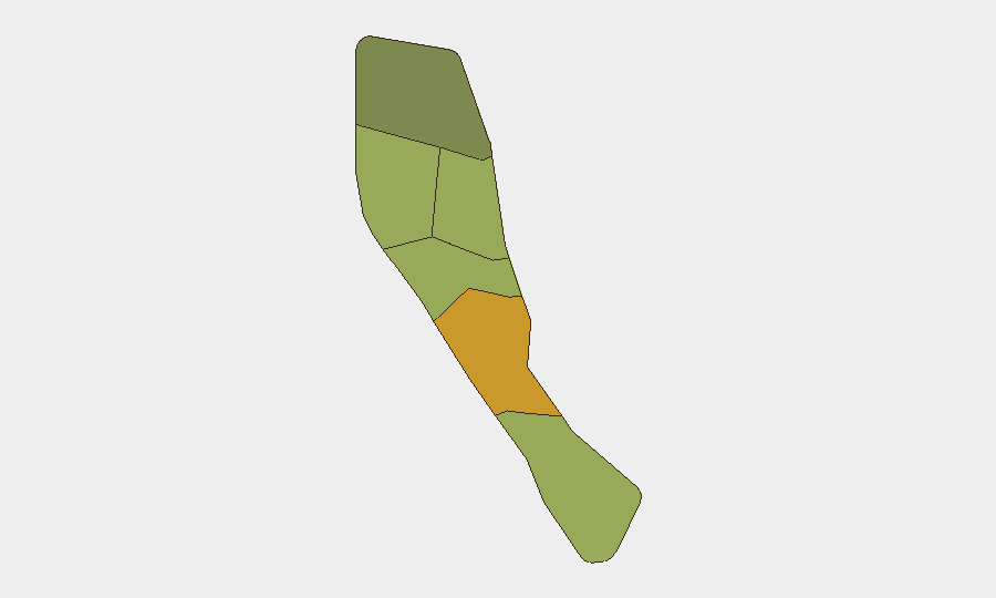
Shefa Province (risk 72) and Penama Province (risk 58) rank highest, driven in part by Penama's inclusion of Ambae Island and its active volcano, a chronic physical hazard rather than a security threat. Sanma, Malampa, and Tafea provinces maintain moderate composite scores; Torba is lowest-risk. The sub-national ranking reflects underlying vulnerability (seismic and volcanic exposure, infrastructure density, and population concentration in Port Vila and regional centers) rather than current acute conflict, crime, or civil unrest. No province shows signs of political instability or organized violence in the current 24–48 hour window.
How GeoBit Would Assist
Security teams with personnel or assets in Vanuatu would deploy AOI Monitoring & Early Warning on Port Vila and provincial capitals to detect emerging unrest or protest activity before escalation. OSINT fusion and multi-language search across local news, social media (X, Telegram), and radio SIGINT would provide real-time ground-truth corroboration of any diplomatic or political friction that might cascade into street-level risk. Satellite and imagery analysis combined with environmental monitoring would track volcanic hazard zones and weather impacts on transport corridors and port operations.
7-Day Outlook
Vanuatu's security environment is expected to remain stable over the next 7 days absent new diplomatic escalation or unforeseen natural hazard (volcanic or cyclonic) intensification. The 28 July diplomatic messaging should be monitored for any signals of domestic political mobilization, but current reporting shows no public unrest or radicalization. Routine weather and volcanic hazards will persist; small-craft operators and personnel near Ambae should remain alert to VMGD advisories.
Highest-Risk Areas — Ranked
| # | State / Region | Risk |
|---|---|---|
| 1 | Shefa Province | 72 |
| 2 | Penama | 58 |
| 3 | Sanma | 52 |
| 4 | Malampa | 48 |
| 5 | Tafea | 45 |
| 6 | Torba | 35 |
Sources
Previous Daily Briefs
A new Vanuatu brief is written every day — each with its own risk map and downloadable CSV. Here's the last week; use the calendar to go further back.
📅 Browse every day by calendar →
Highlighted days have a brief. Tap a day for that day's map & analysis, or “csv” for that day's dataset ($5).
Atlas — our AI intelligence desk — emails them this snapshot personally. Nothing else, no list.