Situation Summary
Australia remains a lower-risk jurisdiction (rank #168 globally, composite score 4) with 888 tracked security events, but sub-national concentration in New South Wales, Northern Territory, and Western Australia is driving elevated concern. Recent event signals indicate domestic political tension, military-related investigations, and territorial activity, though the precise nature and operational impact of these incidents remain unclear from available open reporting. The sparse and largely undated web research environment limits real-time situational clarity, warranting heightened reliance on direct intelligence feeds and AOI monitoring for organisations with critical assets in high-risk states.
Key Developments
GeoBit's event signals from 30 June–1 July identify multiple domains of concern:
- Military/Defence activity (30 June). Signals of conventional military force involving Australian assets in Bangkok region and occupation-related activity in Western Australia, paired with military police investigation and public military statements, suggest either exercise activity or unresolved operational/personnel matter. Precise location and casualty status unknown from available sources.
- Domestic political friction (30 June–1 July). Public statements escalating between Australian government and parliament, Australian entities vs. High Court, Australia vs. business/companies, and Australia vs. military indicate policy or institutional dispute, likely legislative or regulatory in nature. Reputational and operational risk to private-sector compliance and procurement teams.
- Possible international incident (29 June). Conventional military force signal involving Australian asset and Bangkok location; German administrative sanctions signal on same date suggests possible diplomatic or trade friction. Status of Australian personnel or assets unclear.
- Territory occupation/control (30 June, Western Australia). Signal of "occupy territory" activity in WA; lack of corroborating open-source detail prevents assessment of scale, intent, or duration. Potential implications for mining, energy, or remote-asset security in Western Australia.
No additional specific, dated incidents with confirmed location and timeframe emerged from live web research in the last 24–48 hours; most available content is entertainment, undated social media, or historical background. This information gap is typical for Australia's low-threat environment but necessitates active monitoring for sudden escalation.
Highest-Risk Areas
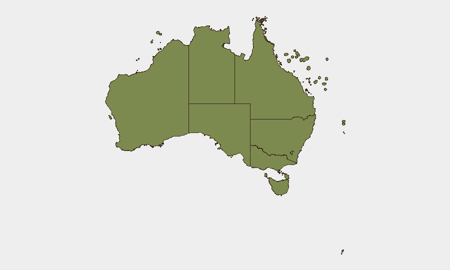
New South Wales (31.7) dominates the sub-national risk ranking, significantly outweighing all other states and likely reflecting concentrated population, economic activity, and event volume in Sydney and surrounds. Northern Territory and Western Australia (13.5 and 13.0 respectively) show secondary elevation, consistent with signals of military and territorial activity in WA and the NT's remote border and remote-asset exposure. Victoria, Queensland, and ACT carry considerably lower composite scores (11.7, 8.9, 5.7), indicating lower event density and intensity. ACT's lower risk likely reflects Canberra's controlled security environment, while southern and island territories register minimal threat signals.
How GeoBit Would Assist
Security teams should leverage AOI Monitoring & Early Warning to establish persistent watch zones in NSW (Sydney CBD, port), WA (mining/energy zones), and NT (borders, remote infrastructure), with real-time alerting on military, protest, or territorial activity. Intel Sweep, X/Twitter OSINT, and multi-language event feed fusion would systematically surface dated, geolocated incidents and policy signals as they break, filling the current gap in open-source clarity. Conflict & Military tracking and satellite imagery analysis would provide early assessment of WA territorial activity and military exercise scope, enabling rapid duty-of-care response.
7-Day Outlook
Domestic political tension and military-related signals are unlikely to escalate to kinetic or widespread disruption, but regulatory and procurement friction will persist. Western Australia remains the highest near-term focus for remote-asset and supply-chain teams. Expect continued sparse open-source reporting; proactive intelligence sourcing and AOI alerting will be essential for early warning.
Highest-Risk Areas — Ranked
| # | State / Region | Risk |
|---|---|---|
| 1 | New South Wales | 31.7 |
| 2 | Northern Territory | 13.5 |
| 3 | Western Australia | 13 |
| 4 | Victoria | 11.7 |
| 5 | Queensland | 8.9 |
| 6 | Australian Capital Territory | 5.7 |
| 7 | South Australia | 3.3 |
| 8 | Tasmania | 3 |
| 9 | Ashmore and Cartier Islands | 1.7 |
| 10 | Jervis Bay Territory | 1.7 |
| 11 | Coral Sea Islands | 1.7 |
Sources
Previous Daily Briefs
A new Australia brief is written every day — each with its own risk map and downloadable CSV. Here's the last week; use the calendar to go further back.
📅 Browse every day by calendar →
Highlighted days have a brief. Tap a day for that day's map & analysis, or “csv” for that day's dataset ($5).