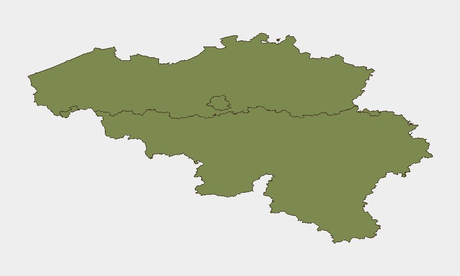
Situation Summary
Belgium remains a low-threat environment globally (rank #96, composite score 10) but exhibits concentrated risk in Flanders, where the threat score is significantly elevated at 31.5. Recent event signals reflect activism, public statements, and civic disapproval across multiple stakeholder groups (residents, European actors, government entities) rather than acute security incidents. No confirmed, corroborated security incidents—crime, terrorism, civil unrest, or infrastructure disruption—were identified in Belgium during the 24–48 hours preceding this brief (July 11–13, 2026).
Key Developments
No verified, location-specific security incidents in Belgium were confirmed within the last 24–48 hours by independent corroborating sources. Web research and open OSINT indicate:
- World Cup coverage (U.S., not Belgium). High-volume reporting on Belgium's national football team and FIFA disciplinary proceedings in the U.S.; not a Belgium security event.
- Cyber-attack reference (unconfirmed, no timestamp). Social media mention of "hundreds of Belgian organisations hit by cyber attack," but lacking publication date, affected entities, scope, or corroboration from news outlets. Cannot be treated as verified recent incident without time-stamped, multi-source confirmation.
- Airport/transport delays (Brussels, no incident date). Social posts reference security and immigration queue confusion at Brussels Midi and airports; no specific date, scale, or independent verification provided.
- Background: 2025 drug-crime context. Older reporting (May 2025) on Brussels drug trafficking and organized crime trends remains relevant to Flanders risk profile but is not a current development.
- Event signals (non-incident). The GEOBIT event index flags activism (demonstrations vs. Russian entities), resident disapproval, government statements, and European inter-agency activity, consistent with normal civic and diplomatic discourse rather than acute threats.
Highest-Risk Areas
Flanders dominates Belgium's risk landscape (31.5 vs. Brussels 11.7, Wallonia 1.5), suggesting concentration of activism, political tension, or organized-crime activity in the Dutch-speaking north and east. Brussels-Capital, as the de facto capital and seat of EU institutions, retains secondary risk exposure typical of major administrative and diplomatic hubs. Wallonia's relatively low score (1.5) indicates minimal tracked threat activity in the southern French-speaking region. The risk gradient correlates with Flanders' larger population, economic output, and historical political polarization.
How GeoBit Would Assist
Corporate security teams with personnel or assets in Belgium should employ AOI (Area-of-Interest) Monitoring & Early Warning on Flanders and Brussels to detect emerging civil unrest, protest activity, or infrastructure disruptions with real-time alerting. OSINT fusion (X/Twitter, Telegram, local news aggregation, multi-language search) enables continuous scanning for corroborated incident reports and sentiment shifts that precede escalation. Routing & Network Analysis supports contingency planning and alternative travel routes for staff in high-risk zones, particularly around Brussels transport hubs and Flanders commercial/industrial centers.
7-Day Outlook
No imminent acute threat is evident. Monitoring should focus on whether current civic activism in Flanders escalates into organized protest or disruption, and whether cyber-threat signals become specific and confirmed. Standard duty-of-care protocols (staff communication, transport contingencies, supply-chain redundancy) remain appropriate for the low-threat environment, with escalation triggers calibrated to verified, location-specific incident reporting.
Highest-Risk Areas — Ranked
| # | State / Region | Risk |
|---|---|---|
| 1 | Flanders | 31.5 |
| 2 | Brussels-Capital | 11.7 |
| 3 | Wallonia | 1.5 |
Sources
Previous Daily Briefs
A new Belgium brief is written every day — each with its own risk map and downloadable CSV. Here's the last week; use the calendar to go further back.
📅 Browse every day by calendar →
Highlighted days have a brief. Tap a day for that day's map & analysis, or “csv” for that day's dataset ($5).
Atlas — our AI intelligence desk — emails them this snapshot personally. Nothing else, no list.