Situation Summary
Iceland remains a low-threat environment with no civil unrest, terrorism, or political instability reported in the last 24–48 hours. Recent security activity is confined to routine policing (group assault in Reykjavík, drunk-driving enforcement), one fatal accident in South Iceland, and the ongoing administrative handling of 21 detained anti-whaling activists in the Capital Region. Background seismic activity near Grindavík and persistent cyber-crime exposure (seven documented victim organizations) present managed but persistent hazards for operations and infrastructure.
Key Developments
- Reykjavík city centre (Miðbær) – night of 3–4 August 2026: Group fight (hópslagsmál) broke out around 05:00; police intervened and detained two individuals. Described as one of the main police interventions of the night.
- Kópavogur / Breiðholt (Capital Region) – night of 3–4 August 2026: One arrest on suspicion of assault; police also reported elevated drunk-driving enforcement during the same period.
- South Iceland – early August 2026: A fatal accident confirmed in the region and flagged in national news roundup; limited details on exact location or circumstances available at this time.
- Reykjavík harbour – 4–5 August 2026: Immigration and legal proceedings ongoing for 21 anti-whaling activists detained after Coast Guard boarding of vessel Bandero (31 July). Authorities moving toward expulsion and entry-ban decisions this week.
- Vestmannaeyjar (Westman Islands) – 2 August 2026 (Þjóðhátíð opening): National Festival reported "unusually quiet" with no serious accidents. Coast Guard helicopter evacuation of one individual with leg injury; minor intoxication incidents handled but no major crime or unrest recorded.
- Nationwide seismic activity – last 48 hours: 58 earthquakes recorded near Svartsengi and Grindavík in 48 hours (strongest magnitude 2.4). Icelandic Meteorological Office assessment: moderate seismic activity, no indication of imminent eruption or infrastructure disruption.
- Highland road closures – ongoing: F-road closures (e.g., F210) persist due to seasonal or safety restrictions; represents travel risk for those ignoring closures, but no new nationwide infrastructure disruption reported in last 24–48 hours.
Highest-Risk Areas
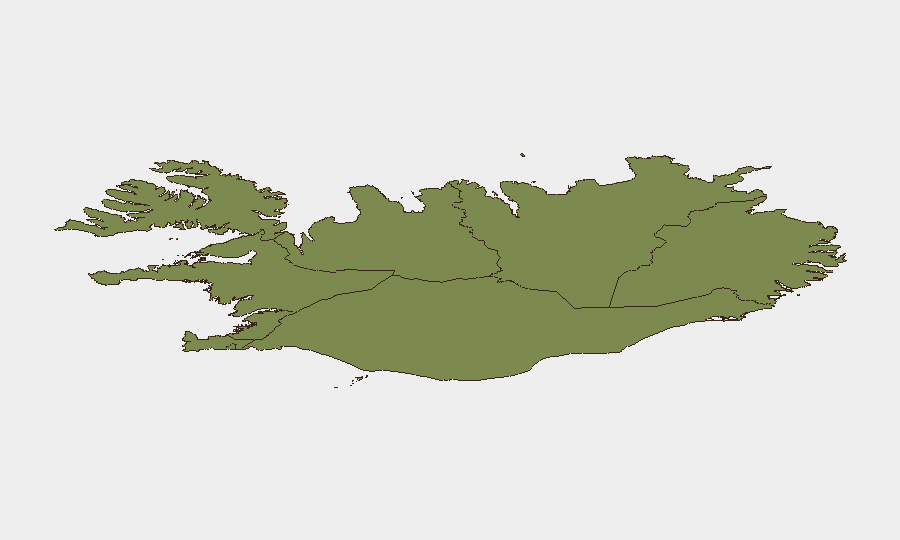
The Capital Region (composite score 24) dominates Iceland's risk profile, driven by Reykjavík's higher population density, incident concentration (downtown assault, anti-whaling detention and processing, harbour activity), and routine law-enforcement activity. Southern Peninsula and Southern Region (scores 12 and 11) follow, with the latter marked by the recent fatal accident and ongoing seismic unrest near Grindavík. All other regions score below 11; peripheral areas (Westfjords, Northwestern, Northeastern) remain substantially lower-risk. Risk concentration in the south reflects both natural hazard (seismic/volcanic) and occasional traffic incidents; capital-region risk reflects urbanization and administrative activity rather than instability.
How GeoBit Would Assist
Security and risk teams monitoring Iceland would employ Intel Sweep and live web research to track routine policing, accident reporting, and activist-detention developments in real time. AOI Monitoring & Early Warning focused on the Capital Region and seismic zones (Svartsengi, Grindavík) would provide persistent watch for escalation or infrastructure impact. Network & Actor Analysis and Cyber intelligence would help track the seven known ransomware victims and assess exposure to Icelandic operations; Routing & Network Analysis would support safe travel planning given ongoing F-road closures and South Iceland accident risks.
7-Day Outlook
No material escalation is anticipated over the next seven days. The anti-whaling activist proceedings will conclude with likely expulsion and entry bans, removing an acute administrative focus from Reykjavík. Seismic activity near Grindavík is expected to remain within monitored, moderate levels absent a sharp uptick in magnitude or frequency. Routine crime and road safety remain the dominant operational hazards for corporate personnel and assets.
Highest-Risk Areas — Ranked
| # | State / Region | Risk |
|---|---|---|
| 1 | Capital Region | 24 |
| 2 | Southern Peninsula | 12 |
| 3 | Southern Region | 11 |
| 4 | Eastern Region | 10 |
| 5 | Western Region | 9 |
| 6 | Westfjords Region | 8 |
| 7 | Northwestern Region | 7 |
| 8 | Northeastern Region | 6 |
Sources
Previous Daily Briefs
A new Iceland brief is written every day — each with its own risk map and downloadable CSV. Here's the last week; use the calendar to go further back.
📅 Browse every day by calendar →
Highlighted days have a brief. Tap a day for that day's map & analysis, or “csv” for that day's dataset ($5).
Atlas — our AI intelligence desk — emails them this snapshot personally. Nothing else, no list.