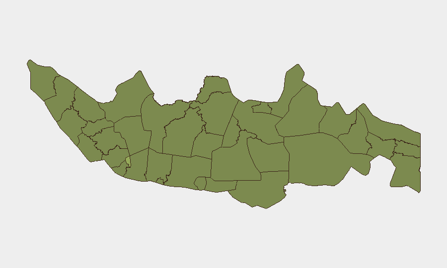
Situation Summary
Indonesia remains at moderate global threat ranking (#44, composite score 38) with 695 tracked events, reflecting persistent security fragmentation rather than nationwide instability. The most acute current risk is concentrated in Papua Highlands following the 2–3 July killing of a U.S. pilot by armed separatists, which has triggered intensified security operations and heightened checkpoints across remote regions. Jakarta continues as the highest-risk subnational zone (56.7), driven by urban crime, protests, and financial-sector tensions, while volcanic activity across six major volcanoes compounds travel and infrastructure risk nationwide.
Key Developments
- Yahukimo Regency, Papua Highlands – 2–3 July 2026 (reported 3–5 July)
American pilot operating for PT AMA fatally shot after landing at Ipdeheik airstrip; aircraft subsequently burned by armed separatists. Indonesian military recovered remains on 3 July; seven Papuan passengers reported unharmed. Attack has triggered joint security-force operations and heightened airstrip security protocols across Papua Highlands.
- Papua region (multiple regencies) – 4–6 July 2026
Indonesia's human rights commission (Komnas HAM) issued public call for ceasefire between security forces and armed groups, citing rising civilian casualties and displacement in recent days. Statement amplified by national media and signals escalating counterinsurgency activity.
- Papua Highlands – 5–6 July 2026
Heightened security operations, road checkpoints, and increased military patrols reported in Yahukimo and adjacent regencies. Movement restrictions and enhanced airfield security noted in social-media and news accounts; granular checkpoint mapping remains incomplete.
- Indonesia nationwide – Volcanic hazard advisory current as of 5 July 2026
UK FCDO travel advice reiterates "high degree of caution" and advises against all travel near six active volcanoes (Lewotobi Laki-Laki, Sinabung, Marapi, Semeru, Ruang, Ibu) due to ongoing eruption risk and infrastructure disruption potential.
- Event signal clustering – 4–6 July 2026
Multiple public statements and investigative activity flagged by platform across finance ministry, school, and religious sectors; specific incidents not yet corroborated in independent reporting but signal potential labor, financial, or policy disputes requiring monitoring.
Highest-Risk Areas
Jakarta's risk score (56.7) substantially exceeds all other regions and reflects concentration of political activity, financial-sector tensions, and organized crime in Indonesia's capital and economic hub. East Java (35.3) and the Bangka-Belitung Islands (34.3) follow, with resource-extraction zones (Jambi, Riau, West Kalimantan) driven by labor disputes, environmental conflict, and smuggling activity. Papua remains exceptional: although not ranked in the top 12 due to lower event density, the current pilot killing and Komnas HAM ceasefire call indicate acute kinetic risk in specific regencies (Yahukimo, neighboring highlands areas) that corporate teams with aviation, extractive, or NGO presence must treat as active threat zones.
How GeoBit Would Assist
Teams operating in Papua Highlands and remote aviation corridors should activate AOI Monitoring & Early Warning on Yahukimo Regency and adjacent airstrips to track checkpoint movements and security-force activity. Conflict & Military force-structure tracking combined with Network & Actor Analysis of separatist groups will clarify faction activity and operational tempo. Alternative route and journey planning via the Routing & Network Analysis function can identify safer transit corridors around active checkpoints and military concentrations.
7-Day Outlook
Heightened security operations in Papua Highlands are likely to persist through mid-July, with airstrip access variability and increased documentation checks affecting supply chains and personnel movement. Jakarta's financial-sector tensions and provincial labor disputes warrant continued passive monitoring for escalation. Volcanic activity poses no imminent change but remains a latent disruptor to regional air and road transport.
Highest-Risk Areas — Ranked
| # | State / Region | Risk |
|---|---|---|
| 1 | Special capital Region of Jakarta | 56.7 |
| 2 | East Java | 35.3 |
| 3 | Bangka-Belitung Islands | 34.3 |
| 4 | Jambi | 30.5 |
| 5 | Lampung | 30.2 |
| 6 | South Sulawesi | 29.9 |
| 7 | North Sumatra | 28.9 |
| 8 | Central Java | 28.6 |
| 9 | West Java | 27.9 |
| 10 | Special Region of Yogyakarta | 27.6 |
| 11 | West Kalimantan | 27.3 |
| 12 | Riau | 27 |
Sources
Previous Daily Briefs
A new Indonesia brief is written every day — each with its own risk map and downloadable CSV. Here's the last week; use the calendar to go further back.
📅 Browse every day by calendar →
Highlighted days have a brief. Tap a day for that day's map & analysis, or “csv” for that day's dataset ($5).
Atlas — our AI intelligence desk — emails them this snapshot personally. Nothing else, no list.