Situation Summary
Maldives remains a low-threat environment globally (rank #149, composite score 6) with no tracked security incidents of political, criminal, or militant character. However, a cluster of maritime disasters over the past four days—including two vessel capsizings and an ongoing search for missing personnel—has exposed operational hazards in the archipelago's waters and highlighted dependency on MNDF and coast guard response capacity. The capital Malé and surrounding atolls carry elevated administrative and transactional risk (scores 85–68), typical of dense urban centers and tourism nodes. No deterioration in security posture is evident; the current threat profile remains stable.
Key Developments
- Gaafaru, North Malé Atoll, 6 Aug 2026: A landing craft capsized in rough seas with two expatriate crew members missing. MNDF, coast guard, and police initiated multi-agency search-and-rescue operations by air, sea, and diving teams; status as of 10 Aug remains unresolved.
- Near Gaafaru / surrounding waters, 6–10 Aug 2026: MNDF issued maritime hazard alerts urging all vessels to maintain vigilance and report sightings as the search for the two missing foreigners continued without positive outcome.
- Laamu-to-Huvadhu maritime route, 6 Aug 2026: Supply vessel *Friend 4* sank during routine transit, triggering a joint MNDF-police rescue operation. During the response, an MNDF soldier and a police officer went missing while assisting in water-removal efforts, expanding the incident to a multi-agency missing-person search involving five total persons at risk.
- At-sea navigation hazard, 7 Aug 2026: MNDF issued a maritime hazard warning for an unlit metal barge drifting eastward in shipping lanes, creating obstruction risk for commercial and tourism vessels.
- Tourism vessel incident, 7 Aug 2026: Live-aboard safari vessel *Princess Laala* ran aground after breaking anchor and striking an outer breakwater. Structural and passenger status reported as of 10 Aug unclear; vessel remains a navigational concern.
Highest-Risk Areas
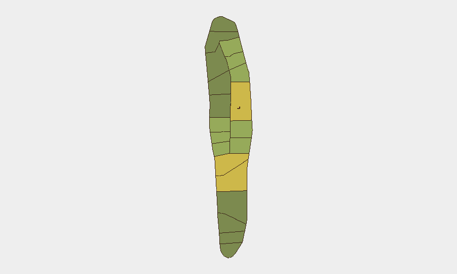
Malé (risk 85) and Malé Atoll (risk 68) dominate the sub-national ranking, reflecting the capital's role as the administrative, commercial, and tourism hub where population density, financial activity, and transactional exposure concentrate corporate and expatriate presence. Hadhdhunmathi (65), Kolhumadulu (60), and Felidhu Atoll (58) elevate northern and central atoll risk, likely reflecting tourism infrastructure and supply-chain dependencies. These rankings reflect administrative and operational complexity rather than active conflict or organized crime; risk is primarily duty-of-care and contingency-related.
How GeoBit Would Assist
Security and duty-of-care teams would employ AOI Monitoring & Early Warning to track maritime incidents and hazards around high-traffic atolls in near-real-time; Maritime & Aviation Tracking to monitor vessel routes, weather windows, and search-and-rescue operations; and Intel Sweep combined with multi-language OSINT (local news, government alerts, community channels) to detect emerging maritime or environmental hazards before they affect personnel or assets. Routing & Network Analysis can identify alternative transit corridors and safer scheduling windows during periods of elevated sea state or incident clustering.
7-Day Outlook
Maritime conditions and incident frequency should stabilize once current search operations conclude and sea state moderates. Routine tourism and supply operations will resume within 7–10 days absent major weather or new capsizings. No indicators suggest escalation to broader security concerns; continued focus on maritime safety protocols and vessel vetting remains appropriate for corporate and NGO teams with offshore or inter-atoll operations.
Highest-Risk Areas — Ranked
| # | State / Region | Risk |
|---|---|---|
| 1 | Malé | 85 |
| 2 | Malé Atoll | 68 |
| 3 | Hadhdhunmathi | 65 |
| 4 | Kolhumadulu | 60 |
| 5 | Felidhu Atoll | 58 |
| 6 | Mulaku Atoll | 55 |
| 7 | Faadhippolhu | 52 |
| 8 | South Miladhunmadulu | 48 |
| 9 | North Miladhunmadulu | 45 |
| 10 | South Nilandhe Atoll | 44 |
| 11 | North Nilandhe Atoll | 42 |
| 12 | South Ari Atoll | 40 |
Sources
Previous Daily Briefs
A new Maldives brief is written every day — each with its own risk map and downloadable CSV. Here's the last week; use the calendar to go further back.
📅 Browse every day by calendar →
Highlighted days have a brief. Tap a day for that day's map & analysis, or “csv” for that day's dataset ($5).
Atlas — our AI intelligence desk — emails them this snapshot personally. Nothing else, no list.