Situation Summary
Tonga remains a very low-threat environment (global rank #191, composite score 2) with no active civil unrest, political violence, or organized crime incidents reported in the last 24–48 hours. The primary operational risk is infrastructure-related: a major generator failure on Tongatapu has triggered controlled power outages affecting the capital Nuku'alofa and surrounding areas through at least late August, posing secondary risks to business continuity, communications, and service delivery. Routine Cabinet appointments on 17 August reflect normal political administration with no associated instability signals.
Key Developments
- Generator failure and rotational power outages – Tongatapu (Nuku'alofa), 15–19 August 2026. Tonga Power Limited's largest generating unit failed on 15 August, forcing load shedding across Tongatapu. Repairs are expected to take approximately two weeks; intermittent outages will likely persist through late August and early September, affecting electricity-dependent operations, refrigeration, telecommunications, and water services.
- Cabinet ministerial appointments – Nuku'alofa, 17 August 2026. Three new ministers were sworn into Cabinet; no reports of associated protests, civil unrest, or political instability in the subsequent 24–48 hours.
- Fuel infrastructure modernization study launched – national, mid-August 2026. A feasibility study initiated to upgrade Tonga's aging fuel transport and storage systems. No current fuel shortages or security-related disruptions reported; this is a medium-term resilience project, not an acute incident.
- No new seismic events or civil security incidents reported in last 24–48 hours. While a magnitude 7.5 earthquake affected Vava'u in March 2026, no follow-on seismic activity or related damage has been reported recently.
Highest-Risk Areas
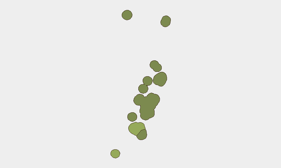
Tongatapu (risk score 45) dominates the national risk profile, primarily due to infrastructure vulnerabilities and concentration of government, commercial, and population assets in and around Nuku'alofa. The current power generation crisis directly impacts this region. Vavaʻu (risk score 28) ranks second, partly reflecting residual structural and geological fragility from the March 2026 earthquake and more limited redundancy in island services. Haʻapai, ʻEua, and Ongo Niua carry lower scores but remain subject to typical Pacific island constraints: limited emergency response capacity, geographic isolation, and dependence on central-island supply chains. None of these areas show active security event drivers; risk reflects structural vulnerability rather than conflict or crime.
How GeoBit Would Assist
GeoBit's Intel Sweep and multi-language OSINT capabilities would monitor Tongan social media, news feeds, and government communications for early warning of labor unrest, supply-chain disruptions, or political instability tied to the power crisis or other triggers. AOI Monitoring & Early Warning on Tongatapu and key infrastructure nodes would detect emerging unrest, service breakdowns, or secondary incidents before they spread. Environmental & Health data integration would track cascading impacts of extended outages on water, sanitation, and healthcare delivery, informing duty-of-care risk assessments for personnel and operations.
7-Day Outlook
Power outages are expected to continue intermittently through late August and possibly early September as repairs progress. No major political or security events are anticipated in the near term; Cabinet stability appears intact. Organizations should prioritize backup power, water storage, and alternative communication protocols for the duration of the generation deficit and monitor Tonga Power Limited's repair timeline for any acceleration or further delays.
Highest-Risk Areas — Ranked
| # | State / Region | Risk |
|---|---|---|
| 1 | Tongatapu | 45 |
| 2 | Vavaʻu | 28 |
| 3 | Haʻapai | 22 |
| 4 | ʻEua | 18 |
| 5 | Ongo Niua | 12 |
Sources
Previous Daily Briefs
A new Tonga brief is written every day — each with its own risk map and downloadable CSV. Here's the last week; use the calendar to go further back.
- August 16, 2026
- August 13, 2026
- August 11, 2026
- August 9, 2026
- August 7, 2026
- August 5, 2026
- August 4, 2026
📅 Browse every day by calendar →
Highlighted days have a brief. Tap a day for that day's map & analysis, or “csv” for that day's dataset ($5).
Atlas — our AI intelligence desk — emails them this snapshot personally. Nothing else, no list.