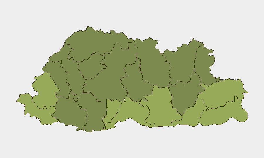
Situation Summary
Bhutan remains a low-threat environment with no active security incidents reported in the current 24–48 hour window. The national composite threat score of 3 (ranked #177 globally) reflects sustained political stability, low crime prevalence, and minimal civil unrest. No changes to this baseline posture are evident from available intelligence.
Key Developments
- No discrete security incidents were reported across Bhutan in the last 24–48 hours. Routine travel-advisory status (Level 1: Exercise Normal Precautions) remains unchanged as of 8 August 2026.
- No new civil unrest, infrastructure disruption, conflict, terrorism, or organized-crime activity has been verified in current reporting windows.
- Border-region monitoring continues as a routine matter given Bhutan's geographic position; no cross-border incidents or heightened activity flagged in recent cycles.
Highest-Risk Areas
Southern border districts—Samtse, Sarpang, Haa, and Pemagatshel—carry the highest composite risk scores (50–58), reflecting longstanding exposure to cross-border criminal networks, informal trade flows, and sporadic unauthorized movement. These areas remain geographically vulnerable despite low absolute incident frequency; risk drivers include terrain, limited formal security infrastructure, and proximity to informal trade corridors. Eastern districts (Samdrup Jongkhar, Trashigang) present secondary concern. Central and northern regions (Wangdue Phodrang, Gasa, Lhuntse) show substantially lower risk, consistent with reduced population density and distance from known smuggling and transit routes.
How GeoBit Would Assist
A corporate security team with personnel or assets in Bhutan's border districts would employ AOI Monitoring & Early Warning to maintain persistent watch on Samtse and Sarpang, with automated alerting for unauthorized cross-border movement, vehicle checkpoints, or incident clusters. Intel Sweep and OSINT fusion (X/Twitter, Telegram, local news feeds) would provide continuous baseline monitoring of Ministry of Home Affairs announcements, law-enforcement activity, and civil-society signals. GIS & Spatial Analysis combined with Routing & Network Analysis would support contingency planning and alternative journey routes for personnel traveling between districts, particularly in high-risk southern zones.
7-Day Outlook
No escalation is anticipated in the near term. Bhutan's political environment remains stable, institutional capacity is intact, and no triggering events are evident. Routine border-region monitoring should continue as standard duty-of-care practice, particularly for organizations operating in Samtse and Sarpang districts.
Highest-Risk Areas — Ranked
| # | State / Region | Risk |
|---|---|---|
| 1 | Samtse District | 58 |
| 2 | Sarpang District | 55 |
| 3 | Haa District | 52 |
| 4 | Pemagatshel District | 50 |
| 5 | Samdrup Jongkhar District | 48 |
| 6 | Tsirang District | 45 |
| 7 | Zhemgang District | 42 |
| 8 | Trashigang District | 40 |
| 9 | Mongar District | 38 |
| 10 | Gasa District | 35 |
| 11 | Lhuntse District | 32 |
| 12 | Wangdue Phodrang District | 30 |
Sources
Previous Daily Briefs
A new Bhutan brief is written every day — each with its own risk map and downloadable CSV. Here's the last week; use the calendar to go further back.
📅 Browse every day by calendar →
Highlighted days have a brief. Tap a day for that day's map & analysis, or “csv” for that day's dataset ($5).
Atlas — our AI intelligence desk — emails them this snapshot personally. Nothing else, no list.