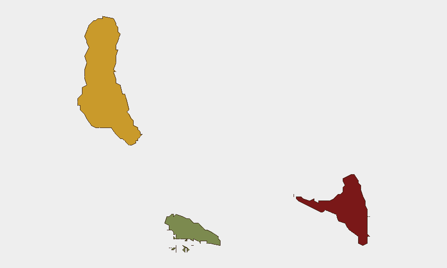
Situation Summary
Comoros remains a low-intensity threat environment with a composite global ranking of #128 and no discrete security events recorded in the current monitoring window. The archipelago's risk profile is driven by persistent structural vulnerabilities—including governance fragility, limited state capacity, and inter-island political tensions—rather than by acute incidents. No confirmed civil unrest, crime escalations, political instability events, or infrastructure disruptions were detected in the last 24–48 hours across Moroni or nationwide channels.
Key Developments
No confirmed security, conflict, civil-unrest, crime, political-instability, infrastructure, or travel-risk incidents were corroborated from open sources, social media, or web research within the last 24–48 hours. Monitoring of Moroni, Grande Comore, and nationwide distribution channels yielded no actionable alerts. Comoros-related results in the current cycle consisted of non-security items (heritage and employment content) and did not contain time-stamped incident confirmation.
Highest-Risk Areas
Anjouan (risk score 88) and Grande Comore (risk score 72) account for the majority of sub-national threat concentration. Anjouan's elevated risk reflects longstanding autonomy disputes, limited central-government authority, and a history of separatist tensions; Grande Comore, the largest and most densely populated island, concentrates political and administrative functions alongside informal-economy vulnerabilities and periodic intercommunal friction. Moheli (risk 35) remains substantially lower-risk. Corporate teams with personnel or assets in Anjouan should prioritize contingency planning around political volatility and restricted state capacity; Grande Comore operations should maintain standard duty-of-care protocols around informal security sector engagement and transport-route reliability.
How GeoBit Would Assist
Teams operating in Comoros should employ Intel Sweep and multi-language OSINT to establish baseline political-stability and crime-trend monitoring across Anjouan and Grande Comore; persistent Area-of-Interest (AOI) monitoring with alerting on Moroni, key ports, and administrative centers to detect civil unrest or infrastructure disruption in near-real time; and entity and network analysis to map informal power structures and cross-island political actors likely to affect business continuity or staff safety. Satellite and imagery analysis can supplement physical security assessments of operational sites, particularly in lower-connectivity zones.
7-Day Outlook
No acute security deterioration is indicated for the coming week. Risk trajectory remains flat absent exogenous political shocks or maritime incidents. Routine monitoring should continue with emphasis on pre-positioned alerts for sudden governance changes, inter-island political escalation, or crime-pattern shifts in Grande Comore and Anjouan.
Highest-Risk Areas — Ranked
| # | State / Region | Risk |
|---|---|---|
| 1 | Anjouan | 88 |
| 2 | Grande Comore | 72 |
| 3 | Moheli | 35 |
Sources
Previous Daily Briefs
A new Comoros brief is written every day — each with its own risk map and downloadable CSV. Here's the last week; use the calendar to go further back.
📅 Browse every day by calendar →
Highlighted days have a brief. Tap a day for that day's map & analysis, or “csv” for that day's dataset ($5).
Atlas — our AI intelligence desk — emails them this snapshot personally. Nothing else, no list.