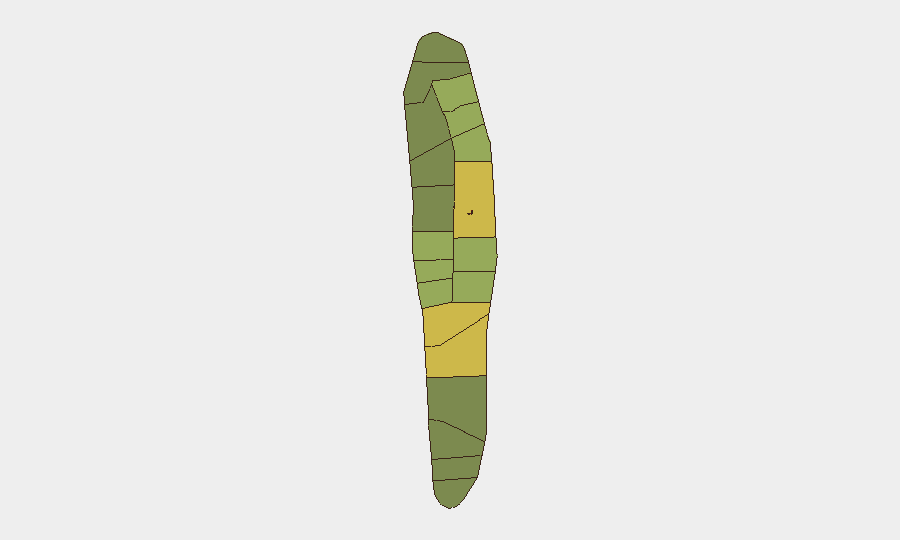
Situation Summary
Maldives remains a low-threat environment overall (global rank #151, composite score 6), with no active conflict, terrorism, or civil unrest. However, a developing maritime emergency and persistent hazardous-sea conditions have created localized risk in the southern atolls. The country's dispersed island geography and dependence on maritime supply routes mean that weather and accident cascades warrant active monitoring.
Key Developments
- Gaafu Alif Atoll / Huvadhoo Sea (2026-08-11) — Supply vessel *Friend 4* capsized and sank in deep water (approximately 1,645 m) while transiting between Laamu and Huvadhu atolls; seven of eight crew rescued, three remain missing (vessel captain, police sergeant, MNDF staff sergeant).
- Huvadhoo Sea search zone (2026-08-11 to 2026-08-12) — Joint MNDF Coast Guard and Maldives Police expanded air-and-sea search across >6,000 square nautical miles using UAVs, aircraft, and multiple surface vessels; no recovery reported as of 2026-08-12 0600 UTC.
- Foreign Ministry coordination, Malé (2026-08-12) — National authorities formally notified bilateral partners and requested international assistance to expand search-and-rescue operations in the southern maritime zone.
- Broader maritime hazard context (2026-08-06 to 2026-08-07) — Multiple vessel incidents in preceding days (landing craft sinking near Gaafaru, another supply vessel incident on Laamu–Huvadhu route, unlit barge drifting in shipping lanes, live-aboard vessel *Princess Laala* grounding) indicate elevated sea-state and navigation hazards across the archipelago.
Highest-Risk Areas
Malé and Malé Atoll (composite scores 85 and 68 respectively) remain the highest-risk zones, reflecting population density, administrative concentration, and port activity. Hadhdhunmathi, Kolhumadulu, and Felidhu Atoll (scores 65–58) follow; these southern and central atolls are now operationally stressed by concurrent maritime incidents and active SAR operations. The current emergency underscores that risk in Maldives is driven by maritime exposure and sea-state hazards rather than security threats; corporate assets dependent on inter-atoll supply chains and personnel traveling by water face elevated incident probability in the near term.
How GeoBit Would Assist
Security teams should deploy Maritime & Aviation Tracking and AOI Monitoring & Early Warning to monitor vessel transit patterns, weather, and SAR zone expansion in real time. GIS & Spatial Analysis and Routing & Network Analysis capabilities enable identification of safer alternative supply routes and asset-movement windows. Intel Sweep and multi-language OSINT provide rapid corroboration of incident scope, casualty data, and official response status across Maldivian media and government channels—critical for duty-of-care reporting and staff welfare verification.
7-Day Outlook
The *Friend 4* SAR operation will likely continue with international support for 5–7 more days. Sea state is expected to remain elevated through mid-August; additional minor maritime incidents (groundings, mechanical failures, collisions) are probable. No indication of cascading security threats; risk remains confined to maritime operations and weather-dependent supply logistics. Organizations with personnel or assets in southern atolls should review maritime transport schedules and consider temporary rerouting or delay protocols.
Highest-Risk Areas — Ranked
| # | State / Region | Risk |
|---|---|---|
| 1 | Malé | 85 |
| 2 | Malé Atoll | 68 |
| 3 | Hadhdhunmathi | 65 |
| 4 | Kolhumadulu | 60 |
| 5 | Felidhu Atoll | 58 |
| 6 | Mulaku Atoll | 55 |
| 7 | Faadhippolhu | 52 |
| 8 | South Miladhunmadulu | 48 |
| 9 | North Miladhunmadulu | 45 |
| 10 | South Nilandhe Atoll | 44 |
| 11 | North Nilandhe Atoll | 42 |
| 12 | South Ari Atoll | 40 |
Sources
Previous Daily Briefs
A new Maldives brief is written every day — each with its own risk map and downloadable CSV. Here's the last week; use the calendar to go further back.
📅 Browse every day by calendar →
Highlighted days have a brief. Tap a day for that day's map & analysis, or “csv” for that day's dataset ($5).
Atlas — our AI intelligence desk — emails them this snapshot personally. Nothing else, no list.