Situation Summary
Tonga remains a very low-threat security environment (global rank #191, composite score 2) with no reported civil unrest, political violence, or organized crime in the last 24–48 hours. The primary operational risk is sustained power instability on Tongatapu due to a major generator failure on 15 August, creating intermittent electricity disruptions affecting telecommunications, water, and logistics. A magnitude 5.1 earthquake struck the Tonga Islands region on 24 August at 10:19 GMT; no onshore damage or secondary impacts have been reported, but infrastructure resilience remains a monitoring focus given concurrent power constraints.
Key Developments
- Tongatapu (Nuku'alofa) – 24–25 Aug 2026: Rotational power outages continue across the capital and wider Tongatapu due to failure of Tonga Power Limited's primary generator (incident date 15 Aug); controlled load-shedding remains in effect. Repairs expected to take approximately two weeks from mid-August baseline; no restoration timeline update surfaced in the last 24 hours.
- Tonga Islands region (offshore) – 24 Aug 2026, 10:19 GMT: Magnitude 5.1 earthquake recorded at 17.92°S, 172.23°W, depth 10 km (GFZ German Research Centre for Geosciences). No follow-on reports of damage, tsunami warning, or secondary security incidents in the 24 hours following.
- Nationwide – 23–24 Aug 2026: Tongan Police issued a public appeal for a wanted suspect, Sione Maile Tonga, in national media on 23 August. Notice indicates active law-enforcement operations but no new crime incident.
- Overall security posture – 24–25 Aug 2026: No credible reports of protests, riots, civil unrest, major violent crime, or politically motivated incidents across Tonga in the last 48 hours.
Highest-Risk Areas
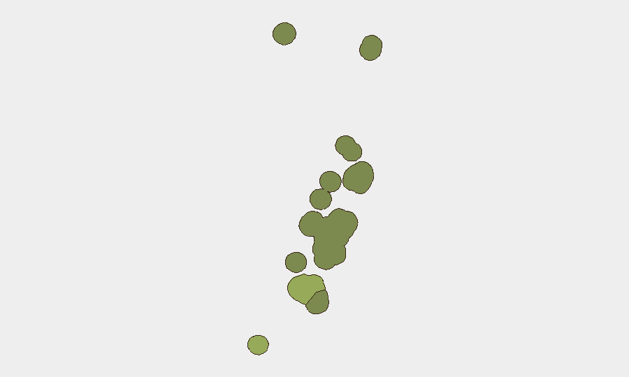
Tongatapu is ranked highest (risk 45) and drives the country's composite score, primarily due to infrastructure vulnerability and the ongoing power crisis affecting the capital, Nuku'alofa, and surrounding areas. Vavaʻu (risk 28) and Haʻapai (risk 22) follow but show significantly lower risk exposure. The sub-national ranking reflects operational fragility rather than acute security threats; Tongatapu's risk elevation stems from service disruptions and logistics strain, not crime or unrest. Remote northern island groups (ʻEua, Ongo Niua) carry minimal risk.
How GeoBit Would Assist
Organizations operating in Tonga should deploy AOI Monitoring & Early Warning on Tongatapu and key infrastructure nodes to track power restoration progress and detect any secondary civil unrest or supply-chain impacts. Multi-language OSINT & Event Feeds capability enables continuous monitoring of Tongan media, social platforms, and regional sources for early signals of unrest or infrastructure escalation. Routing & Network Analysis can identify alternative supply routes and telecommunications pathways to mitigate current and future electricity-related logistics disruptions.
7-Day Outlook
Power outages are expected to persist through early September barring acceleration of generator repairs. The 5.1 magnitude earthquake does not alter the low-threat baseline and carries no reported secondary impacts; however, seismic activity warrants continued infrastructure and utility monitoring on Tongatapu given concurrent grid vulnerability. No indicators suggest imminent escalation of civil unrest or security incidents; the operating environment remains stable.
Highest-Risk Areas — Ranked
| # | State / Region | Risk |
|---|---|---|
| 1 | Tongatapu | 45 |
| 2 | Vavaʻu | 28 |
| 3 | Haʻapai | 22 |
| 4 | ʻEua | 18 |
| 5 | Ongo Niua | 12 |
Sources
Previous Daily Briefs
A new Tonga brief is written every day — each with its own risk map and downloadable CSV. Here's the last week; use the calendar to go further back.
- August 22, 2026
- August 19, 2026
- August 16, 2026
- August 13, 2026
- August 11, 2026
- August 9, 2026
- August 7, 2026
📅 Browse every day by calendar →
Highlighted days have a brief. Tap a day for that day's map & analysis, or “csv” for that day's dataset ($5).
Atlas — our AI intelligence desk — emails them this snapshot personally. Nothing else, no list.