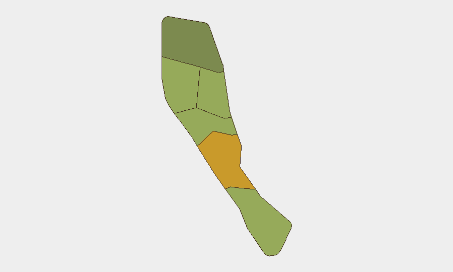
Situation Summary
Vanuatu remains at low acute security risk with no verified incidents of conflict, civil unrest, major crime, or political violence reported in the last 24–48 hours. The primary operational hazards are ongoing natural-hazard warnings: Ambae Island (Penama Province) is at Volcanic Alert Level 3 with minor eruption activity confined to Lake Voui, and countrywide marine strong wind warnings (southeasterly 21–25 knots, seas to 2.5 m) are affecting coastal transport. These geohazards, rather than security events, are currently the dominant risk drivers for personnel movement and supply chains.
Key Developments
- Ambae Island, Penama Province (ongoing as of 4 August 2026): Volcanic Alert Level 3 remains in effect at Manaro Voui volcano; minor eruption activity is confined within Lake Voui but continues to generate ashfall and air-quality risk across the Penama region and downstream aviation routes. Regional air services (including Fiji Airways Port Vila connections) have experienced cancellations tied to ash dispersal.
- Countrywide coastal waters (ongoing as of 4 August 2026): Vanuatu Meteorology and Geohazards Department (VMGD) maintains active Marine Strong Wind Warning across all coastal waters; southeasterly winds 21–25 knots and rough seas to 2.5 m create elevated risk for small-craft and inter-island transport operations.
- Port Vila and regional air routes (late July–early August 2026): Ashfall from Ambae volcanic activity has disrupted Fiji Airways and regional carrier schedules; routing delays and cancellations are expected to persist while Alert Level 3 remains in effect.
- No acute security incidents (24–48 hours, verified): Open-source monitoring, regional news wires, and travel advisories confirm no new incidents of violence, civil unrest, crime spikes, or infrastructure attacks in the last 24–48 hours.
Highest-Risk Areas
Shefa Province (risk score 72) and Penama Province (58) are the highest-risk sub-national zones. Shefa's elevated score reflects its status as the capital region (Port Vila) and concentration of national infrastructure, political activity, and urban density; Penama's ranking is driven by current volcanic hazard exposure at Ambae and downstream effects on regional stability and supply routes. Sanma (52) and Malampa (48) carry moderate composite risk scores reflective of remoteness, limited emergency-response capacity, and inter-island transport dependency. Tafea and Torba present lower acute risk.
How GeoBit Would Assist
Security and duty-of-care teams operating in Vanuatu should deploy AOI Monitoring & Early Warning to maintain persistent watch on Ambae volcanic activity and VMGD hazard bulletins, with automated alerts on Alert Level changes. Maritime & Aviation tracking combined with Routing & Network Analysis can identify real-time diversion and delay risk for supply chains and personnel movements dependent on coastal and air transport. Multi-language OSINT and event-feed intelligence provide rapid corroboration of any emerging civil or political instability, allowing teams to distinguish geohazard disruption from security incidents.
7-Day Outlook
Volcanic activity at Ambae and marine wind conditions are forecast to persist through early August, with ashfall and transport disruption remaining the principal operational constraint. No escalation of civil unrest, conflict, or major crime is anticipated over the next 7 days based on current trajectory and regional stability assessments. Risk posture remains low-to-moderate pending changes in geohazard alert levels or unforeseen political developments.
Highest-Risk Areas — Ranked
| # | State / Region | Risk |
|---|---|---|
| 1 | Shefa Province | 72 |
| 2 | Penama | 58 |
| 3 | Sanma | 52 |
| 4 | Malampa | 48 |
| 5 | Tafea | 45 |
| 6 | Torba | 35 |
Sources
Previous Daily Briefs
A new Vanuatu brief is written every day — each with its own risk map and downloadable CSV. Here's the last week; use the calendar to go further back.
📅 Browse every day by calendar →
Highlighted days have a brief. Tap a day for that day's map & analysis, or “csv” for that day's dataset ($5).
Atlas — our AI intelligence desk — emails them this snapshot personally. Nothing else, no list.