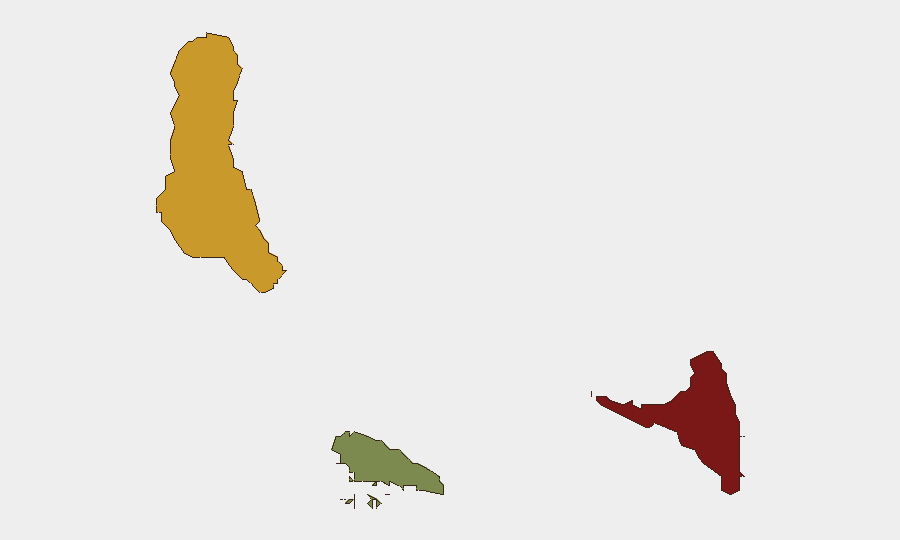
Situation Summary
Comoros maintains a baseline security environment with no independently verified incidents or civil unrest reported in the last 24–48 hours. The archipelago's composite threat score of 8 (rank #131 globally) reflects persistent but contained risks concentrated in Anjouan and Grande Comore, driven primarily by maritime trafficking activity and localized instability rather than widespread violence or political upheaval. The security landscape remains stable relative to regional comparisons, though organized crime networks—evidenced by the 2026-08-08 detention of the Comoros-flagged *IB Atlantic IV* by Ivorian authorities—continue to exploit the country's maritime jurisdiction and flag-registry vulnerabilities.
Key Developments
- No verified security incidents recorded countrywide, 2026-08-10 to 2026-08-12. Cross-checks of news feeds, specialist intelligence, and social media confirm a quiet 48-hour window with no corroborated crime, civil unrest, infrastructure failures, or political developments requiring duty-of-care escalation.
- Maritime trafficking risk remains active (regional context). The *IB Atlantic IV* incident (2026-08-08, Ivory Coast waters) underscores ongoing use of Comoros-flagged vessels by drug-trafficking organizations. While the vessel was interdicted outside Comorian territory, the flag-registry link indicates continued exposure of Comoros infrastructure to transnational organized crime.
Highest-Risk Areas
Anjouan (risk score 88) is the archipelago's primary security concern, driven by weak state capacity, historical separatist tensions dating to the 2000s, and trafficking corridors. Grande Comore (risk 72) follows, hosting the capital and proportionally higher criminal activity and competition for informal trade networks. Moheli (risk 35) remains substantially lower-risk and suitable for routine operations. The risk concentration reflects Anjouan's geographic isolation, limited governance reach, and entrenchment of maritime smuggling networks that exploit regulatory gaps.
How GeoBit Would Assist
Organizations with personnel or assets in Comoros should deploy AOI Monitoring & Early Warning on Anjouan and Grande Comore to detect shifts in security baseline; Maritime & Aviation Tracking to flag suspicious vessel movements and flag-registry abuses; and Network & Actor Analysis to map trafficking organizations and their supply chains. OSINT feeds (X/Twitter, Telegram, local news) and multi-language search provide continuous low-cost monitoring of political rhetoric, port activity, and informal crime indicators that precede formal incidents.
7-Day Outlook
No material escalation in threat is anticipated over the next seven days absent external shocks (e.g., regional maritime incidents or political crises in Madagascar or East Africa). Baseline maritime trafficking risk will persist; security teams should maintain routine vigilance on port activities and vessel movements. The August–September period historically sees elevated smuggling activity, but current political stability suggests no organized violence is imminent.
Highest-Risk Areas — Ranked
| # | State / Region | Risk |
|---|---|---|
| 1 | Anjouan | 88 |
| 2 | Grande Comore | 72 |
| 3 | Moheli | 35 |
Sources
Previous Daily Briefs
A new Comoros brief is written every day — each with its own risk map and downloadable CSV. Here's the last week; use the calendar to go further back.
📅 Browse every day by calendar →
Highlighted days have a brief. Tap a day for that day's map & analysis, or “csv” for that day's dataset ($5).
Atlas — our AI intelligence desk — emails them this snapshot personally. Nothing else, no list.