Situation Summary
Iceland remains a low-threat environment globally (rank #63, composite score 28) with no escalating security patterns as of 08 August 2026. Recent incidents—a maritime dispute involving an anti-whaling vessel, minor civil altercations in Reykjavík, and scattered seismic activity—present localized rather than systemic risks. The Capital Region accounts for the majority of tracked risk, driven primarily by law-enforcement activity and the *Bandero* expulsion case; all other regions remain below risk score 12, indicating stable conditions across the country.
Key Developments
- Reykjavík harbour, 05–06 Aug — Icelandic authorities issued expulsion orders and re-entry bans for 21 crew members of the anti-whaling vessel *Bandero* following Coast Guard seizure of the vessel; police cited suspected violations of international maritime law and obstruction. Crew remain subject to legal proceedings but are permitted to depart the vessel.
- Downtown Reykjavík, 04 Aug 05:00 UTC — A group altercation occurred in central Reykjavík; police detained two individuals. No injuries, property damage, or related secondary incidents were reported in available sources.
- Breiðholt police district, night of 03–04 Aug — One individual was held in custody on suspicion of bodily assault (*líkamsárás*); no further details on motive, victim status, or outcome were confirmed in 24–48-hour reporting.
- Strandir area (northwest Iceland), 07 Aug 16:00–08 Aug 13:00 UTC — The Icelandic Road Administration issued alerts for heightened landslide and rockfall risk due to heavy precipitation; affected roads face temporary closures and transport disruption.
- Ring Road and regional roads, nationwide, 07 Aug — The Ring Road (R1) remained open; however, 21 regional roads were closed or impassable, indicating localized but not systemic travel obstruction.
- Minor seismic activity, last 48 hours — Three earthquakes (magnitudes 1.6–2.1) were recorded near Eldey and Goðabunga in southwest Iceland; all were below impact thresholds with no associated damage or civil disruption reported.
Highest-Risk Areas
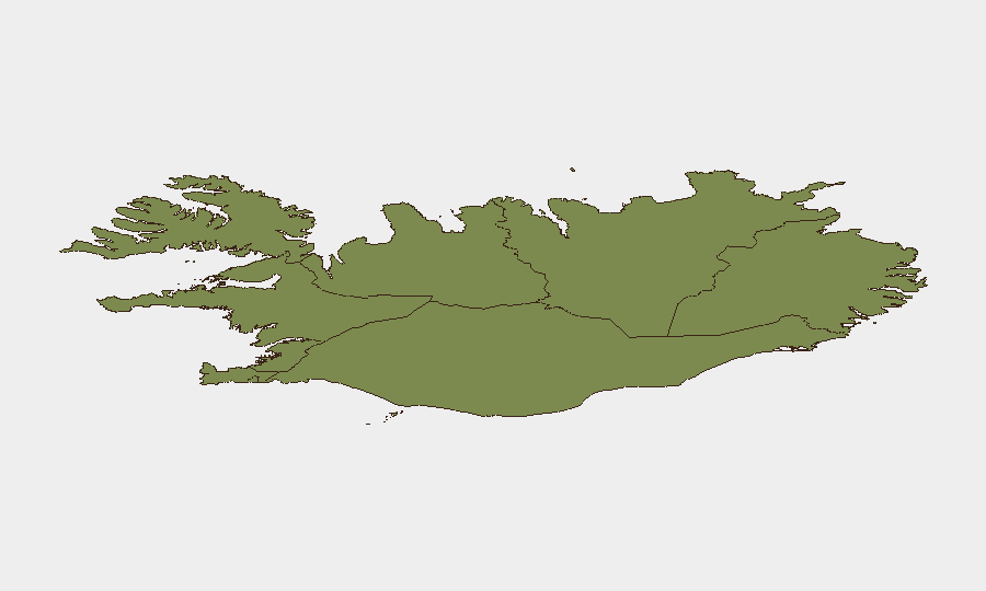
The Capital Region (risk score 24) drives Iceland's overall ranking, reflecting police-recorded incidents, the ongoing *Bandero* maritime case, and concentrated urban activity. The Southern Peninsula (risk 12) and Southern Region (risk 11) follow at roughly half the Capital Region's score, likely reflecting tourism density and isolated incidents rather than organized threat. All remaining regions score below 10, indicating negligible risk concentration; businesses and personnel outside the Capital Region face minimal security exposure from tracked events.
How GeoBit Would Assist
Security teams with assets or personnel in Iceland should employ AOI Monitoring & Early Warning on the Capital Region to track police activity, port operations, and civil unrest in real time. OSINT fusion & corroboration (X/Twitter, local news, and multi-language search) would confirm developments in Reykjavík faster than single-source reporting and alert teams to secondary incidents before broad media coverage. Environmental & Health intelligence tracking would provide lead notice of road closures, weather hazards, and transport disruption, enabling duty-of-care teams to adjust personnel movement and supply chains proactively.
7-Day Outlook
No material escalation is expected through 15 August. The *Bandero* case will likely conclude with crew departure and legal proceedings moving to administrative channels; minor crime in Reykjavík shows no pattern of expansion. Weather-driven road closures in the northwest and southern areas are forecast to ease as precipitation tapers, restoring full Ring Road accessibility by week's end.
Highest-Risk Areas — Ranked
| # | State / Region | Risk |
|---|---|---|
| 1 | Capital Region | 24 |
| 2 | Southern Peninsula | 12 |
| 3 | Southern Region | 11 |
| 4 | Eastern Region | 10 |
| 5 | Western Region | 9 |
| 6 | Westfjords Region | 8 |
| 7 | Northwestern Region | 7 |
| 8 | Northeastern Region | 6 |
Sources
Previous Daily Briefs
A new Iceland brief is written every day — each with its own risk map and downloadable CSV. Here's the last week; use the calendar to go further back.
📅 Browse every day by calendar →
Highlighted days have a brief. Tap a day for that day's map & analysis, or “csv” for that day's dataset ($5).
Atlas — our AI intelligence desk — emails them this snapshot personally. Nothing else, no list.