Situation Summary
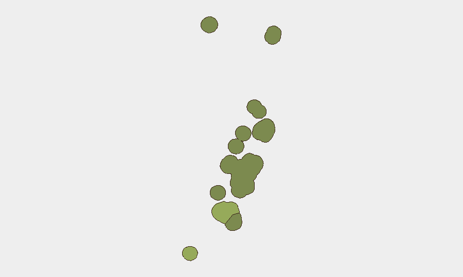
Tonga remains a very low-threat environment with no confirmed security incidents, civil unrest, political violence, or organized crime reported in the last 24–48 hours (27–28 August 2026). The composite national threat score of 2 reflects the absence of acute conflict, terrorism, or governance instability. Risk concentration is sub-national and driven primarily by Tongatapu (composite risk 45), which accounts for the majority of Tonga's limited exposure; remaining island groups pose negligible risk to corporate operations.
Key Developments
No discrete security, crime, unrest, infrastructure, or travel incidents have been confirmed in Tonga during 27–28 August 2026. The most recent structured security assessment (22 August 2026) explicitly confirmed the absence of active incidents and characterized the national threat environment as stable and predictable.
Context (outside 24–48h window but operationally relevant):
- Road-safety enforcement (25 August 2026, nationwide): Tonga Police conducted drink-driving arrests during a broad road-safety operation; 69 arrests resulted from testing of over 2,800 motorists. The enforcement period concluded several days before the report and reflects routine traffic safety, not civil unrest.
- Marine incident (22 August 2026, waters near Tonga): A whale-watching vessel carrying New Zealand Anglican Church delegates capsized. The incident is outside the current 24–48h window but may carry residual implications for marine tourism and foreign-delegation safety protocols.
- Media regulatory action (10 August 2026, capital region): The Tonga Communications Commission issued a licence-revocation notice for a radio station over alleged defamation. The action is routine regulatory enforcement and does not indicate press freedom collapse or political instability.
Highest-Risk Areas
Tongatapu (composite risk 45) drives national risk exposure and is the only island group meriting active monitoring for corporate operations. The capital, Nuku'alofa, concentration of government, commerce, and foreign missions explains elevated sub-national scoring. Vavaʻu (risk 28) and Haʻapai (risk 22) carry secondary risk profiles reflective of their smaller populations and economic footprints; ʻEua and Ongo Niua pose minimal threat. No evidence suggests that risk in Tongatapu is driven by acute criminal networks, political violence, or infrastructure failure; the scoring reflects routine baseline exposure inherent to any island nation's capital region.
How GeoBit Would Assist
Teams with personnel or assets in Tonga should employ AOI Monitoring & Early Warning on Tongatapu to detect any emergence of civil unrest, political instability, or security incidents in real time. OSINT fusion (X/Twitter, Telegram, local media, and multi-language search) provides continuous watch on political statements, labor actions, and crime reporting. Routing & Network Analysis supports contingency planning for evacuation or relocation in the unlikely event of infrastructure disruption or maritime incidents affecting inter-island transport.
7-Day Outlook
No indicators suggest a material change in Tonga's low-threat trajectory over the next 7 days. Seasonal weather patterns, inter-island transport schedules, and routine government activity are the primary operational considerations. Continued baseline monitoring of Tongatapu and periodic review of maritime safety protocols for any foreign-delegation or staff travel remain prudent duty-of-care practice.
Highest-Risk Areas — Ranked
| # | State / Region | Risk |
|---|---|---|
| 1 | Tongatapu | 45 |
| 2 | Vavaʻu | 28 |
| 3 | Haʻapai | 22 |
| 4 | ʻEua | 18 |
| 5 | Ongo Niua | 12 |
Sources
Previous Daily Briefs
A new Tonga brief is written every day — each with its own risk map and downloadable CSV. Here's the last week; use the calendar to go further back.
- August 25, 2026
- August 22, 2026
- August 19, 2026
- August 16, 2026
- August 13, 2026
- August 11, 2026
- August 9, 2026
📅 Browse every day by calendar →
Highlighted days have a brief. Tap a day for that day's map & analysis, or “csv” for that day's dataset ($5).
Atlas — our AI intelligence desk — emails them this snapshot personally. Nothing else, no list.