Situation Summary
Vanuatu remains at low acute security risk as of 5 August 2026, with no verified security incidents, civil unrest, or infrastructure disruption reported in the last 24–48 hours. Ongoing geophysical hazards—including minor volcanic activity on Ambae Island (Alert Level 3) and a marine strong wind warning affecting coastal waters nationwide—persist but show no signs of escalation. The country's baseline risk profile reflects distributed low-level crime and demonstration activity rather than acute instability, with Shefa Province consistently ranking as the highest-risk sub-national area.
Key Developments
No discrete security, conflict, civil-unrest, or infrastructure incidents have been confirmed in Vanuatu during the 24–48-hour reporting window.
Multi-source monitoring—including regional news outlets (ABC Pacific, Islands Business, Pacific Media Network), near-real-time security feeds, and official alerts—has identified no new events meeting incident criteria. Current status reflects:
- Ambae Island, ongoing: Volcanic Alert Level 3 (minor eruption) remains active; no fresh escalation or damage reported in the last 48 hours.
- National coastal waters, ongoing: Marine Strong Wind Warning continues; no new infrastructure or maritime incidents logged in the reporting period.
- Advisory status unchanged: Canadian and Australian travel advisories maintain existing guidance on ciguatera poisoning risk and general crime/demonstration awareness, with no incident-specific updates issued in the last 24–48 hours.
Highest-Risk Areas
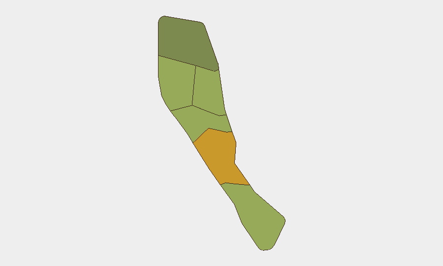
Shefa Province (risk score 72) accounts for the largest risk differential and drives the country's overall risk profile, followed by Penama (58) and Sanma (52). This concentration reflects Port Vila's status as the capital and largest urban center, where demonstrations, petty crime, and police-community tensions are episodically reported. Penama and Sanma provinces, while less densely populated, show elevated risk linked to inter-island transport disruptions, limited security infrastructure, and historical civil-unrest incidents. The remaining three provinces (Malampa, Tafea, Torba) show lower but persistent baseline risk.
How GeoBit Would Assist
Security teams with personnel or assets in Vanuatu would deploy AOI Monitoring & Early Warning on Shefa Province and secondary risk zones to detect emerging unrest, civil-society mobilization, or crime patterns in near-real time. Intel Sweep and multi-language OSINT fusion (including X/Twitter, local news, and regional feeds) would provide continuous situational awareness of political statements, police activity, and demonstration planning that precede unrest events. Satellite & Imagery analysis paired with Environmental & Health monitoring would track volcanic escalation on Ambae and coastal flooding risk, informing duty-of-care assessments for exposed sites.
7-Day Outlook
No acute security deterioration is forecast over the next seven days absent new geopolitical or climate triggers. Ambae volcanic activity and coastal wind conditions should be monitored for any alert-level change, which would necessitate rapid reassessment of transport and site-access protocols. Routine baseline crime and demonstration risk in Shefa Province will remain the primary operational concern for corporate security teams.
Highest-Risk Areas — Ranked
| # | State / Region | Risk |
|---|---|---|
| 1 | Shefa Province | 72 |
| 2 | Penama | 58 |
| 3 | Sanma | 52 |
| 4 | Malampa | 48 |
| 5 | Tafea | 45 |
| 6 | Torba | 35 |
Sources
Previous Daily Briefs
A new Vanuatu brief is written every day — each with its own risk map and downloadable CSV. Here's the last week; use the calendar to go further back.
📅 Browse every day by calendar →
Highlighted days have a brief. Tap a day for that day's map & analysis, or “csv” for that day's dataset ($5).
Atlas — our AI intelligence desk — emails them this snapshot personally. Nothing else, no list.