Situation Summary
Comoros remains a low-frequency threat environment globally (#133 composite ranking) with no tracked security events in the past 24–48 hours. The archipelago's security profile is dominated by maritime crime and trafficking activity, evidenced by the seizure of the Comoros-flagged vessel *IB Atlantic IV* by Ivorian authorities on 2026-08-09 in connection with suspected drug trafficking. Sub-national risk concentrates in Anjouan and Grande Comore, where governance gaps and maritime smuggling networks create persistent vulnerability. No active civil unrest, political instability, or domestic security incidents are currently verified.
Key Developments
- No verified security incidents in Comoros in the last 24–48 hours. Live web research found no corroborated reports of crime, civil unrest, infrastructure disruption, or travel-risk events with specific Comoros locations and recent dates.
- Maritime trafficking concern (2026-08-09, regional). Seizure of *IB Atlantic IV* (Comoros-flagged) by Ivorian coast guard during pursuit indicates continued use of Comoros registry in transnational drug-trafficking operations, reflecting weak maritime oversight and flag-state enforcement.
- No domestic political or security developments reported. Comoros-specific political, military, or public-order incidents do not appear in current verified sources; broader regional developments (Cameroon, Yemen, Strait of Hormuz) remain outside Comoros footprint.
Highest-Risk Areas
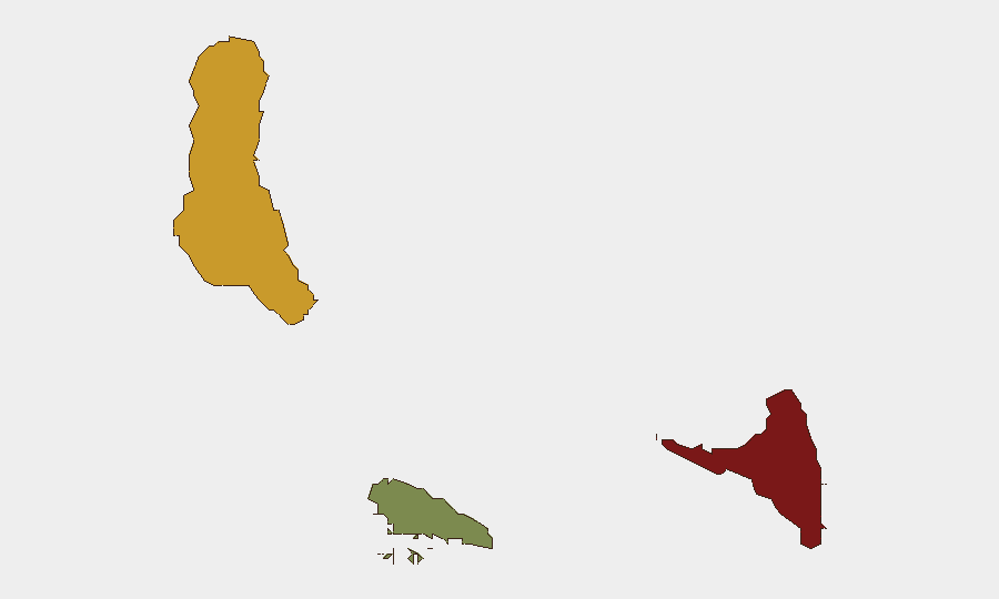
Anjouan (risk 88) and Grande Comore (risk 72) drive the archipelago's threat profile, while Moheli (risk 35) remains substantially lower-risk. Anjouan's elevated score reflects governance weakness, limited central authority presence, and historical separatism—conditions that enable smuggling networks and transnational criminal activity. Grande Comore, the capital island, faces maritime crime exposure and port-security vulnerabilities typical of Indian Ocean trading hubs. Risk in both islands remains indirect for most foreign nationals; direct exposure to violence or organized crime is low absent involvement in maritime trade or illicit networks.
How GeoBit Would Assist
Security teams with personnel or assets in Comoros should employ AOI Monitoring & Early Warning to detect emerging unrest, trafficking, or political shifts with persistent alerts; Maritime & Aviation tracking to monitor vessel movement and flag suspicious activity in territorial waters; and OSINT fusion (multi-language search, X/Telegram intelligence, entity extraction) to corroborate rumors and detect organizational actors (criminal groups, militant factions) before impact escalates. GIS & Spatial Analysis can map high-risk zones by island and sector, supporting duty-of-care routing and contingency planning.
7-Day Outlook
No acute security escalation is forecast for the next seven days. Maritime trafficking activity will likely persist as a chronic, low-visibility risk; international enforcement (Ivorian, regional coast guards) remains the primary countermeasure. Monitoring should remain focused on sub-national governance stability in Anjouan and any political shifts that might weaken central control further. Standard vigilance and maritime due diligence remain appropriate for corporate operations; broader contingency activation is not warranted at present.
Highest-Risk Areas — Ranked
| # | State / Region | Risk |
|---|---|---|
| 1 | Anjouan | 88 |
| 2 | Grande Comore | 72 |
| 3 | Moheli | 35 |
Sources
Previous Daily Briefs
A new Comoros brief is written every day — each with its own risk map and downloadable CSV. Here's the last week; use the calendar to go further back.
- August 12, 2026
- August 10, 2026
- August 8, 2026
- August 6, 2026
- August 5, 2026
- August 4, 2026
- August 3, 2026
📅 Browse every day by calendar →
Highlighted days have a brief. Tap a day for that day's map & analysis, or “csv” for that day's dataset ($5).
Atlas — our AI intelligence desk — emails them this snapshot personally. Nothing else, no list.