Situation Summary
Maldives remains a low-threat environment globally (rank #137, composite score 8) with no documented security incidents in the past 24–48 hours. However, concentrated risk is driven by political tension in the capital and maritime hazards across the atoll chain. Recent weeks have seen protest activity linked to economic grievances (currency depreciation), while maritime disasters signal operational vulnerabilities in inter-atoll transport.
Key Developments
- No security, civil-unrest, crime, or infrastructure incidents confirmed in Maldives for 15–16 August 2026 across available open sources. Earlier protest planning (MDP announcement, 10–14 August) remains unexecuted or unreported as of this brief.
- Maritime casualty trend continues: Supply vessel *Friend 4* capsized 4.1 nm off Kudalafari on 10 August (7 of 8 crew rescued); diving dhoni *Urafaa* ran aground west of Nolhivaranfaru on 13 August (6 rescued, no casualties). Pattern reflects seasonal weather and operational risk rather than security threat.
- Economic context: Dollar-rate volatility cited as driver of planned protest activity in Malé (announced 10–14 August window); no civil disorder reported to date.
Highest-Risk Areas
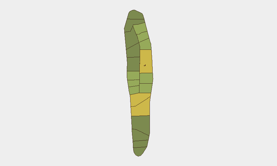
Malé and Malé Atoll (composite risk scores 85 and 68 respectively) account for the plurality of national risk, reflecting population density, administrative centrality, and protest susceptibility. Hadhdhunmathi, Kolhumadulu, and Felidhu Atoll (scores 65–58) form a secondary arc of concern, likely driven by socioeconomic stress and maritime transit exposure. Northern atolls (North/South Miladhunmadulu, North/South Nilandhe; scores 42–48) and South Ari Atoll (40) carry lower but sustained risk profiles. Risk distribution reflects proximity to labor hubs, resort concentrations, and inter-atoll supply-chain reliance.
How GeoBit Would Assist
Intel Sweep and X/Twitter OSINT (including Dhivehi-language monitoring) would capture protest mobilization, labor unrest, and political signaling in near–real time, ahead of public disorder. Maritime & Aviation tracking combined with AOI Monitoring & Early Warning would detect vessel anomalies, weather-driven transport disruptions, and infrastructure stress on the atoll supply chain—critical for duty-of-care teams with personnel or assets dependent on inter-island logistics. Economic & Trade analysis would flag currency, inflation, and labor-market signals that historically precede social unrest in island economies.
7-Day Outlook
No imminent security escalation is forecast; however, the unexecuted protest announced for mid-August warrants close observation. If labor or currency grievances intensify, demonstration activity in Malé in the coming 7–10 days remains plausible. Maritime hazard risk will persist through the current monsoon season, necessitating contingency planning for supply-chain delays and personnel evacuation routes.
Report Date: 16 August 2026 | Next Update: 17 August 2026 | Confidence: Moderate (limited recent incident-level reporting; economic and political context stable but monitored)
Highest-Risk Areas — Ranked
| # | State / Region | Risk |
|---|---|---|
| 1 | Malé | 85 |
| 2 | Malé Atoll | 68 |
| 3 | Hadhdhunmathi | 65 |
| 4 | Kolhumadulu | 60 |
| 5 | Felidhu Atoll | 58 |
| 6 | Mulaku Atoll | 55 |
| 7 | Faadhippolhu | 52 |
| 8 | South Miladhunmadulu | 48 |
| 9 | North Miladhunmadulu | 45 |
| 10 | South Nilandhe Atoll | 44 |
| 11 | North Nilandhe Atoll | 42 |
| 12 | South Ari Atoll | 40 |
Sources
Previous Daily Briefs
A new Maldives brief is written every day — each with its own risk map and downloadable CSV. Here's the last week; use the calendar to go further back.
- August 14, 2026
- August 12, 2026
- August 10, 2026
- August 8, 2026
- August 6, 2026
- August 5, 2026
- August 4, 2026
📅 Browse every day by calendar →
Highlighted days have a brief. Tap a day for that day's map & analysis, or “csv” for that day's dataset ($5).
Atlas — our AI intelligence desk — emails them this snapshot personally. Nothing else, no list.