Situation Summary
Tonga remains stable with no credible reports of civil unrest, violent crime, or politically motivated incidents in the last 24–48 hours. The overall threat profile is low (composite score 2, ranking #191 globally); however, critical infrastructure vulnerabilities persist on the main island of Tongatapu, including ongoing power instability from a generator failure on 15 August. Maritime hazard activity—including an unconfirmed whale-watching vessel incident and a M4.9 earthquake near Houma on 27 August—warrants routine situational monitoring but does not indicate an escalation in security risk.
Key Developments
- No significant security incidents reported in Tonga over the last 24–48 hours; no civil unrest, protests, riots, or politically motivated activity detected by available corroborated sources.
- Maritime incident (unconfirmed): A whale-watching boat reportedly capsized and sank in Tonga waters on or around 27 August; details remain limited and not independently corroborated; location and impact status unclear.
- Seismic activity (Tongatapu, 27 August): M4.9 earthquake recorded near Houma; no reported security or travel impact documented.
- Power infrastructure vulnerability (Tongatapu, ongoing since 15 August): Generator failure continues to drive intermittent power outages; affects operational continuity for businesses and critical services island-wide.
Highest-Risk Areas
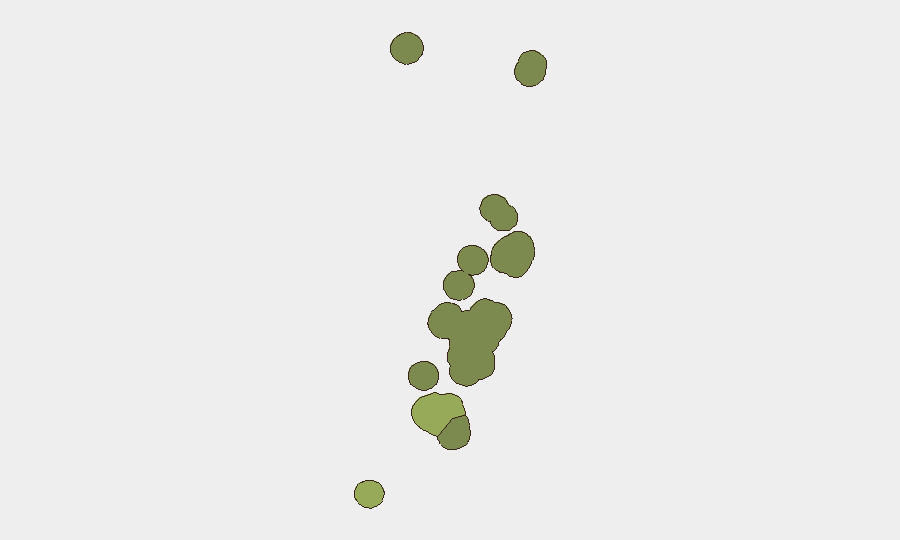
Tongatapu (risk score 45) dominates the sub-national ranking and represents the primary concern for corporate assets and personnel. The capital, Nukuʻalofa, concentrates government, finance, and transport infrastructure; power instability on this island directly impacts operational resilience. Vavaʻu (risk 28) and Haʻapai (risk 22) register elevated scores but remain secondary; ʻEua and Ongo Niua carry minimal risk (18 and 12 respectively). Tongatapu's risk profile reflects infrastructure fragility rather than active conflict or civil disorder; duty-of-care planning should prioritize generator backup, fuel redundancy, and alternative supply-chain routing.
How GeoBit Would Assist
Security teams protecting assets in Tonga should deploy Area-of-Interest (AOI) Monitoring & Early Warning on Tongatapu and Nukuʻalofa to detect emerging civil unrest, port/logistics disruptions, or infrastructure failures in real time. Maritime & Aviation tracking combined with OSINT fusion and corroboration would clarify the whale-watching incident and identify ongoing maritime hazards. Routing & Network Analysis capabilities enable alternative operational pathways and supply continuity planning around power outages and transport chokepoints, reducing exposure to single-point-of-failure scenarios.
7-Day Outlook
Tonga is expected to remain operationally stable over the next seven days absent new triggering events. Infrastructure challenges—particularly power supply on Tongatapu—will likely persist and require contingency measures; seasonal weather and maritime conditions should be monitored via routine channels. A return to full grid reliability depends on generator repair timelines, currently unconfirmed.
Report Date: 2026-08-31 | Confidence: Medium (limited recent corroboration) | Next Update: 2026-09-01
Highest-Risk Areas — Ranked
| # | State / Region | Risk |
|---|---|---|
| 1 | Tongatapu | 45 |
| 2 | Vavaʻu | 28 |
| 3 | Haʻapai | 22 |
| 4 | ʻEua | 18 |
| 5 | Ongo Niua | 12 |
Sources
Previous Daily Briefs
A new Tonga brief is written every day — each with its own risk map and downloadable CSV. Here's the last week; use the calendar to go further back.
- August 28, 2026
- August 25, 2026
- August 22, 2026
- August 19, 2026
- August 16, 2026
- August 13, 2026
- August 11, 2026
📅 Browse every day by calendar →
Highlighted days have a brief. Tap a day for that day's map & analysis, or “csv” for that day's dataset ($5).
Atlas — our AI intelligence desk — emails them this snapshot personally. Nothing else, no list.