Situation Summary
Vanuatu remains at a low acute security risk level, with no verified security incidents, civil unrest, or infrastructure disruptions reported in the last 24–48 hours. The operating environment is stable; routine geohazard monitoring and one minor political-policing incident constitute the only recent developments. Corporate and operational risk in-country remains within normal safety-precaution parameters, with no indicators of deteriorating trajectory.
Key Developments
- Nationwide coastal waters (as of early August 2026): Vanuatu Meteorology and Geohazards Department maintains an active Marine Strong Wind Warning affecting all coastal zones. Small-vessel operators and coastal logistics should observe heightened caution; this is routine seasonal risk but operationally relevant for maritime movements and supply chains.
- Ambae Island, Lake Voui area (as of early August 2026): Ambae volcano remains at Alert Level 3 (minor eruption) with activity contained to Lake Voui and a 3 km hazard radius. No evacuations or wider disruption reported in the last 24–48 hours; localized travel and infrastructure planning impact only. This status is ongoing but stable.
- Chapuis area, Luganville, Santo (reported within last 1–3 days): National police arrested Louis Kalnpel, founder of the Vanuatu Presidential Party and Vanuatu People's Investment and Equity Fund, following an unauthorized public parade and display of a self-created flag. Investigation centers on unauthorized use of public roads and investment-group oversight; no violence or broader unrest indicated.
- Nationwide advisory status: Australia's Smartraveller and aligned travel-risk platforms maintain Vanuatu at "exercise normal safety precautions" with no new security, civil-unrest, or major-crime alerts introduced in the last 24–48 hours. This reflects confidence in the current operational environment.
Highest-Risk Areas
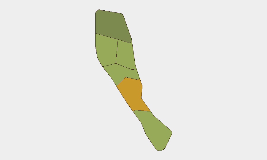
Shefa Province (composite risk 72) is the primary focus area, driven by higher concentrations of urban activity, informal settlements, and petty crime in the Port Vila metropolitan zone. Penama (risk 58) and Sanma (risk 52) follow, reflecting geographic and socioeconomic vulnerabilities common to remote or under-resourced provincial areas. None of these rankings signal acute instability; rather, they reflect persistent structural risks (limited law enforcement capacity, poverty, informal economic activity, and geographic isolation) typical of island-state operating environments. Recent 24–48 hour reporting does not indicate acute escalation in any province.
How GeoBit Would Assist
Security teams operating in Vanuatu should leverage AOI (Area-of-Interest) Monitoring & Early Warning on Shefa Province and Penama to detect emerging unrest or crime signals in real time. OSINT fusion and multi-language social-media intelligence (X/Twitter, Telegram, local Facebook groups) combined with conflict and crime-risk search will enable rapid detection of political mobilization, gang activity, or infrastructure disruption before mainstream reporting. Satellite and imagery analysis can track port, airfield, and critical-infrastructure status to support duty-of-care reporting and continuity planning.
7-Day Outlook
No acute deterioration is forecast for the near term. The volcanic activity on Ambae is expected to remain contained; marine conditions may persist but do not imply broader security risk. Political-policing incidents such as the Kalnpel arrest are unlikely to trigger cascade unrest absent additional triggers. Monitoring should remain steady-state, with emphasis on early-warning signals from provincial areas and volcano/geohazard updates from VMGD.
Highest-Risk Areas — Ranked
| # | State / Region | Risk |
|---|---|---|
| 1 | Shefa Province | 72 |
| 2 | Penama | 58 |
| 3 | Sanma | 52 |
| 4 | Malampa | 48 |
| 5 | Tafea | 45 |
| 6 | Torba | 35 |
Sources
Previous Daily Briefs
A new Vanuatu brief is written every day — each with its own risk map and downloadable CSV. Here's the last week; use the calendar to go further back.
📅 Browse every day by calendar →
Highlighted days have a brief. Tap a day for that day's map & analysis, or “csv” for that day's dataset ($5).
Atlas — our AI intelligence desk — emails them this snapshot personally. Nothing else, no list.