Situation Summary
Burkina Faso remains under sustained multi-region insurgent pressure, with elevated threat activity distributed across northern, central, and eastern areas. The composite national threat score of 78 (#30 globally) reflects persistent jihadist and splinter-group operations rather than a single acute crisis. No discrete kinetic incidents have been reliably documented in the last 24–48 hours; however, structural conditions—resource scarcity, fragmented state control, and porous borders—continue to enable armed-group recruitment and cross-border coordination.
Key Developments
Recent infrastructure investment (positive trajectory, 8 July):
Africa Finance Corporation announced financial close and first disbursement (US$60m) of a US$300m loan for a 119 MW thermal power plant near Kossodo, Ouagadougou, to be built by Aksa Enerji Üretim A.Ş. The project is framed as bolstering national energy security and reducing import dependency. While not a security incident, it signals medium-term infrastructure and economic resilience planning in the capital region.
No dated kinetic incidents in the last 24–48 hours:
Available web-sourced reports on extremist attacks in northern regions (near Dedougou and Solhan) lack precise timestamps that can be anchored to 9–10 July 2026, and are likely several days old. Intelligence and corporate teams should monitor GeoBit's event feeds and AOI alerting for any time-stamped confirmations.
Highest-Risk Areas
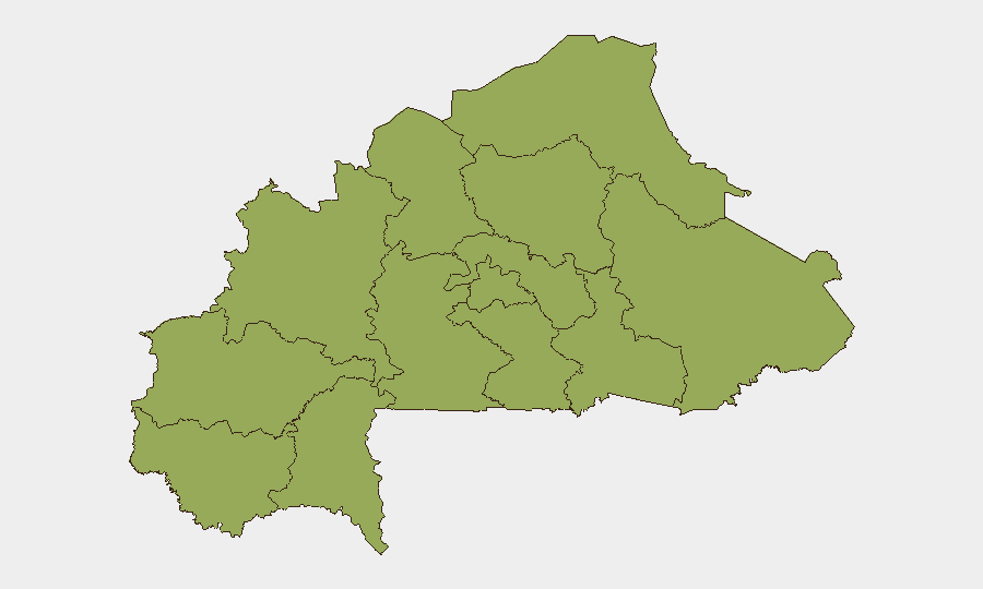
All 12 sub-national regions are ranked at near-parity (54.9 composite score), indicating that insurgent activity and associated risks are geographically diffuse rather than confined to a single flashpoint. Upper-Basins, Boucle du Mouhoun, Central-West, Central-South, Central-East, Waterfalls, Southwest, Sahel, Central-North, East, North, and Centre all carry equivalent elevated threat levels. This uniformity reflects the spread of jihadist franchises (JNIM, ISIS–West Africa) and localized armed groups across the country's north, east, and central belt, with particular pressure along ungoverned corridors and near international borders. Operations in or transit through any of these regions should assume heightened exposure to IED risk, armed checkpoints, and kidnapping.
How GeoBit Would Assist
Intel Sweep and AOI Monitoring: Teams can establish persistent area-of-interest watches on Ouagadougou, logistics hubs, and operating zones (e.g., Sahel, East, or Central regions) with real-time alerting for new attack reports, military operations, and movement of armed actors via multi-language OSINT, X/Telegram feeds, and radio SIGINT.
Conflict Mapping and Routing Analysis: GeoBit's battle-mapping and network-routing tools enable security teams to identify safe transit corridors, assess checkpoint density, and model casualty/IED risk profiles for planned movements—critical for duty-of-care planning in high-risk sub-national regions.
Early Warning and Prediction: Temporal analysis of attack timing, seasonal patterns, and actor coordination can support 7–14 day threat forecasting, allowing preemptive travel restrictions or security posture adjustments ahead of predicted escalation windows.
7-Day Outlook
No imminent shift in the macro-threat picture is anticipated. Insurgent activity is likely to remain distributed and opportunistic, with sporadic attacks on security forces, civilian settlements, and infrastructure in ungoverned or contested areas. The power-plant project near Ouagadougou may attract heightened scrutiny from extremist groups seeking economic-disruption targets; hardened perimeter security and staff vetting should be considered standard practice.
Highest-Risk Areas — Ranked
| # | State / Region | Risk |
|---|---|---|
| 1 | Upper-Basins | 54.9 |
| 2 | Boucle du Mouhoun | 54.9 |
| 3 | Central-West | 54.9 |
| 4 | Central-South | 54.9 |
| 5 | Central-East | 54.9 |
| 6 | Waterfalls | 54.9 |
| 7 | Southwest | 54.9 |
| 8 | Sahel | 54.9 |
| 9 | Central-North | 54.9 |
| 10 | East | 54.9 |
| 11 | North | 54.9 |
| 12 | Centre | 54.9 |
Sources
Previous Daily Briefs
A new Burkina Faso brief is written every day — each with its own risk map and downloadable CSV. Here's the last week; use the calendar to go further back.
📅 Browse every day by calendar →
Highlighted days have a brief. Tap a day for that day's map & analysis, or “csv” for that day's dataset ($5).
Atlas — our AI intelligence desk — emails them this snapshot personally. Nothing else, no list.