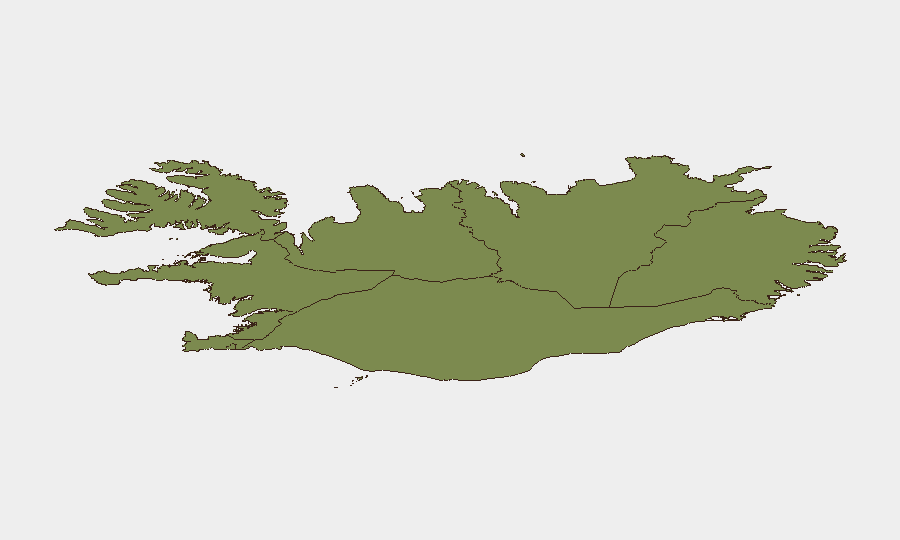
Situation Summary
Iceland remains a low-threat environment (composite score 28, ranked #63 globally) with no mass-casualty events or organized security crises. However, a fatal homicide investigation in the Kópavogur area (2026-08-09) and a recent cluster of assault incidents in Reykjavík (2026-08-10) indicate elevated violent-crime activity in the Capital Region over the past 48 hours. Overall trajectory is stable; isolated incidents do not suggest systemic instability or widespread criminality.
Key Developments
- Kársnes, Kópavogur (2026-08-09): A man was fatally attacked on a residential street; police classified the death as a criminal homicide and have detained multiple suspects. Investigation remains active and ongoing.
- Eastern Reykjavík / Gnoðarvogur (2026-08-09): Police conducted large-scale operations linked to the Kársnes homicide, resulting in additional arrests in the eastern capital area.
- Reykjavík (2026-08-10): Local media reported a cluster of seven assault incidents ("yesterday and last night"), indicating a spike in interpersonal violence across the capital. Specific locations and injury severity remain unclear from available reporting.
- Reykjavík Port (2026-08-05, background context): Police expelled and banned re-entry for 21 anti-whaling activists from the vessel *Bandero* following obstruction of commercial whaling operations. This event falls outside the 24–48-hour window but reflects ongoing civil-order management in the capital region.
Highest-Risk Areas
The Capital Region (risk score 24) is by far the primary driver of Iceland's national risk profile, accounting for the majority of recorded incidents and absorbing all recent violent-crime activity. The Southern Peninsula (risk 12) and Southern Region (risk 11) trail significantly. Within the Capital Region, eastern Reykjavík (Gnoðarvogur, Kópavogur, Breiðholt districts) shows the highest concentration of recent violent incidents and police activity. All other regions (Western, Westfjords, Northwestern, Northeastern) remain low-risk; dispersion of threats is minimal.
How GeoBit Would Assist
Security teams with personnel or assets in Iceland should employ Area-of-Interest (AOI) Monitoring & Early Warning on the Capital Region's high-crime districts (Kópavogur, Gnoðarvogur, Breiðholt) to flag emerging violent-crime clusters in real time. Intel Sweep and multi-language OSINT (social media, local news, police radio intelligence) would provide early warning of protest activity, criminal incidents, or civil disorder before they affect operations. Routing & Network Analysis can identify safer transit corridors in Reykjavík and flag high-risk areas for personnel movement planning.
7-Day Outlook
The homicide investigation is expected to dominate local news and police operations through the week, with potential for further arrests and court proceedings. The recent assault cluster may reflect summer seasonal patterns or isolated criminal activity rather than organized gang violence; no evidence of escalation to broader public safety crisis. Duty-of-care teams should maintain baseline awareness of the Capital Region's southern and eastern districts but need not elevate Iceland's overall threat posture materially.
Highest-Risk Areas — Ranked
| # | State / Region | Risk |
|---|---|---|
| 1 | Capital Region | 24 |
| 2 | Southern Peninsula | 12 |
| 3 | Southern Region | 11 |
| 4 | Eastern Region | 10 |
| 5 | Western Region | 9 |
| 6 | Westfjords Region | 8 |
| 7 | Northwestern Region | 7 |
| 8 | Northeastern Region | 6 |
Sources
Previous Daily Briefs
A new Iceland brief is written every day — each with its own risk map and downloadable CSV. Here's the last week; use the calendar to go further back.
📅 Browse every day by calendar →
Highlighted days have a brief. Tap a day for that day's map & analysis, or “csv” for that day's dataset ($5).
Atlas — our AI intelligence desk — emails them this snapshot personally. Nothing else, no list.