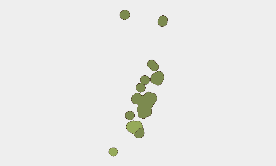
Situation Summary
Tonga remains a low-threat environment globally (rank #191, composite score 2) with no tracked security incidents in the reporting period. The principal operational concerns are seismic activity (four earthquakes 4.6–5.3 magnitude within the past week), a multi-day internet routing disruption now largely resolved, and ongoing media-access litigation reflecting political-process friction between government and press. No civil unrest, organized violence, or major crime spikes have been reported; the security posture remains stable.
Key Developments
- Neiafu, Vavaʻu – 8–9 Sep 2026: A moderate earthquake (M5.3, depth ~10 km) struck 26 km northwest of Neiafu at 11:51 UTC on 8 Sep; no tsunami warning issued, but localized structural damage to poorly constructed buildings possible.
- Houma, Tongatapu – 9 Sep 2026: A light earthquake (M4.6) occurred near Houma with minor expected impact; assessment indicates relevance to local infrastructure and travel planning.
- Regional seismicity – 8–9 Sep 2026: Two additional earthquakes (M4.9 and M4.6, depths ~10 km) recorded across Tonga, consistent with the region's tectonic activity; cumulative seismic activity within one week warrants heightened awareness for structural vulnerability assessment.
- Nationwide internet disruption – 3–9 Sep 2026: A multi-day Border Gateway Protocol (BGP) routing failure caused sustained loss of visible prefixes and traffic volumes until restoration around 9–10 Sep; cause remains unattributed, creating residual business-continuity and communications risk.
- Nukuʻalofa – 8 Sep 2026: Tonga's Supreme Court issued interim orders restraining the Prime Minister and officials from refusing admission to journalists from Tonga Chronicle and 88.1 FM Letio 'a e Kakai at government press conferences; reflects ongoing media-access dispute and political-process friction without physical unrest.
- Nukuʻalofa – 4 Sep incident, reported 7 Sep: CEO of 88.1 FM and Tonga Chronicle received interim court orders following denial of entry to St George Government Building on 19 Aug; legal action signals underlying transparency and press-freedom tensions within government processes.
- Nationwide police deployment – 8–10 Sep 2026: Ten Tonga Police officers deployed to Palau as part of a 120-officer Pacific Islands Forum regional security contingent; marginal effect on domestic surge capacity during major events.
Highest-Risk Areas
Tongatapu (risk 45) remains the dominant risk driver, accounting for administrative concentration, population density, and seismic exposure in the capital and surrounding lowlands. Vavaʻu (risk 28) presents secondary concern, reinforced by the 8–9 September moderate earthquake near Neiafu and potential for structural damage in older infrastructure. Haʻapai (risk 22) and ʻEua (risk 18) carry lower but measurable risk profiles; Ongo Niua (risk 12) is the lowest-risk region. Seismic activity and internet connectivity resilience are the primary risk drivers across all regions, not political instability or violence.
How GeoBit Would Assist
Organizations operating in Tonga should deploy AOI Monitoring & Early Warning on high-density infrastructure in Tongatapu and Vavaʻu to track seismic impacts and structural integrity. Network & Actor Analysis combined with OSINT fusion (X/Twitter, media outlets, court filings) will provide early signals of political-process disputes and government stability. Routing & Network Analysis capabilities enable real-time validation of internet connectivity restoration and identification of alternative communication pathways during future outages.
7-Day Outlook
Seismic activity is expected to remain within normal regional parameters, though shallow earthquakes (depth ~10 km) carry higher structural risk than deeper events. Internet routing stability appears restored but should be monitored for recurrence. Media-access litigation will likely continue; no escalation to physical unrest is anticipated, but political-process volatility warrants sustained attention to government transparency and institutional stability.
Highest-Risk Areas — Ranked
| # | State / Region | Risk |
|---|---|---|
| 1 | Tongatapu | 45 |
| 2 | Vavaʻu | 28 |
| 3 | Haʻapai | 22 |
| 4 | ʻEua | 18 |
| 5 | Ongo Niua | 12 |
Sources
Previous Weekly Briefs
A new Tonga brief is written every Monday, covering the week — each with its own risk map and downloadable CSV. Use the calendar to go further back.
- September 7, 2026
- August 31, 2026
- August 28, 2026
- August 25, 2026
- August 22, 2026
- August 19, 2026
- August 16, 2026
📅 Browse past briefs by calendar →
Highlighted days have a brief. Tap a day for that day's map & analysis, or “csv” for that day's dataset ($5).
Atlas — our AI intelligence desk — emails them this snapshot personally. Nothing else, no list.