Situation Summary
Vanuatu's security environment remains stable with no material civil unrest, organized crime escalation, conflict, or political instability reported in the last 24–48 hours. A magnitude 5.0 earthquake struck Tafea Province on 2026-08-20 with no reported casualties, representing the most significant recent event but falling within the country's routine seismic hazard profile. Routine baseline risks—petty crime, maritime hazards, and weather exposure—persist across the archipelago. The national composite threat score of 7 (ranked #143 globally) reflects a low-risk operating environment for corporate and expatriate personnel.
Key Developments
- No verified security, civil unrest, crime, political, or infrastructure incidents were confirmed in Vanuatu during the 24–48-hour reporting window as of 2026-08-22.
- Magnitude 5.0 earthquake near Isangel, Tafea Province on 2026-08-20 at 11:20 local time; no casualties reported. Tafea Province ranks fifth in GeoBit's sub-national risk assessment (score 45), primarily reflecting natural-hazard and seismic exposure rather than security instability.
- Open-source intelligence monitoring across social media, news feeds, and verified local sources shows no escalation in petty crime, maritime incidents, or political tensions during the assessed period.
- Continued baseline stability forecast barring external shocks such as cyclones or maritime emergencies.
Highest-Risk Areas
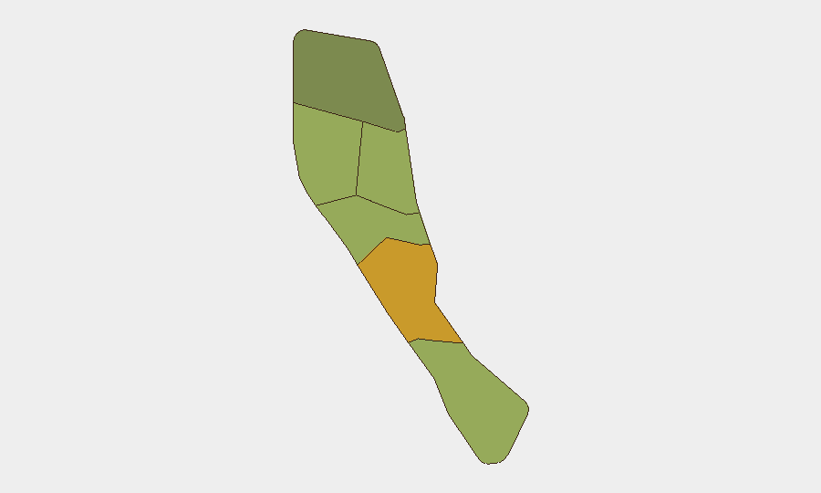
Shefa Province (risk 72) drives the majority of Vanuatu's tracked risk, followed by Penama (58) and Sanma (52). These rankings reflect a combination of factors: Shefa's inclusion of Port Vila and periurban districts, where petty crime and civil-order management present routine corporate-security concerns; Penama's relative remoteness and limited law-enforcement capacity; and Sanma's exposure to inter-island maritime hazards. Tafea's seismic activity (5.0 magnitude event on 2026-08-20) contributes to its rank of 45 but does not indicate imminent instability. Overall, sub-national risk in Vanuatu remains operationally manageable for duty-of-care planning; no region shows signs of acute conflict, organized crime networks, or state fragility.
How GeoBit Would Assist
Security teams should employ AOI Monitoring & Early Warning to establish persistent watch on Shefa, Penama, and Sanma provinces, with alerting thresholds set for civil unrest, political incidents, and crime escalation. Intel Sweep and multi-language OSINT fusion (including X/Twitter, Telegram, local news, and radio SIGINT) would provide continuous low-noise feeds on political statements, labor disputes, and maritime security developments. Environmental & Health monitoring paired with satellite imagery analysis can track cyclone exposure, seismic aftershock patterns, and infrastructure vulnerability, critical given Vanuatu's natural-hazard profile and the 2026-08-20 earthquake.
7-Day Outlook
No acute security triggers are forecast for the next seven days. Routine petty crime, maritime transit risks, and seismic aftershock monitoring should remain standard corporate-security baseline postures. Personnel and asset exposure in Shefa, Penama, and Sanma provinces warrant standard duty-of-care protocols; no escalation in threat level is anticipated absent major external shocks.
Highest-Risk Areas — Ranked
| # | State / Region | Risk |
|---|---|---|
| 1 | Shefa Province | 72 |
| 2 | Penama | 58 |
| 3 | Sanma | 52 |
| 4 | Malampa | 48 |
| 5 | Tafea | 45 |
| 6 | Torba | 35 |
Sources
Previous Daily Briefs
A new Vanuatu brief is written every day — each with its own risk map and downloadable CSV. Here's the last week; use the calendar to go further back.
- August 20, 2026
- August 18, 2026
- August 16, 2026
- August 14, 2026
- August 12, 2026
- August 10, 2026
- August 8, 2026
📅 Browse every day by calendar →
Highlighted days have a brief. Tap a day for that day's map & analysis, or “csv” for that day's dataset ($5).
Atlas — our AI intelligence desk — emails them this snapshot personally. Nothing else, no list.