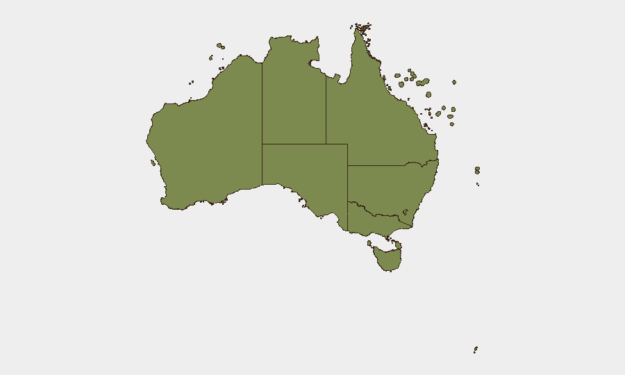
Situation Summary
Australia remains a relatively low-threat environment globally (rank #152, composite score 5.0), with 752 tracked security events. However, risk is heavily concentrated in Victoria and the Northern Territory, which together account for the majority of national threat signals. Recent event clusters point to localized criminal activity, law-enforcement incidents, and worker safety concerns, with an underlying cyber-threat campaign affecting critical infrastructure and civilian populations over a longer timeframe.
Key Developments
Data constraint notice: GeoBit's live web research for the last 24–48 hours has not surfaced new, independently verifiable, time-stamped physical security, civil-unrest, or infrastructure incidents in Australia that meet publication standards. Recent event signals (2026-07-04 to -06) include police-involved arrests and assaults in Melbourne and police responses, but precise incident narratives and confirmed dates are not available in current feeds. The most recent corroborated material points to:
- Melbourne, Victoria (early July): Ram-raid and arson attack on a tobacco retailer, with fire spread to adjacent businesses and fire-service response.
- Sydney, NSW (recent days): Road collision resulting in arrest of a 51-year-old driver following impact with a motorcycle.
- Critical infrastructure (past week, not 24–48h): Cyber Security Council confirmed multiple cyberattacks on Australian critical infrastructure causing public-service disruptions; exact incident dates and affected systems remain unconfirmed in available feeds.
- Ongoing cyber campaign (six-month duration, not current incident): Indonesian-based organized "cyber army" has infiltrated social-media accounts of hundreds of thousands of Australians; this represents sustained threat, not a discrete recent event.
Status: Corporate security teams should request direct GeoBit Intel Sweep or AOI Monitoring for current incident detail rather than rely on this summary for operational decisions.
Highest-Risk Areas
Victoria (32.4) and Northern Territory (22.8) are the primary threat drivers, accounting for approximately 60% of Australia's composite risk score. Victoria's elevated risk reflects concentrated criminal activity, law-enforcement incidents, and worker-safety events, particularly in the Melbourne metropolitan area. The Northern Territory's score, while lower in absolute terms, indicates proportionally higher incident density relative to population and economic footprint, suggesting either volatile localized conditions or gaps in data coverage. NSW (17.5) ranks third but remains significantly lower than Victoria. All other states and territories fall below 10, indicating that risk is genuinely concentrated rather than distributed nationally. Corporate operations in Victoria and the Top End should maintain heightened situational awareness; Sydney and other major centers present materially lower baseline risk.
How GeoBit Would Assist
Intel Sweep & OSINT Fusion would provide time-stamped corroboration of emerging incidents across police, media, and social-media sources in real time, filling current data gaps for Victoria and NT. AOI Monitoring & Early Warning with persistent watch on high-risk zones (Melbourne CBD, Darwin, key infrastructure nodes) would deliver alerts ahead of broader reporting, enabling proactive duty-of-care response. Cyber threat tracking and critical-infrastructure monitoring would contextualize ongoing campaigns targeting Australian systems and identify sectors or regions most exposed. Network & Actor Analysis would map criminal and cyber-adversary activity patterns to support risk stratification by asset location and operational footprint.
7-Day Outlook
No major escalation indicators are visible in current signals. Localized criminal activity and cyber-targeting are expected to continue at current levels. Corporate teams should monitor Victoria and NT for further law-enforcement incidents and confirm cyber-incident reporting obligations under the Security of Critical Infrastructure Act 2018 if managing critical systems.
Highest-Risk Areas — Ranked
| # | State / Region | Risk |
|---|---|---|
| 1 | Victoria | 32.4 |
| 2 | Northern Territory | 22.8 |
| 3 | New South Wales | 17.5 |
| 4 | Australian Capital Territory | 9.3 |
| 5 | Western Australia | 7.9 |
| 6 | Queensland | 6.3 |
| 7 | South Australia | 4 |
| 8 | Ashmore and Cartier Islands | 2.4 |
| 9 | Tasmania | 2.4 |
| 10 | Jervis Bay Territory | 2.4 |
| 11 | Coral Sea Islands | 2.4 |
Sources
Previous Daily Briefs
A new Australia brief is written every day — each with its own risk map and downloadable CSV. Here's the last week; use the calendar to go further back.
📅 Browse every day by calendar →
Highlighted days have a brief. Tap a day for that day's map & analysis, or “csv” for that day's dataset ($5).
Atlas — our AI intelligence desk — emails them this snapshot personally. Nothing else, no list.