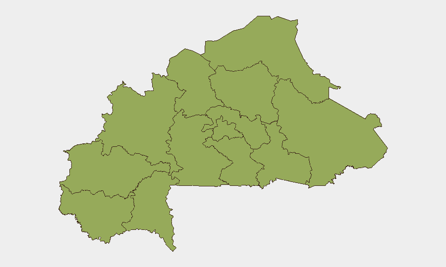
Situation Summary
Burkina Faso remains at composite threat rank #29 globally with a score of 77, reflecting persistent jihadist insurgency, state fragility under Captain Ibrahim Traoré's military administration, and ongoing civil-military tensions. The country continues to experience decentralized armed-group activity across 12 sub-national regions, all rated at identical risk levels (53.5), indicating systemic rather than localized instability. A bilateral diplomatic expulsion event involving France (2026-07-12) signals renewed state-level friction alongside deepening security pressures. The operational environment remains high-risk for civilian and corporate assets, particularly in rural and northern zones.
Key Developments
- Bilateral Expulsion (Burkina Faso–France, 2026-07-12): Burkina Faso has expelled French personnel or diplomatic staff; reciprocal action by France is unconfirmed in available sources. Context: Traoré's administration has increasingly restricted foreign military and intelligence presence since taking office. Implications for corporate/NGO security posture and duty-of-care protocols for French-affiliated personnel require urgent review.
- No specific location-specific attack, clash, or infrastructure incident has been reliably identified in open reporting for 2026-07-10 through 2026-07-12. NewsNow and general web aggregators show no dated, location-pinned security events in the last 48 hours; available coverage focuses on political context and long-running insurgency narrative rather than discrete tactical incidents.
*Background context (not current developments):* ICC withdrawal procedures (dated 2 July 2026) and ongoing jihadist pressure across the Sahel belt and northern regions remain defining factors, but do not constitute new incidents as of 12 July.
Highest-Risk Areas
All 12 tracked regions (Upper-Basins, Boucle du Mouhoun, Central-West, Central-South, Central-East, Waterfalls, Southwest, Sahel, Central-North, East, North, Centre) carry identical composite risk of 53.5, indicating that threat is geographically distributed rather than concentrated. This uniformity suggests that jihadist cell presence, displaced-population density, and state-security-force fragmentation are now endemic across the country rather than limited to traditional northern hotspots. Corporate teams should apply heightened vigilance to all regions; no zone qualifies as materially "safer" under current conditions.
How GeoBit Would Assist
Security and risk teams operating in or monitoring Burkina Faso should prioritize AOI Monitoring & Early Warning to maintain persistent watch over key corporate sites, supply routes, and personnel concentrations across high-risk regions, with real-time alerting to detect armed-group movement or protest activity. Multi-language search, X/Twitter & Telegram OSINT, and radio SIGINT would surface local-language security reports, NGO field feeds, and community-level warnings hours or days ahead of mainstream news indexes, improving decision-lead time for travel, evacuation, or lockdown protocols. Routing & Network Analysis capabilities enable alternative journey planning for personnel and logistics to minimize exposure to known conflict zones and checkpoints.
7-Day Outlook
The Burkina Faso security environment is forecast to remain volatile and unpredictable over the next seven days, with no immediate de-escalation in sight given state-level diplomatic friction and persistent armed-group activity. Duty-of-care teams should expect continued restrictions on movement, potential further bilateral friction affecting foreign-national safety, and localized clashes in rural areas. Heightened situational awareness and pre-positioned contingency plans (evacuation routes, safe havens, comms protocols) are operationally essential.
Highest-Risk Areas — Ranked
| # | State / Region | Risk |
|---|---|---|
| 1 | Upper-Basins | 53.5 |
| 2 | Boucle du Mouhoun | 53.5 |
| 3 | Central-West | 53.5 |
| 4 | Central-South | 53.5 |
| 5 | Central-East | 53.5 |
| 6 | Waterfalls | 53.5 |
| 7 | Southwest | 53.5 |
| 8 | Sahel | 53.5 |
| 9 | Central-North | 53.5 |
| 10 | East | 53.5 |
| 11 | North | 53.5 |
| 12 | Centre | 53.5 |
Sources
Previous Daily Briefs
A new Burkina Faso brief is written every day — each with its own risk map and downloadable CSV. Here's the last week; use the calendar to go further back.
📅 Browse every day by calendar →
Highlighted days have a brief. Tap a day for that day's map & analysis, or “csv” for that day's dataset ($5).
Atlas — our AI intelligence desk — emails them this snapshot personally. Nothing else, no list.