Situation Summary
Iceland remains a low-threat environment with composite risk score 28 (rank #64 globally) and zero tracked major security events. The security landscape is dominated by routine crime and infrastructure incidents rather than political instability, terrorism, or civil unrest. Current developments—a NATO military exercise and weekend cultural event in Reykjavík—present standard operational considerations only. The trajectory remains stable, with official travel advisories unchanged at "low risk."
Key Developments
- Reykjavík (city centre) – 22 August 2026, 07:00–01:00. Menningarnótt (Culture Night) will close downtown streets to motor vehicles and draw large crowds for events and fireworks at 22:00. Standard crowd-management and emergency-access considerations apply; pickpocketing and traffic disruption are primary concerns.
- Iceland (nationwide) – 22 August–3 September 2026. NATO exercise "Northern Viking 2026" begins, involving US Sixth Fleet, allied forces, and Icelandic Coast Guard. US personnel already present at Keflavík; localized airspace and maritime-area restrictions likely. No conflict dimension; exercise is routine allied activity.
- Iceland (unspecified cemetery) – 21 August 2026 (reported). A grave was opened, an urn broken into, and human ashes stolen. District prosecutor confirms the case remains unsolved with no identified perpetrator. No indication of targeted motive or broader unrest.
- Iceland (nationwide) – 21–22 August 2026 (ongoing political discourse). Public debate and polarization around the 29 August EU-accession referendum intensifies, with campaigns including "Iceland is not for Sale" messaging. As of 21–22 August, no confirmed demonstrations, violence, or civil-unrest incidents have been reported.
- No additional civil-unrest, terrorism, armed conflict, or major infrastructure failures reported in the past 48 hours. Official composite travel-risk indices (UK FCDO, US State Dept., Germany) remain unchanged at "low risk," last updated 16–22 August 2026.
Highest-Risk Areas
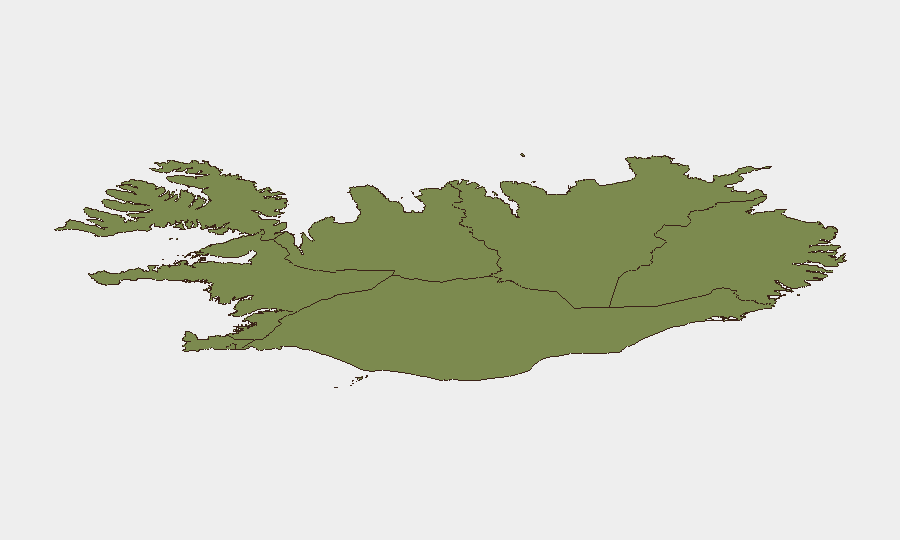
The Capital Region (Reykjavík and suburbs; risk score 24) accounts for the majority of tracked incidents and remains the primary focus for duty-of-care teams. The Southern Peninsula (risk 12) and Southern Region (risk 11) follow, driven primarily by routine traffic incidents in tunnels and mountain passes rather than security threats. Eastern, Western, Westfjords, Northwestern, and Northeastern regions (scores 6–10) pose minimal incremental risk. Elevated Capital Region scores reflect higher population density and event frequency rather than acute threat concentration; regional variations do not indicate geographic vulnerability to terrorism, organized crime, or political violence.
How GeoBit Would Assist
AOI Monitoring & Early Warning with persistent alerting would track the Capital Region and Southern Peninsula for any escalation tied to the referendum, NATO exercise, or crowd events. Intel Sweep and multi-language OSINT fusion (X/Twitter, local media, police sources) would detect emerging demonstrations, rhetoric shifts, or sectarian tensions before they manifest in mainstream reporting. Routing & Network Analysis would support real-time journey planning around Culture Night closures and military-exercise airspace restrictions, and alternative route identification in tunnel-prone southern areas where vehicle incidents cluster.
7-Day Outlook
The security environment is expected to remain stable through the NATO exercise (ending 3 September) and the EU referendum vote (29 August). Culture Night events on 22 August will generate temporary localized crowding and traffic disruption but carry no elevated threat profile. Monitoring should remain routine, focused on early warning for referendum-related protests and standard traffic-incident tracking in the Capital Region and Southern Peninsula.
Highest-Risk Areas — Ranked
| # | State / Region | Risk |
|---|---|---|
| 1 | Capital Region | 24 |
| 2 | Southern Peninsula | 12 |
| 3 | Southern Region | 11 |
| 4 | Eastern Region | 10 |
| 5 | Western Region | 9 |
| 6 | Westfjords Region | 8 |
| 7 | Northwestern Region | 7 |
| 8 | Northeastern Region | 6 |
Sources
Previous Daily Briefs
A new Iceland brief is written every day — each with its own risk map and downloadable CSV. Here's the last week; use the calendar to go further back.
- August 21, 2026
- August 20, 2026
- August 19, 2026
- August 18, 2026
- August 17, 2026
- August 16, 2026
- August 15, 2026
📅 Browse every day by calendar →
Highlighted days have a brief. Tap a day for that day's map & analysis, or “csv” for that day's dataset ($5).
Atlas — our AI intelligence desk — emails them this snapshot personally. Nothing else, no list.