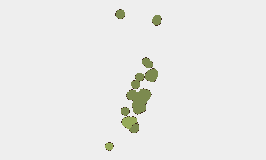
Situation Summary
Tonga remains a low-threat environment with no civil unrest, organized violence, or major crime incidents in the reporting week. Seismic activity—including a magnitude 5.3 earthquake on 17 September near Hihifo—continues as the primary natural hazard, with no significant casualties or infrastructure damage reported. A major internet routing disruption that began on 3 September was resolved by 14 September; no further connectivity degradation has been documented in the past seven days. Overall security posture is stable with routine governance and judicial activity proceeding without disruption.
Key Developments
- Neiafu, Vavaʻu – 16 September 2026: Former prison officer Spencer Sikalu (46) was sentenced at the Supreme Court for unlawful importation of 1,655 .22-caliber bullets, a .22 rifle, fireworks, and failure to declare ammunition and explosives shipped from the United States. The case has been resolved through prosecution and imprisonment, eliminating an immediate threat vector.
- Hihifo region – 17 September 2026: A magnitude 5.3 earthquake struck approximately 155 km south-southeast of Hihifo at 04:06:53 UTC, depth ~10 km. Classified as moderate, it is capable of light to moderate damage to poorly constructed structures and was widely felt; no major damage or casualties have been reported as of 21 September.
- Vavaʻu – 19 September 2026: A whale-watching boat was involved in an accident off Vavaʻu, reported as one of three serious boating incidents in recent weeks. The incident raises operational safety concerns for marine tourism providers and tourists, though detailed casualty information is limited in available sources.
- Internet routing (nationwide) – status as of 14 September 2026: A multi-day BGP visibility disruption that began on 3 September and degraded connectivity by 10–59% was resolved by 14 September. No further outages or routing instability have been reported in the 14–21 September window.
- Judicial proceedings (nationwide) – 8 September 2026 (context): Tonga's Supreme Court issued interim orders restraining the Prime Minister and officials from refusing press access, signaling ongoing attention to governance transparency; no escalation or civil unrest resulted.
- Seismic sequence – 8–9 September 2026 (context): A magnitude 4.6 earthquake near Houma on 9 September followed a 5.3 event on 8 September northwest of Neiafu, consistent with continued regional seismic activity; no tsunami warning was issued for either event.
Highest-Risk Areas
Tongatapu (composite risk 45) significantly outweighs other districts and likely reflects concentration of the capital, Nuku'alofa, with its larger population density, greater asset concentration, and higher incidence of routine crime and governance-related incidents. Vavaʻu (risk 28), the second-highest-risk region, is now elevated by recent marine safety incidents and previous seismic events; Haʻapai (risk 22) and ʻEua (risk 18) register moderate residual risk tied primarily to natural hazards and geographic isolation. Ongo Niua (risk 12) remains the lowest-risk district.
How GeoBit Would Assist
Organizations with people or assets in Tonga should deploy AOI Monitoring & Early Warning to track seismic and marine-safety incidents in real time across Tongatapu and Vavaʻu, with alerting configured for earthquake magnitude thresholds and maritime accidents. Network & Actor Analysis combined with OSINT Fusion & Corroboration would enable continuous monitoring of governance developments and security-relevant crime, surfacing any pattern shifts in arrests or political stability. Routing & Network Analysis should be configured to alert on recurring BGP disruptions or internet outages that could degrade business continuity.
7-Day Outlook
No major civil, political, or security escalation is anticipated in the near term; seismic activity may persist as part of regional tectonics, but frequency and magnitude are currently within normal parameters. Marine-tourism operators should be monitored for safety protocol improvements; organizations should assume routine baseline risk unchanged from the current low-threat assessment through late September.
Highest-Risk Areas — Ranked
| # | State / Region | Risk |
|---|---|---|
| 1 | Tongatapu | 45 |
| 2 | Vavaʻu | 28 |
| 3 | Haʻapai | 22 |
| 4 | ʻEua | 18 |
| 5 | Ongo Niua | 12 |
Sources
Previous Weekly Briefs
A new Tonga brief is written every Monday, covering the week — each with its own risk map and downloadable CSV. Use the calendar to go further back.
- September 14, 2026
- September 7, 2026
- August 31, 2026
- August 28, 2026
- August 25, 2026
- August 22, 2026
- August 19, 2026
📅 Browse past briefs by calendar →
Highlighted days have a brief. Tap a day for that day's map & analysis, or “csv” for that day's dataset ($5).
Atlas — our AI intelligence desk — emails them this snapshot personally. Nothing else, no list.