Situation Summary
Vanuatu remains a low-threat jurisdiction (composite score 7; #145 globally) with no active civil unrest, armed conflict, or major crime incidents reported in the last 24–48 hours. However, the country faces elevated disaster and natural-hazard risk following a large-scale volcanic eruption at Ambae on 25 August and a 5.0 earthquake near Isangel (Tafea) on 20 August. Transnational maritime crime—including drug trafficking and people smuggling—remains an emerging concern flagged by the government as part of broader Pacific-region criminal activity.
Key Developments
- Ambae Volcano, Penama Province (25 Aug 2026): Large-scale eruption triggered regional tsunami warnings and elevated hazard risk for surrounding islands. Infrastructure and transportation disruptions likely but not fully documented in available reporting.
- Isangel, Tafea Province (20 Aug 2026): Magnitude 5.0 earthquake struck with no reported casualties. Continued seismic and volcanic activity reinforces heightened disaster preparedness across the archipelago.
- Port Vila, Shefa Province (25 Aug 2026): Asian Development Bank approved crisis-financing mechanism for Vanuatu, enabling faster emergency funding after disasters. Indicates government and institutional readiness for rapid response infrastructure and services restoration.
- Honiara, Solomon Islands / Regional (24 Aug 2026): Vanuatu Minister of Internal Affairs Andrew Solomon Napuat signed police cooperation MOU with Royal Solomon Islands Police Force, highlighting illicit drugs, illegal fishing, people smuggling, and cybercrime as shared transnational threats. No domestic incidents tied to this agreement.
- Maritime Zone, National (24 Aug 2026): Government officials warned that criminal organizations are exploiting maritime space and transnational smuggling routes across the Pacific. No specific interdiction or attack reported; assessment reflects ongoing regional vulnerability.
Highest-Risk Areas
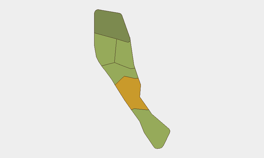
Shefa Province (risk score 72), encompassing the capital Port Vila and surrounding islands, carries the highest sub-national risk, likely driven by urbanization, port activity, and exposure to transnational crime networks. Penama Province (58), home to Ambae Volcano, now faces acute natural-hazard risk following the 25 August eruption and associated tsunami threat. Sanma (52) and Malampa (48) remain moderately elevated, consistent with broader disaster and maritime-crime exposure across the northern and central archipelago. Tafea (45) and Torba (35) carry lower composite scores but are not immune to seismic and volcanic activity.
How GeoBit Would Assist
Security and duty-of-care teams should employ AOI Monitoring & Early Warning to track Ambae and other active volcanoes in near-real time, with alerting triggered by hazard escalation or evacuation orders affecting personnel or supply chains. Maritime & Aviation tracking and Routing & Network Analysis will identify alternative transport corridors if ports or airfields experience closure or congestion due to volcanic ash or tsunami response. Multi-language OSINT and local media monitoring via Intel Sweep and sentiment analysis will flag emerging transnational crime activity (drug, smuggling, or cybercrime incidents) affecting corporate operations or expatriate communities before formal government advisories.
7-Day Outlook
Volcanic and seismic activity will likely remain the dominant near-term risk driver, with ash, tremors, and tsunami hazards potentially disrupting inter-island transport and coastal operations through early September. Authorities and development partners will focus on emergency response logistics and infrastructure stabilization. No escalation in civil unrest, political instability, or organized-crime violence is evident; transnational maritime crime remains a chronic rather than acute threat to corporate assets and personnel.
Highest-Risk Areas — Ranked
| # | State / Region | Risk |
|---|---|---|
| 1 | Shefa Province | 72 |
| 2 | Penama | 58 |
| 3 | Sanma | 52 |
| 4 | Malampa | 48 |
| 5 | Tafea | 45 |
| 6 | Torba | 35 |
Sources
Previous Daily Briefs
A new Vanuatu brief is written every day — each with its own risk map and downloadable CSV. Here's the last week; use the calendar to go further back.
- August 24, 2026
- August 22, 2026
- August 20, 2026
- August 18, 2026
- August 16, 2026
- August 14, 2026
- August 12, 2026
📅 Browse every day by calendar →
Highlighted days have a brief. Tap a day for that day's map & analysis, or “csv” for that day's dataset ($5).
Atlas — our AI intelligence desk — emails them this snapshot personally. Nothing else, no list.