Situation Summary
Bhutan remains a globally low-threat environment (rank #186, composite score 3) with no confirmed security incidents reported during the week of September 23–29. The country's stable political landscape, strong rule of law, and geographic isolation continue to insulate it from major transnational crime, terrorism, or civil unrest. Near-term trajectory remains benign, though southern border districts register measurably elevated risk profiles warranting baseline monitoring.
Key Developments
- Lunana, Gasa District — September 23: Ministry of Energy and Natural Resources unveiled the foundation stone for a 500-kW small hydropower project. While infrastructure development, this signals continued government investment in remote northern regions and underscores Gasa's isolation and limited service access.
- Phuentsholing — September 25: Expansion of the 24-hour Sustainable Development Fee waiver to include Milarepa Lhakhang and Pachu Community Ecotourism Site. This administrative measure facilitates cross-border and regional tourism traffic but carries no reported security incident component.
- National governance — September 25: Adoption of Gross Ecosystem Product as an official national measure. Policy-level development with no direct security or travel-risk implications.
- No discrete crime, civil unrest, or conflict events were independently corroborated for the reporting period. Absence of reporting does not indicate absence of risk; rather, Bhutan's low baseline threat and limited open-source event density mean that only major incidents reach international outlets.
Highest-Risk Areas
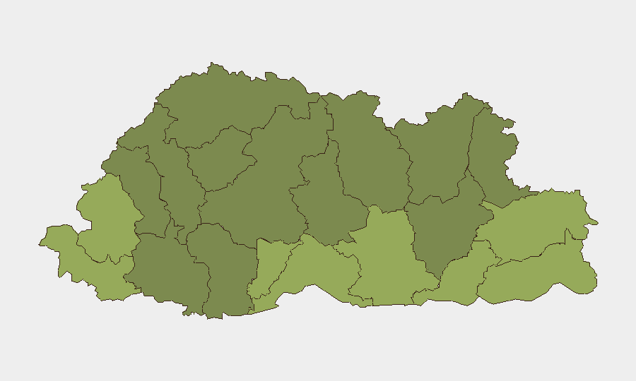
Southern border districts—Samtse, Sarpang, Haa, and Pemagatshel—drive the country's composite risk ranking, with scores ranging from 50 to 58. These districts share proximity to India and, in some cases, lower population density and remoter terrain, creating vulnerability to cross-border commodity smuggling, human trafficking, and wildlife poaching. Samdrup Jongkhar District (east, bordering India and Myanmar) ranks fifth at risk 48, reflecting similar transnational-crime vectors. Central and northern districts (Lhuntse, Gasa, Wangdue Phodrang) register materially lower risk (30–35), consistent with geographic remoteness and lower population density. Risk elevation in border districts is relative and does not indicate instability; Bhutan's rule-of-law capacity remains strong across all regions.
How GeoBit Would Assist
Security teams with personnel or assets in Bhutan should employ AOI Monitoring & Early Warning focused on the five highest-risk southern and eastern districts to detect emerging trafficking, smuggling, or civil-disturbance signals in real time. OSINT Fusion & Corroboration (Intel Sweep, multi-language search, sentiment & temporal analysis) would consolidate regional reporting from Indian, Myanmar, and Bhutanese sources to identify cross-border crime trends or policy changes affecting duty-of-care obligations. Routing & Network Analysis capabilities can identify alternative travel corridors and safe transit windows for personnel transiting Phuentsholing or southern checkpoints, especially during peak tourism periods.
7-Day Outlook
No acute security triggers are evident for the coming week. Continued baseline stability is expected. Teams should maintain standard due-diligence protocols for personnel in southern districts and monitor for any seasonal uptick in border-region trafficking activity as dry season approaches. Routine updates will resume only if confirmed events warrant escalation.
Highest-Risk Areas — Ranked
| # | State / Region | Risk |
|---|---|---|
| 1 | Samtse District | 58 |
| 2 | Sarpang District | 55 |
| 3 | Haa District | 52 |
| 4 | Pemagatshel District | 50 |
| 5 | Samdrup Jongkhar District | 48 |
| 6 | Tsirang District | 45 |
| 7 | Zhemgang District | 42 |
| 8 | Trashigang District | 40 |
| 9 | Mongar District | 38 |
| 10 | Gasa District | 35 |
| 11 | Lhuntse District | 32 |
| 12 | Wangdue Phodrang District | 30 |
Sources
Previous Weekly Briefs
A new Bhutan brief is written every Monday, covering the week — each with its own risk map and downloadable CSV. Use the calendar to go further back.
- September 22, 2026
- September 15, 2026
- September 8, 2026
- September 1, 2026
- August 29, 2026
- August 26, 2026
- August 23, 2026
📅 Browse past briefs by calendar →
Highlighted days have a brief. Tap a day for that day's map & analysis, or “csv” for that day's dataset ($5).
Atlas — our AI intelligence desk — emails them this snapshot personally. Nothing else, no list.