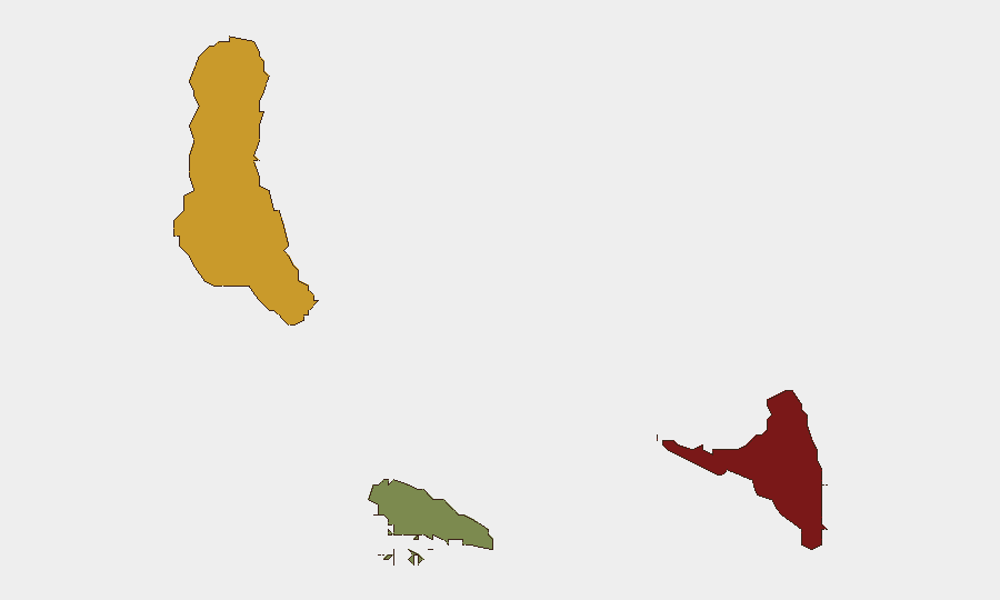
Situation Summary
Comoros remains a lower-frequency security environment globally (composite threat rank #137), with no significant incidents reported in the last 24–48 hours. The archipelago's risk profile is heavily concentrated in Anjouan island (risk score 88), which continues to drive the national composite score. Absent new discrete events, the security posture reflects chronic underlying vulnerabilities—maritime crime, localized governance challenges, and limited state capacity—rather than acute crisis conditions.
Key Developments
No verifiable incidents meeting corroboration standards have been reported in Comoros in the last 24–48 hours. Open-source reporting does not surface discrete security, civil unrest, crime, conflict, or infrastructure events dated 19–20 August 2026. Routine lower-level crime may occur across the archipelago, as in any jurisdiction, but cannot be reliably validated without access to local law-enforcement, regional media feeds, or near-real-time alerting services.
Highest-Risk Areas
Anjouan (risk 88) remains the primary driver of national threat elevation, reflecting a combination of weak institutional control, maritime criminal activity, and a history of separatist tension. Grande Comore (risk 72), home to the capital Moroni and largest population concentration, carries secondary but substantial risk owing to urban crime, informal settlement volatility, and port/maritime exposure. Moheli (risk 35) presents materially lower risk. The geographic concentration of risk in Anjouan and Grande Comore underscores the vulnerability of critical infrastructure and expatriate populations in those zones and warrants differentiated monitoring intensity.
How GeoBit Would Assist
Intelligence & OSINT capabilities—including multi-language search, X/Twitter & Telegram OSINT, and sentiment/temporal analysis—enable persistent scanning of Comoros-specific reporting to surface emerging incidents before they become widespread. AOI Monitoring & Early Warning with persistent area-of-interest watch on Anjouan, Grande Comore ports, and Moroni would trigger alerts when credible new threats emerge, reducing blind-spot risk for duty-of-care teams. Maritime & Aviation Tracking, combined with routing & network analysis, supports real-time alternative journey planning for personnel and asset movements should conditions deteriorate.
7-Day Outlook
No significant escalation is indicated in the near-term outlook; the security environment is expected to remain characterized by chronic, low-visibility risks rather than acute events. Seasonal maritime crime patterns and routine urban crime in Moroni and Anjouan are likely to persist. Security teams should continue standard heightened vigilance protocols in Anjouan and maintain current travel/movement safeguards, but no imminent operational disruption is forecast over the next seven days absent new intelligence.
Next Update: 2026-08-21 or upon emergence of verifiable incident signals.
Data Confidence: Moderate (limited real-time local reporting availability).
Highest-Risk Areas — Ranked
| # | State / Region | Risk |
|---|---|---|
| 1 | Anjouan | 88 |
| 2 | Grande Comore | 72 |
| 3 | Moheli | 35 |
Sources
Previous Daily Briefs
A new Comoros brief is written every day — each with its own risk map and downloadable CSV. Here's the last week; use the calendar to go further back.
- August 18, 2026
- August 16, 2026
- August 14, 2026
- August 12, 2026
- August 10, 2026
- August 8, 2026
- August 6, 2026
📅 Browse every day by calendar →
Highlighted days have a brief. Tap a day for that day's map & analysis, or “csv” for that day's dataset ($5).
Atlas — our AI intelligence desk — emails them this snapshot personally. Nothing else, no list.