Situation Summary
Iceland remains a low-threat environment (rank #64 globally, composite score 28) with no tracked security events in the current reporting period. Recent recorded incidents—a politically motivated civilian confrontation (15 Aug), and two unrelated transport accidents in tunnels (19–20 Aug)—are isolated and do not indicate systemic instability. The Capital Region accounts for the majority of assessed risk; peripheral regions show minimal threat activity. Security posture is stable, though seasonal transport and weather hazards warrant standard duty-of-care monitoring.
Key Developments
- 2026-08-22 · Traffic & Events · Reykjavík City Center: Reykjavík Culture Night (Menningarnótt) road closures in effect on 22 Aug; central city thoroughfares and running-event routes closed. Standard event-related mobility disruption; no security incidents reported.
- 2026-08-20 · Infrastructure · Akureyri Ring Road: Traffic accident (car/motorcycle) near Vaðlaheiðargöng tunnel entrance on Ring Road; no fatalities confirmed in available reporting. Standard accident response; no indication of deliberate cause.
- 2026-08-19 · Infrastructure · Hvalfjörður Tunnel: Car fire reported in tunnel northwest of Reykjavík; no evidence of criminal or deliberate cause in available reports. Routine fire-service response.
- 2026-08-15 · Protest/Confrontation · Reykjavík (Café): Group of Israeli tourists verbally abused and threatened café staff, removed and destroyed Palestinian artwork. Isolated political-expression incident; no broader civil unrest reported.
Note: Live web research for the 24–48 hours immediately preceding 2026-08-23 is limited by available snapshot data. Older transport and infrastructure maintenance events (e.g., Jökulsá bridge works dated 2026-08-18, temporary Ring Road closure dated 2026-08-20) are noted for situational context but fall outside strict 24–48h window. Official Icelandic Police, Vegagerðin (Road and Coastal Administration), and Almannavarnir (Civil Protection) feeds should be monitored directly for real-time incident status.
Highest-Risk Areas
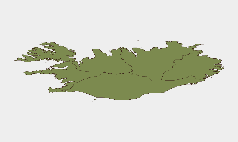
The Capital Region (risk score 24) dominates Iceland's threat profile, reflecting Reykjavík's concentration of population, tourism, political activity, and infrastructure. The Southern Peninsula (risk 12) and Southern Region (risk 11) register secondary concern, likely reflecting tourism volumes and exposure to weather/volcanic hazard corridors; the remaining five regions (Eastern, Western, Westfjords, Northwestern, Northeastern) show minimal risk below 10. Risk is primarily driven by incident *frequency* and *population density* rather than organized violence or instability; peripheral regions benefit from isolation and smaller footprints.
How GeoBit Would Assist
Intel Sweep and X/Twitter & Telegram OSINT enable real-time monitoring of Icelandic police, emergency services, and regional media feeds to detect emerging incidents faster than public reporting lag. AOI Monitoring & Early Warning can be configured on critical transport corridors (Ring Road, key tunnels, airport approaches) and high-profile venues (city center, tourist zones, ports) to trigger alerts on protests, accidents, or infrastructure disruptions. Routing & Network Analysis provides corporate teams with alternative journey planning during events, closures, or weather disruptions—critical for duty-of-care during seasonal disruptions (Culture Night, winter storms, volcanic activity).
7-Day Outlook
No escalation indicators are present. Seasonal weather and transport-accident risk will remain low to moderate across the next week; summer tourism levels are declining into late August. Teams should maintain standard alert-subscription protocols with Icelandic emergency services and road authorities (Vegagerðin daily updates) to stay ahead of any unplanned closures or weather-driven disruptions.
Highest-Risk Areas — Ranked
| # | State / Region | Risk |
|---|---|---|
| 1 | Capital Region | 24 |
| 2 | Southern Peninsula | 12 |
| 3 | Southern Region | 11 |
| 4 | Eastern Region | 10 |
| 5 | Western Region | 9 |
| 6 | Westfjords Region | 8 |
| 7 | Northwestern Region | 7 |
| 8 | Northeastern Region | 6 |
Sources
Previous Daily Briefs
A new Iceland brief is written every day — each with its own risk map and downloadable CSV. Here's the last week; use the calendar to go further back.
- August 22, 2026
- August 21, 2026
- August 20, 2026
- August 19, 2026
- August 18, 2026
- August 17, 2026
- August 16, 2026
📅 Browse every day by calendar →
Highlighted days have a brief. Tap a day for that day's map & analysis, or “csv” for that day's dataset ($5).
Atlas — our AI intelligence desk — emails them this snapshot personally. Nothing else, no list.