Situation Summary
Tonga remains a low-threat environment globally (rank #193) with minimal organized security incidents, but localized crime, seismic activity, and maritime hazards present operational risks for foreign personnel and assets. Drug trafficking—particularly methamphetamine—has emerged as a notable concern, evidenced by arrests and seizures in the capital region this week and regional law-enforcement assessments of potential domestic manufacturing. The 5.3-magnitude earthquake on 17 September and recurring boating accidents in Vavaʻu underscore the environment's natural hazard profile, which poses secondary duty-of-care liabilities for organizations with maritime or field operations.
Key Developments
- 21 September, Halaleva and Vaini (Tongatapu): Tonga Police arrested three individuals—a 36-year-old woman from Halaleva and two men (ages 68 and 45) from Vaini—on charges of conspiracy to import illicit drugs; approximately 200 grams of methamphetamine and electronic devices were seized.
- 21 September, Nuku'alofa: Police media release confirmed the drug-importation arrests and seizure; the Halaleva suspect also faced two additional unspecified charges, suggesting an expanded investigation.
- 17 September, 155 km south-southeast of Hihifo: A magnitude 5.3 earthquake struck at depth ~10 km (04:06:53 UTC), classified as moderate; no immediate casualty reports, but seismic risk remains present throughout the archipelago.
- 17 September, Vavaʻu waters: A whale-watching boat was involved in a serious accident; reported as one of three significant boating incidents in recent weeks, reflecting maritime safety concerns.
- 22 September, Nuku'alofa: Health Minister Siale ʻAkauʻola announced the planned national dialysis centre project has effectively stalled after its US-based sponsor failed to secure sufficient funding; project viability remains uncertain and may affect healthcare service delivery.
- Regional intelligence context (late September): During an organised-crime panel, law-enforcement officials indicated methamphetamine may be manufactured locally within Tonga, though no specific new incident or location was confirmed; this suggests evolving trafficking infrastructure.
Highest-Risk Areas
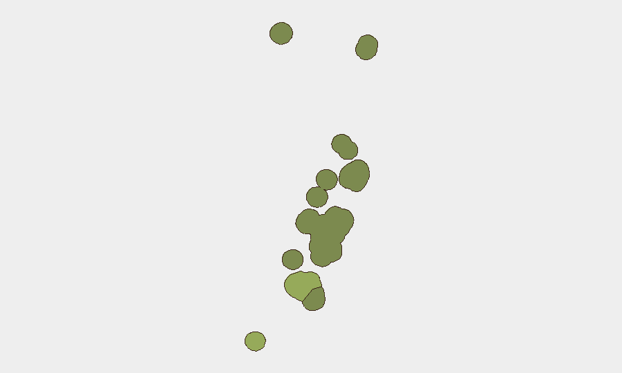
Tongatapu (composite risk 45) is the primary risk driver, concentrating drug trafficking, importation activity, and urban crime in and around Nuku'alofa, where the recent arrests and seizures occurred. Vavaʻu (risk 28) ranks second, driven by maritime hazards and boating incidents that pose risks to tourism, supply-chain operations, and personnel transit; its geographic dispersion and limited rapid-response infrastructure amplify consequence severity. The remaining island groups (Haʻapai, ʻEua, Ongo Niua) carry lower but non-zero risk profiles, primarily environmental and logistical in nature.
How GeoBit Would Assist
Organizations with operations in Tonga should deploy Intel Sweep and multi-language OSINT to monitor trafficking indicators, police activity, and health/infrastructure announcements in real time. AOI Monitoring & Early Warning configured for Tongatapu and Vavaʻu would provide persistent, alert-driven coverage of arrest activity, port movements, and maritime incidents. Environmental & Health intelligence and GIS & Spatial Analysis would support route planning for personnel and supply chains, accounting for seismic zones and high-incident maritime corridors.
7-Day Outlook
No imminent escalation is anticipated; however, continued drug-trafficking pressure—possibly linked to local manufacturing—suggests law-enforcement intensity will remain elevated. Natural hazards (seismic, maritime) will persist as routine operational risks requiring standard duty-of-care mitigation. Supply-chain and healthcare service continuity may face periodic disruption, particularly if the dialysis project collapse affects broader health-system stability.
Highest-Risk Areas — Ranked
| # | State / Region | Risk |
|---|---|---|
| 1 | Tongatapu | 45 |
| 2 | Vavaʻu | 28 |
| 3 | Haʻapai | 22 |
| 4 | ʻEua | 18 |
| 5 | Ongo Niua | 12 |
Sources
Previous Weekly Briefs
A new Tonga brief is written every Monday, covering the week — each with its own risk map and downloadable CSV. Use the calendar to go further back.
- September 21, 2026
- September 14, 2026
- September 7, 2026
- August 31, 2026
- August 28, 2026
- August 25, 2026
- August 22, 2026
📅 Browse past briefs by calendar →
Highlighted days have a brief. Tap a day for that day's map & analysis, or “csv” for that day's dataset ($5).
Atlas — our AI intelligence desk — emails them this snapshot personally. Nothing else, no list.