Situation Summary
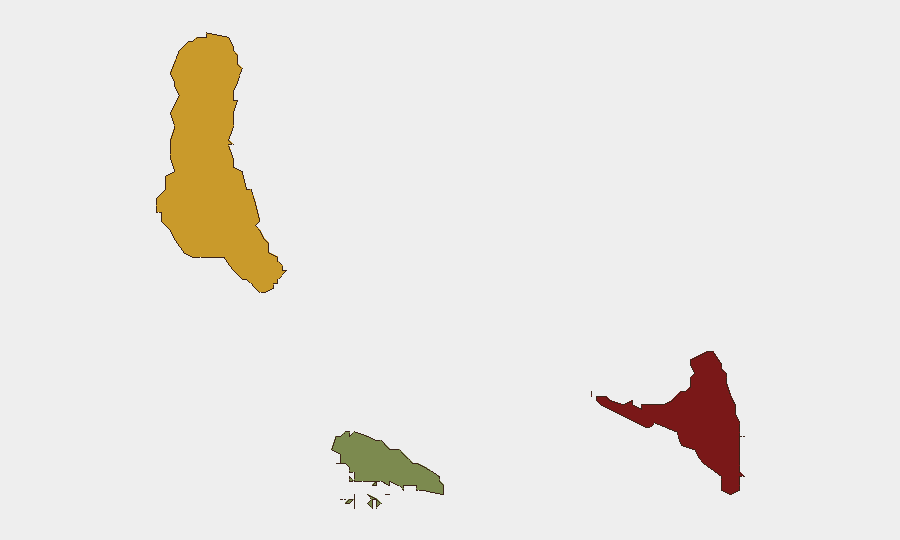
Comoros remains a low-frequency security environment globally (#138 in GeoBit's composite ranking), with no significant acute incidents detected in open sources over the past 24–48 hours. The archipelago's risk profile is shaped by chronic governance fragility, economic stress, and exposure to regional maritime threats rather than active conflict or mass civil unrest. The sub-national distribution is highly skewed, with Anjouan presenting acute instability while Moheli remains comparatively stable.
Key Developments
No credible, clearly dated security incidents in Comoros have been identified in open reporting for 21–22 August 2026. The most recent event associated with Comoros—a drone attack on the merchant vessel *Volgo Balt 226* (under Comoros flag, crewed by Azerbaijani nationals) in the Black Sea around 20 August—occurred outside Comoros territory and reflects wider Red Sea/Black Sea maritime conflict rather than domestic instability. Routine operational and governance dynamics are assumed to be ongoing, but no new protests, criminal incidents, infrastructure failures, or terrorist activity have surfaced in monitored feeds.
Highest-Risk Areas
Anjouan (risk score 88) is GeoBit's highest-concern zone and reflects longstanding political fragmentation, weak state capacity, and a history of separatist and autonomy movements. Grande Comore (risk 72), home to the capital Moroni and the majority of the population, carries elevated risk tied to urban poverty, governance tensions, and sensitivity to regional events in nearby Mayotte and the wider Mozambique Channel. Moheli (risk 35) remains the lowest-risk island, with less dense population and fewer drivers of acute instability. The ranking emphasizes that risk in Comoros is driven by state weakness and island-level political competition rather than organized insurgency or transnational terror networks.
How GeoBit Would Assist
AOI Monitoring & Early Warning would be the primary tool: persistent watch over Anjouan and Grande Comore with alert thresholds for protest activity, port disruptions, or security force movements. OSINT Fusion (multi-language feeds, X/Twitter, Telegram, local media) would close visibility gaps when international reporting is sparse, capturing local developments before they surface in Western press. Maritime & Aviation Tracking would flag vessel movements, anomalies, and incidents in Comoros waters and airspace—critical given the archipelago's exposure to piracy corridors and the *Volgo Balt* precedent. Routing & Network Analysis supports contingency planning for personnel or cargo movement if political or infrastructure risk spikes.
7-Day Outlook
No indicators suggest a sharp deterioration in the near term. Comoros' trajectory remains one of low-visibility, chronic fragility with periodic political friction but no imminent trigger for mass instability. Regional factors—French security operations in Mayotte, monsoon-season weather, and maritime tensions in adjacent waters—warrant continued monitoring for indirect spillover effects. Teams with operations in Anjouan should maintain elevated alertness to political signals; Grande Comore operations face standard urban-security baseline risks.
Highest-Risk Areas — Ranked
| # | State / Region | Risk |
|---|---|---|
| 1 | Anjouan | 88 |
| 2 | Grande Comore | 72 |
| 3 | Moheli | 35 |
Sources
Previous Daily Briefs
A new Comoros brief is written every day — each with its own risk map and downloadable CSV. Here's the last week; use the calendar to go further back.
- August 20, 2026
- August 18, 2026
- August 16, 2026
- August 14, 2026
- August 12, 2026
- August 10, 2026
- August 8, 2026
📅 Browse every day by calendar →
Highlighted days have a brief. Tap a day for that day's map & analysis, or “csv” for that day's dataset ($5).
Atlas — our AI intelligence desk — emails them this snapshot personally. Nothing else, no list.