Situation Summary
Iceland maintains a low threat profile (rank #64 globally, composite score 28) with no credible indicators of mass unrest, terrorism, or infrastructure disruption as of 24 August 2026. The security picture is dominated by routine crime in the Capital Region—sporadic violent incidents and weapons possession—and planned urban events rather than emergent instability. No new material incidents have been reported in the last 24–48 hours that would elevate national or regional risk posture.
Key Developments
- Reykjavík metropolitan area – violent crime and weapons arrests (23 Aug):
Police arrested three individuals following an assault involving edged weapons and brass knuckles; separate arrests made for knife possession, fighting, and assault on officers. Incidents logged under Reykjavík police district; no specific street locations disclosed. Reflects sporadic but non-organized violent crime.
- Downtown Reykjavík – planned event closures (22 Aug):
Extensive street closures ("víðtækar götulokanir") implemented in central Reykjavík for Reykjavík Marathon and Culture Night (Menningarnótt) events. Planned disruption to traffic and access; no disorder reported. Expected to resolve on completion of events.
- Capital Region – no escalation in routine incident volume (23–24 Aug):
Web research and event signals show no uptick in violence, protest activity, or public-safety alerts beyond the isolated incidents noted above. Pattern consistent with baseline low-threat environment for the region.
- Political debate on EU membership and defence posture (23 Aug):
Public and media commentary on Iceland's potential EU membership and security implications intensified; Foreign Minister reaffirmed NATO and US defence pact as security foundation. No protests, unrest, or civil disorder connected to the debate in the last 48 hours. This is a strategic/political discussion, not a trigger for immediate instability.
- Kársnes homicide investigation – ongoing judicial process (last update 22 Aug):
Media reporting on pre-trial detention of suspects in earlier August homicide case continues; police have communicated no general public-safety threat. Included for situational awareness only; not a new incident.
Highest-Risk Areas
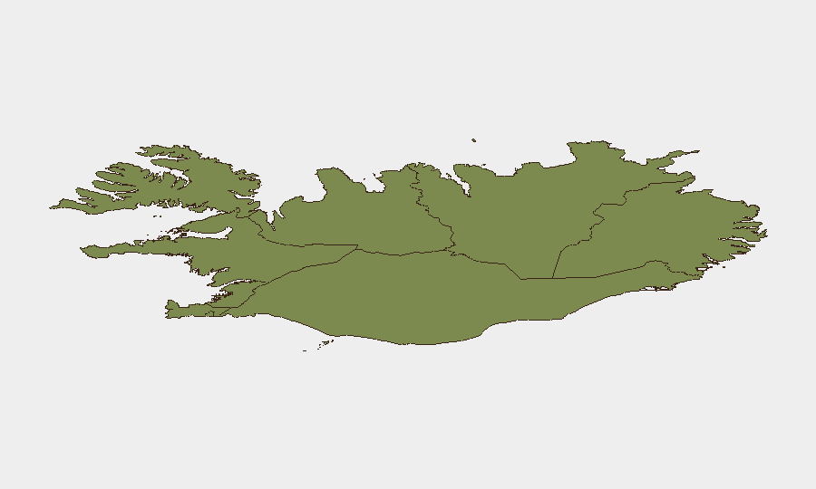
The Capital Region drives Iceland's overall composite risk (score 24), reflecting the concentration of population, administrative functions, and sporadic violent crime in and around Reykjavík. The Southern Peninsula (risk 12) and Southern Region (risk 11) carry secondary but still-material risk, likely driven by seasonal tourism density, remote geography, and vehicular incidents on the Ring Road (e.g., recent accidents near Vaðlaheiðargöng and Hvalfjörður Tunnel, 19–20 Aug). The remaining regions—Eastern, Western, Westfjords, Northwestern, and Northeastern—score progressively lower (10 down to 6), reflecting sparser populations and fewer reported security events. Risk is distributed but not concentrated in any zone of acute instability.
How GeoBit Would Assist
Security teams with personnel or assets in Iceland should deploy AOI Monitoring & Early Warning on the Capital Region and Southern Peninsula to track sporadic violent-crime clustering and event-driven access disruptions in real time. Intel Sweep and multi-language OSINT (local Icelandic media, police logs, and social platforms) provide ongoing visibility into routine incidents, protests, and political rhetoric that could signal escalation. Routing & Network Analysis enables contingency planning around predictable event closures and Ring Road hazards, and Early Warning & Prediction can flag seasonal or political triggers (EU debate, tourism peaks) that might amplify baseline risks.
7-Day Outlook
No material change in Iceland's low-threat trajectory is anticipated over the next seven days. Planned Reykjavík events will conclude, restoring normal traffic patterns; routine crime and political debate are unlikely to generate organized unrest or systemic disruption. Continued monitoring of Capital Region incident reporting and seasonal Ring Road safety remain prudent for duty-of-care planning.
Highest-Risk Areas — Ranked
| # | State / Region | Risk |
|---|---|---|
| 1 | Capital Region | 24 |
| 2 | Southern Peninsula | 12 |
| 3 | Southern Region | 11 |
| 4 | Eastern Region | 10 |
| 5 | Western Region | 9 |
| 6 | Westfjords Region | 8 |
| 7 | Northwestern Region | 7 |
| 8 | Northeastern Region | 6 |
Sources
Previous Daily Briefs
A new Iceland brief is written every day — each with its own risk map and downloadable CSV. Here's the last week; use the calendar to go further back.
- August 23, 2026
- August 22, 2026
- August 21, 2026
- August 20, 2026
- August 19, 2026
- August 18, 2026
- August 17, 2026
📅 Browse every day by calendar →
Highlighted days have a brief. Tap a day for that day's map & analysis, or “csv” for that day's dataset ($5).
Atlas — our AI intelligence desk — emails them this snapshot personally. Nothing else, no list.