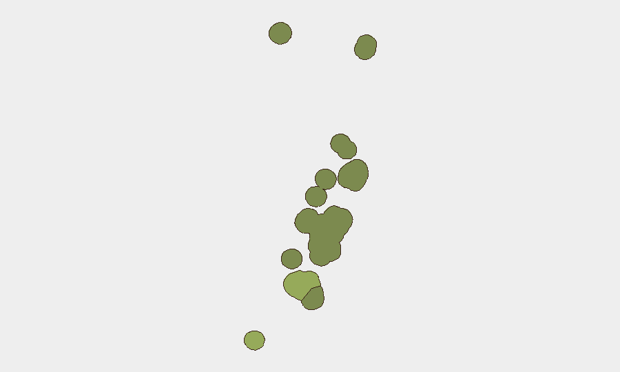
Situation Summary
Tonga remains a low-threat environment (global rank #193, composite score 2) with no tracked security incidents in the past week. The near-term risk picture is shaped by natural hazards—seismic activity and drought—rather than crime or civil instability, though drug-trafficking arrests since late September indicate ongoing organized-crime pressure. The kingdom's security posture is stable, with routine parliamentary processes and diplomatic engagement proceeding without disruption.
Key Developments
- 'Eua, October 5: A magnitude-5.0 earthquake struck offshore approximately 71 km from 'Ohonua at 10 km depth. No casualties or significant structural damage were reported; the event did not trigger warnings or evacuation protocols.
- Tongatapu, Vavaʻu, Haʻapai, ʻEua, and Niuafo'ou, October 9: Tonga's Meteorological Service declared drought across Tongatapu, Niuatoputapu, Haʻapai, and ʻEua due to intensifying El Niño conditions. Vavaʻu was placed on drought alert and Niuafo'ou under drought warning, affecting agricultural output and freshwater supply across the archipelago.
- Tongatapu 2 and Ongo Niua 17 constituencies, October 8: Parliamentary by-elections were held to fill two vacant People's Representative seats. Polling closed at 4:00 p.m. local time, with results announced by the Electoral Commissioner before 7:00 p.m. No irregularities or security incidents were reported.
- Nadi, Fiji (Tonga government delegation), October 7: Tonga launched its Nationally Determined Contribution 3.0 during Pacific Pre-COP31 meetings, presenting climate-resilience and finance priorities to regional partners. This diplomatic engagement reflects ongoing infrastructure and climate-adaptation concerns but carries no direct security risk.
- Nationwide, September 21–October 2 (background context): Tonga Police arrested five individuals in two separate operations linked to illicit drug importation (approximately 200 grams) and transnational organized crime. A New Zealand citizen wanted for serious organized crime was deported on October 2. These arrests underscore sustained trafficking activity but no escalation or violence was documented.
Highest-Risk Areas
Tongatapu (composite risk 45) drives national exposure, reflecting concentration of government, port infrastructure, and urban population; organized-crime activity—particularly drug trafficking—remains the primary driver. Vavaʻu (risk 28) and Haʻapai (risk 22) carry secondary risk, likely associated with maritime transit vulnerability and remote-area governance capacity. The current drought declaration across four island groups introduces secondary natural-hazard risk to supply chains and subsistence agriculture, particularly in lower-ranked areas like ʻEua and Ongo Niua, but does not immediately elevate security risk.
How GeoBit Would Assist
Tonga-focused security teams should deploy AOI Monitoring & Early Warning on Tongatapu's port and urban centers to detect trafficking indicators and organized-crime clustering; Election Monitoring and Sentiment & Temporal Analysis of social media to verify stability during by-election cycles; and Environmental & Health monitoring alongside meteorological data to anticipate drought-driven resource stress and secondary civil order risks. Radio SIGINT and Telegram/X OSINT would provide real-time situational awareness of law-enforcement operations and trafficking networks.
7-Day Outlook
Seismic and drought conditions are expected to persist; the earthquake risk remains background-level for the region. Drought may intensify pressure on outer islands and subsistence populations over the coming weeks, but no political or security crisis is anticipated. Organized-crime enforcement activity will likely continue, but drug-trafficking arrests have not historically escalated to violence or instability in Tonga.
Highest-Risk Areas — Ranked
| # | State / Region | Risk |
|---|---|---|
| 1 | Tongatapu | 45 |
| 2 | Vavaʻu | 28 |
| 3 | Haʻapai | 22 |
| 4 | ʻEua | 18 |
| 5 | Ongo Niua | 12 |
Sources
Previous Weekly Briefs
A new Tonga brief is written every Monday, covering the week — each with its own risk map and downloadable CSV. Use the calendar to go further back.
- October 5, 2026
- September 28, 2026
- September 21, 2026
- September 14, 2026
- September 7, 2026
- August 31, 2026
- August 28, 2026
📅 Browse past briefs by calendar →
Highlighted days have a brief. Tap a day for that day's map & analysis, or “csv” for that day's dataset ($5).
Atlas — our AI intelligence desk — emails them this snapshot personally. Nothing else, no list.