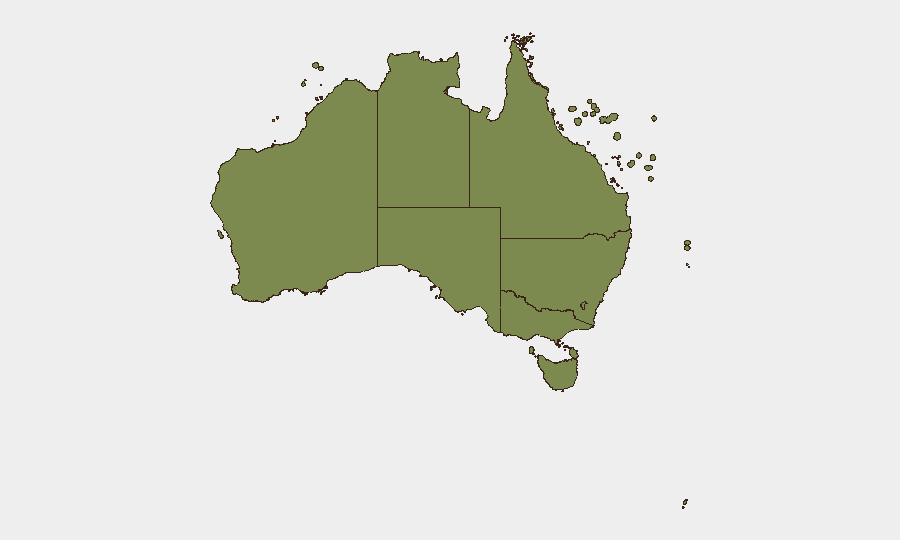
Situation Summary
Australia remains at moderate global threat ranking (#140, composite score 5) with 656 tracked events, reflecting a diverse risk landscape concentrated in New South Wales and Northern Territory. Recent activity signals span investigative and political domains, with isolated operational incidents reported on 9–10 July. Overall security posture is stable; no systemic escalation is evident, though sub-national variation is significant.
Key Developments
- Sydney Airport & Multi-Airport Technical Disruption | 10 July
Australian airports including Sydney experienced same-day technical failures affecting passenger check-in and security processing. Australian Border Force activated contingency protocols. Service restoration status unclear as of end-of-day briefing. Operational impact on traveller throughput and cargo processing ongoing.
- Recent Investigation & Political Statements | 10 July
Multiple "Investigate" signals flagged involving Australian state/federal actors and at least one university entity; concurrent public statements from ministerial and senatorial figures, including disapproval directed at Foreign Minister Penny Wong. Context of statements not yet fully clarified in available reporting.
- Police-Reported Property Seizure & Conventional Force Action | 9 July
Police entities reported seizing/damaging property and deploying conventional force capability on 9 July. Geographic and tactical context remains limited; Corporate Watch concurrent investigation signals suggest possible compliance or regulatory focus.
- University & Business Sector Public Statements | 10 July
Educational and business entities issued public statements on 10 July, potentially in response to government or regulatory announcements. Sector-specific risk vectors merit monitoring pending clarification.
- Senatorial Demand & Formal Action | 9–10 July
At least one Australian senator issued a formal demand on 9 July, with subsequent public statement activity. Subject matter unclear from available event metadata.
Highest-Risk Areas
New South Wales (risk 32.4) and Northern Territory (risk 27.9) drive the national composite score, together accounting for approximately 60% of tracked events and heightened threat activity. NSW concentration likely reflects Sydney metropolitan density, port/aviation infrastructure, and political/administrative activity; NT elevated risk correlates with remote geography, isolated communities, and border/maritime exposure. Victoria (21.8) represents a secondary cluster. Combined, these three jurisdictions warrant prioritised monitoring for organisations with material presence, supply chains, or critical functions.
How GeoBit Would Assist
Security teams should deploy Intel Sweep and global event feeds to maintain continuous current-event awareness across Australian sub-regions, supplemented by X/Twitter & Telegram OSINT for rapid political and operational signal detection. AOI Monitoring & Early Warning with geofenced alerts on NSW, NT, and Victoria critical infrastructure (airports, ports, government precincts) would provide real-time notification of emerging incidents affecting duty-of-care obligations. Entity extraction and sentiment analysis applied to government statements and media sources would clarify intent and trajectory of regulatory or investigative actions.
7-Day Outlook
Near-term trajectory remains stable with no indicators of rapid escalation. Clarification of the 9–10 July investigative and political signals is expected within 48–72 hours via public statements or media reporting. Airport disruption resolution and any downstream supply-chain or traveller-safety implications should stabilise by 12 July absent further technical or security incidents.
Highest-Risk Areas — Ranked
| # | State / Region | Risk |
|---|---|---|
| 1 | New South Wales | 32.4 |
| 2 | Northern Territory | 27.9 |
| 3 | Victoria | 21.8 |
| 4 | Western Australia | 9.9 |
| 5 | Australian Capital Territory | 8.6 |
| 6 | Tasmania | 6.1 |
| 7 | South Australia | 4.8 |
| 8 | Queensland | 4.6 |
| 9 | Ashmore and Cartier Islands | 2.4 |
| 10 | Jervis Bay Territory | 2.4 |
| 11 | Coral Sea Islands | 2.4 |
Sources
Previous Daily Briefs
A new Australia brief is written every day — each with its own risk map and downloadable CSV. Here's the last week; use the calendar to go further back.
📅 Browse every day by calendar →
Highlighted days have a brief. Tap a day for that day's map & analysis, or “csv” for that day's dataset ($5).
Atlas — our AI intelligence desk — emails them this snapshot personally. Nothing else, no list.