Situation Summary
Comoros remains a low-frequency threat environment globally (#139 composite ranking) with no documented security incidents inside its territory in the last 24–48 hours. Underlying structural risks—political fragmentation across three main islands, organized crime networks, and limited state capacity—persist, but no acute crisis or escalation is evident from current reporting. The security posture is stable but underpinned by chronic inter-island tensions, particularly involving Anjouan, and vulnerability to maritime and transnational crime.
Key Developments
No credible, clearly dated security, civil-unrest, or infrastructure incidents have been identified within Comoros territory during 23–24 August 2026.
Note on indirect reference: A cargo vessel flying the Comoros flag (Volgo Balt 226, Azov Shipping) was damaged by drone attack in the Black Sea en route to Trabzon on 2026-08-20; this reflects Comoros' role in maritime registry but poses no direct threat to the territory itself.
Limited open-source reporting for Comoros over short 48-hour windows is typical and does not necessarily indicate under-reporting of major incidents. Security teams should rely on baseline risk posture and sentinel monitoring rather than on incident clustering at present.
Highest-Risk Areas
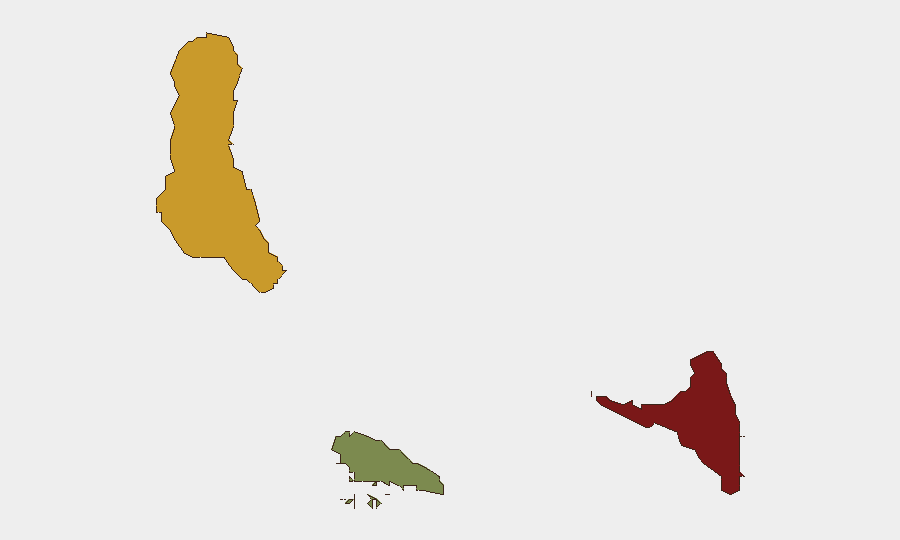
Anjouan (composite risk 88) and Grande Comore (72) dominate the sub-national landscape, reflecting political autonomy disputes, weak law enforcement, and organized crime activity concentrated on those two islands. Anjouan's separatist tensions and history of coup attempts make it the primary driver of national instability; Grande Comore, as the seat of the federal capital and largest population center, carries elevated crime and political volatility risk. Moheli (35) remains significantly lower-risk, with limited criminal infrastructure and lower political salience. Teams with personnel or assets on Anjouan or in Moroni (Grande Comore) should maintain heightened vigilance and contingency protocols.
How GeoBit Would Assist
AOI Monitoring & Early Warning with persistent watch on Anjouan and Grande Comore would provide real-time alerting on protests, security force activity, or emerging unrest, reducing reaction time to developing threats. Intel Sweep and multi-language OSINT (social media, local news, radio SIGINT) would capture early signals of political tension, criminal organization activity, or maritime incidents weeks or days before mainstream reporting. Maritime & Aviation tracking, combined with Routing & Network Analysis, would enable security teams to plot safe transit corridors for personnel and assets, flag vessel or aircraft anomalies, and model alternative supply-chain routes in case of port disruption.
7-Day Outlook
No specific acute threat indicators point to a near-term security escalation in Comoros over the next seven days. Baseline risks—petty crime, inter-island political friction, and maritime exposure—will remain steady. Security teams should maintain routine monitoring posture and ensure contingency protocols are current, particularly for Anjouan-based operations, rather than escalate alert status based on current reporting.
Next update: 2026-08-25, 06:00 UTC, or upon credible incident alert.
Highest-Risk Areas — Ranked
| # | State / Region | Risk |
|---|---|---|
| 1 | Anjouan | 88 |
| 2 | Grande Comore | 72 |
| 3 | Moheli | 35 |
Sources
Previous Daily Briefs
A new Comoros brief is written every day — each with its own risk map and downloadable CSV. Here's the last week; use the calendar to go further back.
- August 22, 2026
- August 20, 2026
- August 18, 2026
- August 16, 2026
- August 14, 2026
- August 12, 2026
- August 10, 2026
📅 Browse every day by calendar →
Highlighted days have a brief. Tap a day for that day's map & analysis, or “csv” for that day's dataset ($5).
Atlas — our AI intelligence desk — emails them this snapshot personally. Nothing else, no list.