Situation Summary
Iceland remains a low-threat environment (global rank #64, composite score 28) with no tracked security events in the current cycle. Recent incident activity is confined to routine urban crime, isolated assaults, and accident response in the Capital Region; no civil unrest, terrorism, or infrastructure disruption is evident. The security trajectory is stable, with localized hazards—tourist accidents and petty crime—dominating the threat landscape rather than systemic or organized risks.
Key Developments
- Stuðlagil Canyon, Eastern Region – 24–25 Aug 2026
Search and rescue operations ongoing following a man's fall into the river at Stuðlagil tourist site near Jökuldalur. Rescue efforts continued into the night of 24–25 August and were adjusted for darkness. Classified as accident/safety incident; relevant for traveler risk awareness in East Iceland.
- Reykjavík, Capital Region – 23 Aug 2026
Three individuals arrested following assault involving edged weapons and brass knuckles in central Reykjavík. Concurrent report of domestic violence incident in postal district 105 (injury details undisclosed). Both incidents treated as isolated criminal matters.
- Hafnarfjörður, Capital Region – 23 Aug 2026
Residential burglary with theft reported in postal district 220; property crime continues at low but steady rate in suburban capital region.
- Reykjavík retail district, Capital Region – 22 Aug 2026
Altercation between security guard and alleged shoplifter escalated during police response to reported theft. Minor assault; no mass-casualty or organized crime indicators.
- Downtown Reykjavík, Capital Region – 22 Aug 2026 (event weekend conclusion)
Extensive street closures and traffic restrictions for Culture Night (Menningarnótt) festival and Reykjavík Marathon concluded; no violence or unrest reported during event.
- Oslo Gardermoen, Norway – 24–25 Aug 2026 (transit-relevant)
Air traffic controller strike and airport closure at Oslo caused disruption to Nordic air routes. No direct closure or strike reported at Keflavík International or domestic Icelandic airports, but transiting passengers may experience delays on northern European routings.
- EU Accession Referendum Campaign – Ongoing, highlighted 24 Aug 2026
Iceland's political discourse focused on upcoming referendum regarding EU membership negotiations. Coverage emphasizes debate over fisheries policy and cost-of-living issues; no protests, unrest, or political violence reported.
Highest-Risk Areas
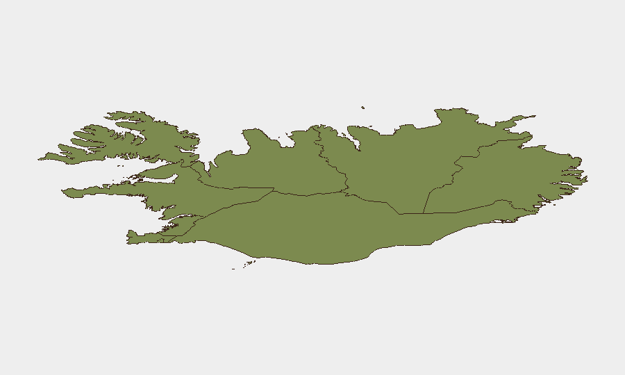
The Capital Region (risk score 24) dominates Iceland's threat profile, accounting for the majority of recent incidents—petty crime, assaults, and burglary concentrated in Reykjavík and adjacent postal districts. The Southern Peninsula (risk 12) and Southern Region (risk 11) register secondary risk elevation, likely reflecting both tourist density and seasonal mobility patterns. All remaining regions score below 10, indicating that security risk is highly concentrated in the metropolitan area and major population corridors; rural and remote regions present minimal documented threat.
How GeoBit Would Assist
Security teams with personnel or assets in Iceland should deploy AOI Monitoring & Early Warning on the Capital Region to track emerging crime clusters and protest activity in real time. OSINT fusion across local media, police statements, and social platforms provides early detection of isolated incidents before they escalate to organizational concern. Routing & Network Analysis capabilities enable rapid identification of alternative transport corridors in the event of planned disruptions—as demonstrated by the Culture Night street closures—or emergency evacuation planning.
7-Day Outlook
No significant escalation in threat activity is anticipated over the next seven days. Routine urban crime and accident response will likely continue at baseline rates in the Capital Region. The EU referendum campaign may generate public discourse and minor demonstration activity in downtown Reykjavík, but current reporting indicates no indication of organized protest or civil unrest.
Highest-Risk Areas — Ranked
| # | State / Region | Risk |
|---|---|---|
| 1 | Capital Region | 24 |
| 2 | Southern Peninsula | 12 |
| 3 | Southern Region | 11 |
| 4 | Eastern Region | 10 |
| 5 | Western Region | 9 |
| 6 | Westfjords Region | 8 |
| 7 | Northwestern Region | 7 |
| 8 | Northeastern Region | 6 |
Sources
Previous Daily Briefs
A new Iceland brief is written every day — each with its own risk map and downloadable CSV. Here's the last week; use the calendar to go further back.
- August 24, 2026
- August 23, 2026
- August 22, 2026
- August 21, 2026
- August 20, 2026
- August 19, 2026
- August 18, 2026
📅 Browse every day by calendar →
Highlighted days have a brief. Tap a day for that day's map & analysis, or “csv” for that day's dataset ($5).
Atlas — our AI intelligence desk — emails them this snapshot personally. Nothing else, no list.