Situation Summary
Comoros remains a stable, low-threat environment with a composite threat score of 8 globally (rank #140). No verified security incidents, civil unrest, political instability, or infrastructure failures have been documented within Comoros territory in the last 24–48 hours. The primary risk exposure for Comoros-linked assets derives from maritime transit in high-threat zones rather than domestic conditions.
Key Developments
- Black Sea, off Novorossiysk – 21–25 August 2026: Unmanned aerial vehicle strike on the dry cargo vessel *Volgo Balt 226*, flagged to Comoros and operated by Azov Shipping. The vessel sustained damage while transiting to Trabzon, Türkiye; no crew casualties reported. This represents the only recent, verified incident with direct Comoros linkage and highlights exposure of Comoros-flagged shipping to active maritime conflict zones.
- No domestic Comoros incidents confirmed in the 24–48 hour window. Web research across news, security alerts, and OSINT sources yielded no reports of protests, criminal activity, political tension, or infrastructure disruption within Moroni, Anjouan, Mohéli, or other Comoros locations as of 26 August 2026.
Highest-Risk Areas
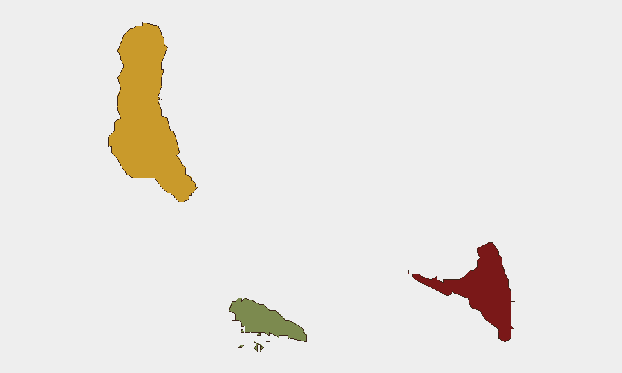
Anjouan (risk score 88) and Grande Comore (risk score 72) remain GeoBit's highest-ranked sub-national zones, likely reflecting historical patterns of maritime traffic irregularities, weak maritime law enforcement, and governance fragmentation rather than acute current threats. Mohéli (risk score 35) presents significantly lower risk. The absence of recent discrete events in Anjouan or Grande Comore does not eliminate structural vulnerabilities—including limited port-state control, potential for illicit maritime activity, and limited infrastructure resilience—that elevate baseline risk even during periods of surface stability.
How GeoBit Would Assist
For organizations with shipping or maritime assets flagged to or transiting through Comoros waters, Maritime & Aviation Tracking and Network & Actor Analysis would provide real-time visibility of vessel movements and supply-chain exposure to conflict zones. AOI Monitoring & Early Warning applied to Anjouan and Grande Comore ports would detect emerging instability, irregular governance activity, or unrest before they escalate. Economic & Trade and Search & Conflict modules enable continuous monitoring of port-state compliance, sanctions evasion, and piracy/maritime crime patterns that could disrupt shipping and logistics.
7-Day Outlook
Domestic security conditions in Comoros are expected to remain stable over the next 7 days absent new political triggers or external shocks. However, organizations relying on Comoros-flagged shipping should maintain elevated awareness of ongoing Black Sea and Red Sea maritime conflict, which directly affects vessels under Comoros registry. Routine monitoring of port operations, governance announcements, and regional maritime incidents remains prudent given structural fragility in governance and enforcement infrastructure.
Next Brief: 27 August 2026
Data as of: 26 August 2026, 06:00 UTC
Highest-Risk Areas — Ranked
| # | State / Region | Risk |
|---|---|---|
| 1 | Anjouan | 88 |
| 2 | Grande Comore | 72 |
| 3 | Moheli | 35 |
Sources
Previous Daily Briefs
A new Comoros brief is written every day — each with its own risk map and downloadable CSV. Here's the last week; use the calendar to go further back.
- August 24, 2026
- August 22, 2026
- August 20, 2026
- August 18, 2026
- August 16, 2026
- August 14, 2026
- August 12, 2026
📅 Browse every day by calendar →
Highlighted days have a brief. Tap a day for that day's map & analysis, or “csv” for that day's dataset ($5).
Atlas — our AI intelligence desk — emails them this snapshot personally. Nothing else, no list.