Situation Summary
Iceland remains one of the world's lowest-threat environments, ranked #65 globally with a composite threat score of 28 and zero tracked security events. The last 24–48 hours have recorded only minor, non-threatening incidents—chiefly a tourist detained with a knife in Reykjavík who was released without charge after police confirmed no public-safety risk. Reykjavík was confirmed as the safest city globally in 2026, reflecting sustained low baseline crime and violence. Trajectory remains stable with no indicators of emerging instability, organized unrest, or significant security deterioration.
Key Developments
- Reykjavík, evening 25 August: A foreign tourist was briefly detained after police responded to a report of an individual carrying a knife; the person was cutting and picking flowers and posed no threat. Released without charges after questioning.
- Capital Region (Reykjavík and suburbs), nights of 23–24 August: Multiple low-level property crimes and domestic violence incidents reported across postal districts 105 and 220 (Reykjavík and Hafnarfjörður). Assault with edged weapons and brass knuckles resulted in three arrests on 23 August in central Reykjavík.
- Stuðlagil canyon (Eastern Region), 24–25 August: Search and rescue operations ongoing following a reported fall into the canyon near the Jökla river; this is a wilderness/accident incident, not a security threat.
- Keflavík International Airport (Southwest), operational through 22 August: Sustained flight delays and gate-capacity congestion continue from post-eclipse traffic surge (12 August). Operational strain rather than security incident; potential for travel disruption.
- National political development (no street-level incident as of 25 August): Iceland will vote on 29 August 2026 regarding EU accession talks reopening. Reporting as of 25 August indicates political debate but no confirmed protests, civil unrest, or related security incidents in the past 48 hours.
- Organized crime procedural update (not new violence): Pre-trial detention extended on 19 August for two men suspected in an earlier homicide in Kársnes (Greater Reykjavík area); one suspect arrested in Barcelona on 11 August. No new violent incidents reported on 25–26 August.
Highest-Risk Areas
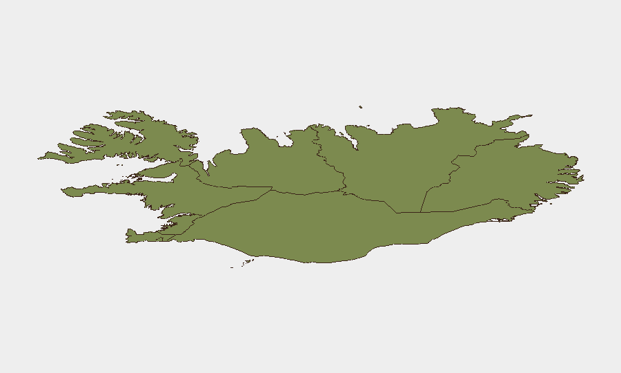
The Capital Region (Reykjavík and greater metropolitan area) accounts for the plurality of recorded incidents and ranks highest at composite risk score 24—primarily driven by petty property crime, isolated assaults, and domestic violence rather than organized or mass-casualty threats. The Southern Peninsula and Southern Region (scores 12 and 11) show secondary activity, though incident density remains low. Remaining regions (Eastern, Western, Westfjords, Northwestern, Northeastern) show minimal activity; risk scores decline with distance from population centers. Risk concentration reflects Iceland's demographic distribution: the Capital Region contains roughly two-thirds of the population, and crime activity scales accordingly. No region displays indicators of organized violence, insurgency, or state-level instability.
How GeoBit Would Assist
A security team operating in Iceland would deploy AOI Monitoring & Early Warning on the Capital Region and Keflavík Airport to track emerging unrest, protest activity, or operational incidents affecting travel; Intel Sweep and multi-language OSINT to monitor social media, local news, and Telegram channels for sentiment shifts around the 29 August EU vote; and Risk & Threat Assessment combined with sentiment analysis to detect any escalation in organized crime or political mobilization before ground-level manifestation.
7-Day Outlook
The 29 August EU accession referendum remains the most politically salient near-term event but, as of 25 August, shows no indicators of violence or civil unrest. Airport congestion should normalize as post-eclipse traffic clears. Baseline security profile is expected to remain very low; no credible warnings or threat indicators are present for the next seven days.
Highest-Risk Areas — Ranked
| # | State / Region | Risk |
|---|---|---|
| 1 | Capital Region | 24 |
| 2 | Southern Peninsula | 12 |
| 3 | Southern Region | 11 |
| 4 | Eastern Region | 10 |
| 5 | Western Region | 9 |
| 6 | Westfjords Region | 8 |
| 7 | Northwestern Region | 7 |
| 8 | Northeastern Region | 6 |
Sources
Previous Daily Briefs
A new Iceland brief is written every day — each with its own risk map and downloadable CSV. Here's the last week; use the calendar to go further back.
- August 25, 2026
- August 24, 2026
- August 23, 2026
- August 22, 2026
- August 21, 2026
- August 20, 2026
- August 19, 2026
📅 Browse every day by calendar →
Highlighted days have a brief. Tap a day for that day's map & analysis, or “csv” for that day's dataset ($5).
Atlas — our AI intelligence desk — emails them this snapshot personally. Nothing else, no list.