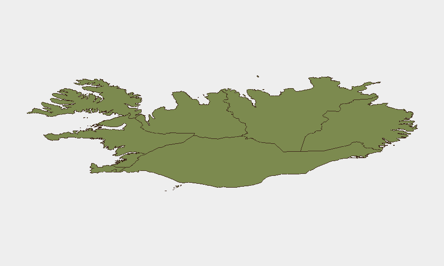
Situation Summary
Iceland remains a low-threat environment (rank #65 globally, composite threat score 28) with no tracked security incidents in the reporting window. Recent events reflect Iceland's primary hazard profile: accident risk in natural tourism sites and emerging economic pressure. The Capital Region concentrates the highest sub-national risk (score 24), driven by petty crime and minor violence; all other regions score 12 or below, indicating geographically dispersed, low-intensity concerns.
Key Developments
- East Iceland, Stuðlagil canyon (Jökulsá á Brú river) – 2026-08-24: A 39-year-old Polish tourist drowned after falling into the glacial river; body recovered at 22:00 from 3–4 metres depth following a large-scale rescue operation. Case classified as accidental; highlights significant hazard from strong currents and unpredictable pool/rapid transitions at this popular site.
- Central Reykjavík, postal district 105 – 2026-08-23: Three individuals arrested following an assault involving edged weapons and brass knuckles; concurrent reports of multiple low-level property crimes and domestic violence incidents in the same postal district on the night of 23 August.
- Hafnarfjörður area, postal district 220 – 2026-08-24: Multiple low-level property crimes and domestic violence incidents reported; pattern consistent with routine urban crime in greater Reykjavík metropolitan region.
- Mosfellsdalur – 2026-08-25: Metropolitan Police arrested multiple persons in connection with a break-in and burglary at Dalsbú mink farm; ongoing investigation into underlying criminal activity.
- National – Inflation and wage agreements – 2026-08-27: Iceland's inflation reached 5.6% in August, exceeding the 4.7% threshold in 2024 collective wage agreements. Unions (ASÍ) and employers (SA) are in negotiations until 8 October to prevent agreement termination; raises risk of labour disputes or strike action if talks fail, though no strike or protest action is currently reported.
Highest-Risk Areas
The Capital Region (Reykjavík metropolitan area) drives Iceland's overall risk score, accounting for the majority of reported violence and property crime, though absolute incident counts remain low by international standards. The Southern Peninsula and Southern Region (combined scores 12 and 11) reflect hazards centred on glacier and glacial-river sites popular with tourists, as underscored by the Stuðlagil fatality. All other regions score 10 or below; risk is concentrated in urban centres and high-traffic natural tourism zones rather than dispersed across the country. Regional risk reflects accident exposure and routine urban crime, not political instability or organized crime networks.
How GeoBit Would Assist
A corporate security team with personnel or assets in Iceland would deploy AOI Monitoring & Early Warning on high-risk regions (Capital Region, Southern Peninsula) and tourist hotspots (Stuðlagil, Sólheimajökull) to detect incident clusters, injury or fatality patterns, and emerging hazards in real time. Search & Threat Assessment capabilities (labour dispute, strike, economic tension tracking, sentiment analysis) would provide 30–60-day forward warning of collective-action risk tied to wage negotiations. Routing & Network Analysis would enable alternative travel and supply-chain planning in the event of labour disruption affecting aviation, ports, or road access.
7-Day Outlook
No major escalation in security incidents is forecast. The near-term risk trajectory remains stable, with accident and petty-crime incidents likely to continue at current baseline rates. The primary uncertainty is labour-sector outcome by 8 October; failure to reach agreement on wage indexing could trigger strikes or service disruption in late September or early October, warranting contingency planning for teams dependent on Icelandic aviation, shipping, or utilities.
Highest-Risk Areas — Ranked
| # | State / Region | Risk |
|---|---|---|
| 1 | Capital Region | 24 |
| 2 | Southern Peninsula | 12 |
| 3 | Southern Region | 11 |
| 4 | Eastern Region | 10 |
| 5 | Western Region | 9 |
| 6 | Westfjords Region | 8 |
| 7 | Northwestern Region | 7 |
| 8 | Northeastern Region | 6 |
Sources
Previous Daily Briefs
A new Iceland brief is written every day — each with its own risk map and downloadable CSV. Here's the last week; use the calendar to go further back.
- August 27, 2026
- August 26, 2026
- August 25, 2026
- August 24, 2026
- August 23, 2026
- August 22, 2026
- August 21, 2026
📅 Browse every day by calendar →
Highlighted days have a brief. Tap a day for that day's map & analysis, or “csv” for that day's dataset ($5).
Atlas — our AI intelligence desk — emails them this snapshot personally. Nothing else, no list.