Situation Summary
Iceland remains a low-threat environment (global rank #65, composite score 28) with no tracked security events. Current risk is concentrated in the Capital Region (Reykjavík and Greater Reykjavík municipalities) and is driven primarily by political activity surrounding a nationwide EU accession referendum on 29 August 2026, rather than systemic crime or civil unrest. Isolated violent incidents (assault, armed robbery, a fatal domestic case) and hazardous natural conditions on specific hiking routes present localized risks, but do not signal broader deterioration. The security trajectory remains stable, with police and administrative capacity adequate to manage election-day logistics.
Key Developments
- Reykjavík & nationwide – 29 August 2026 (ongoing) – EU referendum polling. Polling stations opened at 09:00 local time across Iceland for an advisory referendum on restarting EU accession negotiations. Increased crowds, police presence, and logistical activity at voting locations, particularly in Reykjavík, but no reported disturbances or security breaches as of midday. Electorate reported as "effectively split," with heightened political debate but a peaceful climate.
- Reykjavík – 28–29 August 2026 – fatal domestic assault in Kársnes, Kópavogur. Police investigating a fatal assault at a private residence in Kópavogur (Greater Reykjavík). Described as a domestic incident; no indication of wider public safety impact or civil unrest.
- Reykjavík – 23 August 2026 – armed pharmacy robbery. An SUV was driven into a pharmacy in central Reykjavík and pharmaceuticals stolen; no casualties reported. Investigation ongoing.
- Reykjavík – 23 August 2026 – assault with edged weapons. Three individuals arrested following an assault involving edged weapons and brass knuckles in central Reykjavík; one victim hospitalized. Localized incident; no mass unrest.
- Mosfellsdalur – 25 August 2026 – burglary at mink farm. Police arrested multiple persons in connection with a break-in and burglary at Dalsbú mink farm. Investigation ongoing; no casualties.
- Vestfjarðarvegur, Dölun – 23 August 2026 – traffic collision. SUV-truck collision with one minor injury; routine road accident.
- Fimmvörðuháls trail, Southern Iceland – 25–26 August 2026 – hiking route closure advisory. Search-and-rescue teams issued formal warning that heavy rainfall has created dangerous conditions (new ravines, water channels, steep scree) on the Fimmvörðuháls trail between Skógar and Þórsmörk; strong advisory against hiking the route.
Highest-Risk Areas
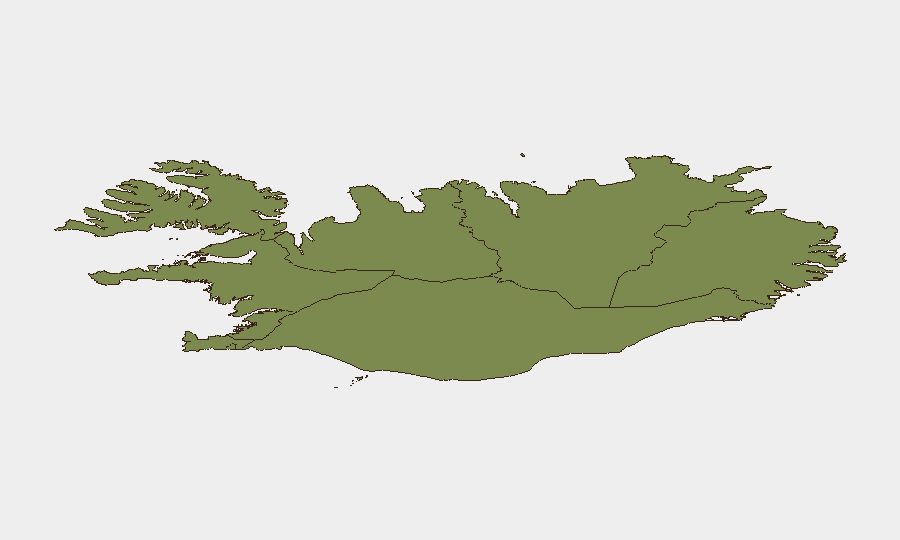
The Capital Region (Reykjavík and immediate suburbs) accounts for the majority of reported risk (composite score 24) and is currently amplified by referendum activity and the concentration of violent crime incidents in recent days. The Southern Peninsula (score 12) and Southern Region (score 11) present secondary risks, driven by natural hazards (glacial outburst flooding in mid-August, hiking trail closures, avalanche/scree danger) rather than crime. Eastern, Western, Westfjords, Northwestern, and Northeastern regions are low-risk, with minimal incident reports.
How GeoBit Would Assist
Security teams managing personnel or assets in Iceland would employ Intel Sweep and global event feeds to monitor Reykjavík and the Capital Region for escalation beyond current referendum-related political activity. Election monitoring capabilities would track voting disruptions, crowd management issues, or security breaches at polling sites through 29 August. AOI Monitoring & Early Warning would establish persistent watch on high-risk districts (central Reykjavík, Kópavogur) and hiking zones (Fimmvörðuháls, Stuðlagil) to flag new violent incidents, traffic accidents, or natural hazards in real time.
7-Day Outlook
Referendum polling concludes on 29 August evening; results are expected within days. Political tensions may remain elevated during vote counting and debate over outcomes, but the peaceful tenor of campaigning to date suggests low risk of civil unrest. Focus will shift to natural hazards: continued monitoring of weather systems affecting hiking routes and glacial rivers in the south, and routine urban crime management in Reykjavík.
Highest-Risk Areas — Ranked
| # | State / Region | Risk |
|---|---|---|
| 1 | Capital Region | 24 |
| 2 | Southern Peninsula | 12 |
| 3 | Southern Region | 11 |
| 4 | Eastern Region | 10 |
| 5 | Western Region | 9 |
| 6 | Westfjords Region | 8 |
| 7 | Northwestern Region | 7 |
| 8 | Northeastern Region | 6 |
Sources
Previous Daily Briefs
A new Iceland brief is written every day — each with its own risk map and downloadable CSV. Here's the last week; use the calendar to go further back.
- August 28, 2026
- August 27, 2026
- August 26, 2026
- August 25, 2026
- August 24, 2026
- August 23, 2026
- August 22, 2026
📅 Browse every day by calendar →
Highlighted days have a brief. Tap a day for that day's map & analysis, or “csv” for that day's dataset ($5).
Atlas — our AI intelligence desk — emails them this snapshot personally. Nothing else, no list.